Snowy, slick roads could impact travel in southern Ontario Sunday

Sunday snow and colder air descending on the province this week will bring winter back to the forefront in southern Ontario.
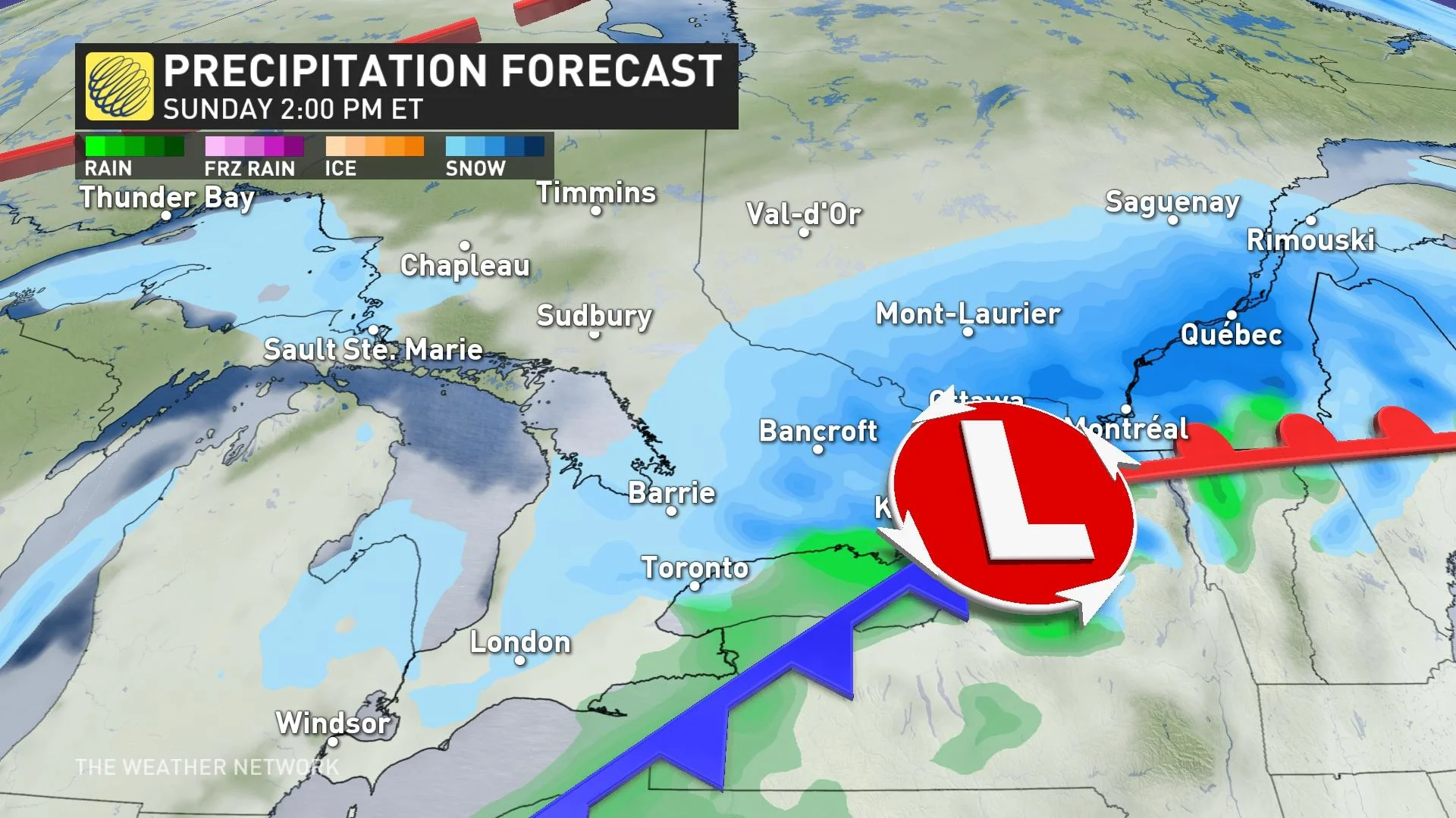
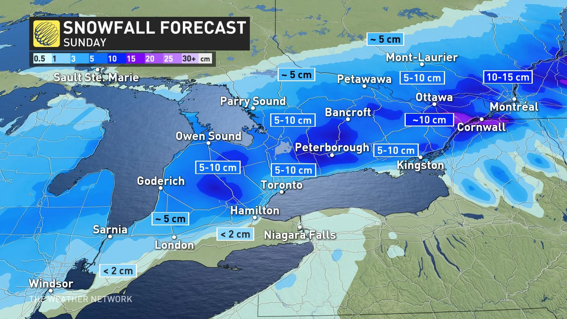
Another dose of snowy weather could put in a wrench into Sunday travel plans in southern Ontario, with 5-10 cm expected for most areas and as much as 15 cm for a few sections of the region. Make sure you plan ahead if you are travelling since you could encounter some delays on the road. And, as we enter the final days of January and kick off February, temperatures will become much colder.
PHOTOS: Blast of heavy, wet snow coats Ontario like wintry cement
A second clipper system is expected to bring about 5-10 cm of snow expected for most areas in southern Ontario, as much as 10-15 cm possible for areas across higher terrain northwest of the Greater Toronto Area (GTA).
Winter weather travel advisories are widespread across southern Ontario for the secondary system, along with snowfall warnings for regions seeing the highest amounts.
Motorists should expect hazardous winter driving conditions and adjust travel plans accordingly. Surfaces such as highways, roads, walkways and parking lots may become icy and slippery.
Eastern Ontario will see precipitation begin early Sunday morning with the snow ending across the province throughout the afternoon and evening.
It should be noted that warmer temperatures nudging in from the south could allow for some mixed precipitation and even rain to mix in along the shores of Lake Erie and the Niagara Peninsula, but this will be a snow event for mostly everyone.
Wintry weather continues next week with colder-than-seasonal temperatures dominating.
In fact, it's shaping up to be the coldest weather of the winter thus far late next week and into the weekend. Ottawa should see its first -20°C temperatures of the winter, with even -20°C pressing into southern Ontario away from the lakes.
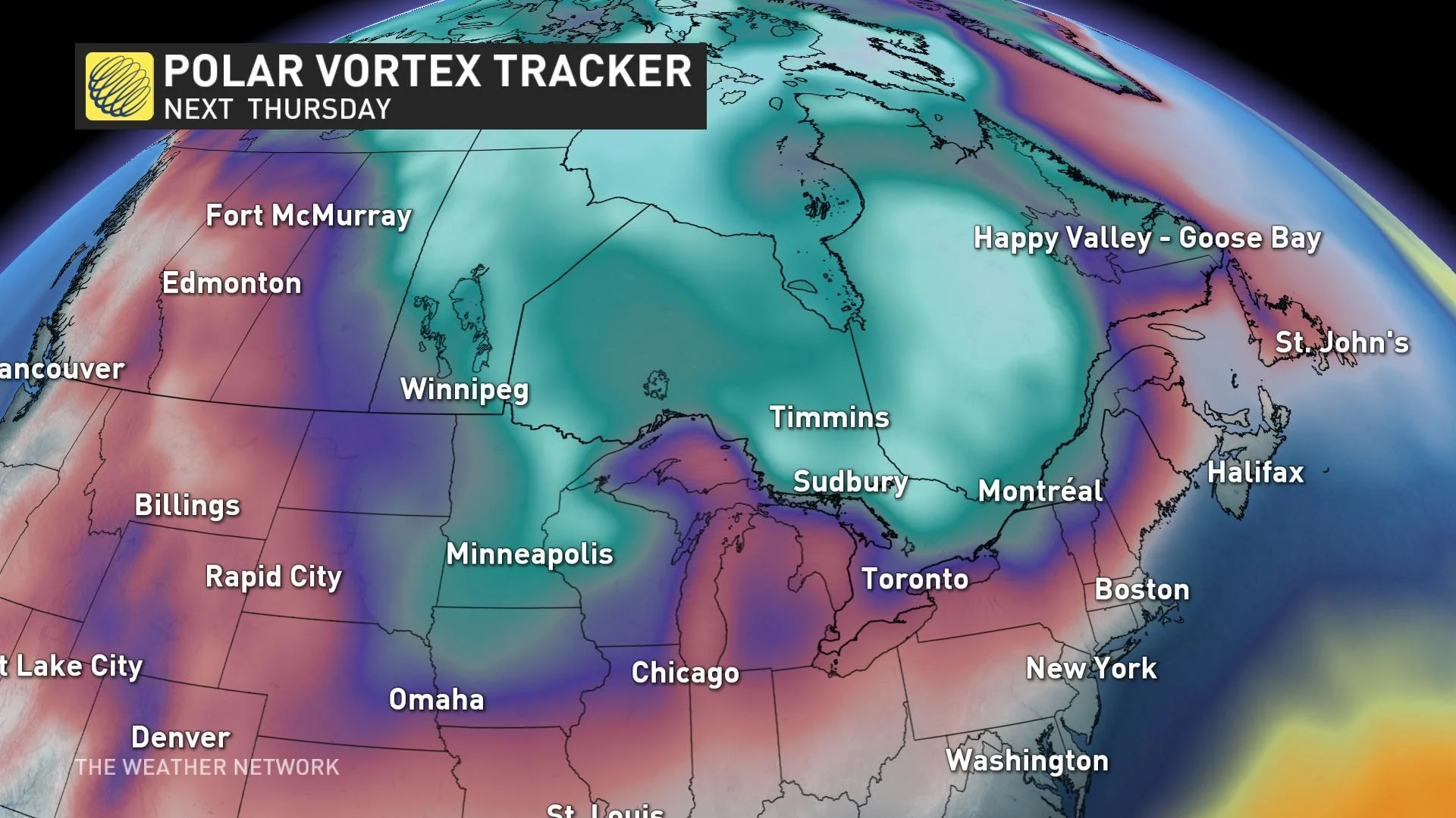
Some snow is possible at times, but the storm track should shift well south of the region for most of the week.
A much milder and more active pattern is expected for the second and third week of February.
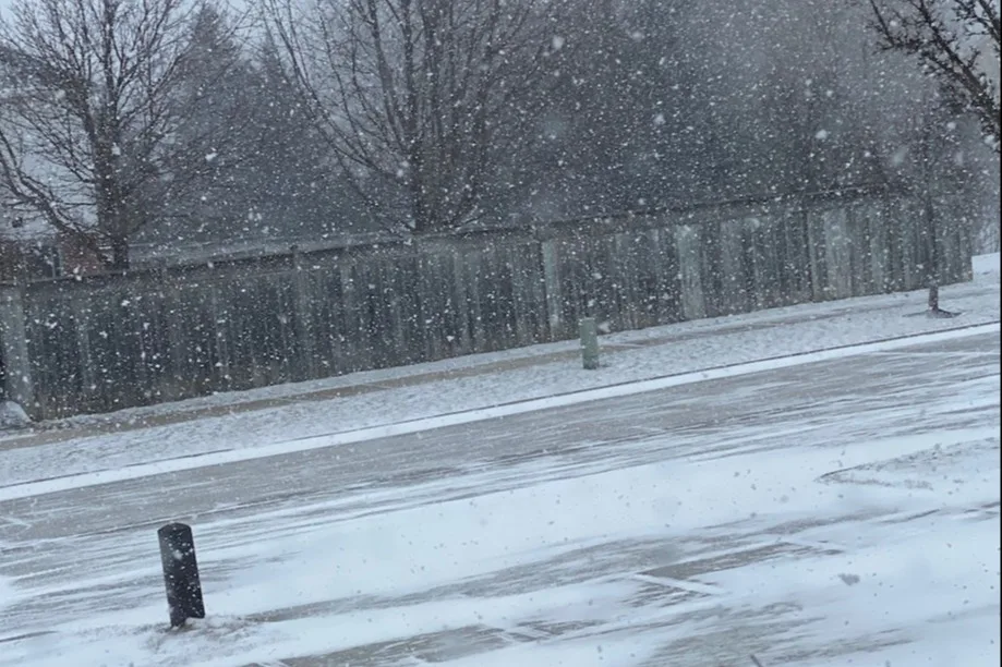
Thumbnail courtesy of @1Weathercanada/Twitter, taken in Kitchener, Ont.
Stay with The Weather Network for the latest on conditions across Ontario.