Extreme cold will tightly grip the Prairies following snow burst

After a brief blast of snow in parts of the Prairies through Tuesday, a shot of frigid Arctic air will send temperatures diving into the minus double digits through the week.
The Prairies are in for a stark reminder this week that the start of the astrological winter is just around the corner. The cue will be twofold, with a quick burst of snow from an Alberta clipper marking the first for parts of the region through Tuesday. The heavier accumulations, which may total 10-20 cm, will be confined to northern Alberta and Saskatchewan. The second part of the wintry equation is the downright bitter cold that will plunge the region into minus double digits by Wednesday, persisting through the remainder of the week. To compound the situation, a brisk northerly wind will make daytime highs feel even colder -- with wind chills forecast to be in the mid-minus 20s. More on the forthcoming snow and deep freeze, below.
Visit our Complete Guide to Winter 2022 for an in-depth look at the Winter Forecast, tips to plan for it, and much more!
TUESDAY: BRIEF SHOT OF SNOW FOR ALBERTA AND SASKATCHEWAN
A typical Alberta clipper that will come to fruition Monday night will continue to brush the aforementioned province and Saskatchewan with snow Tuesday as it continues to march northeast. Snowfall warnings are in place for both provinces.
"Visibility may be suddenly reduced at times in heavy snow. Surfaces such as highways, roads, walkways and parking lots may become difficult to navigate due to accumulating snow. If visibility is reduced while driving, turn on your lights and maintain a safe following distance," warns Environment and Climate Change (ECCC) Canada in the warning.
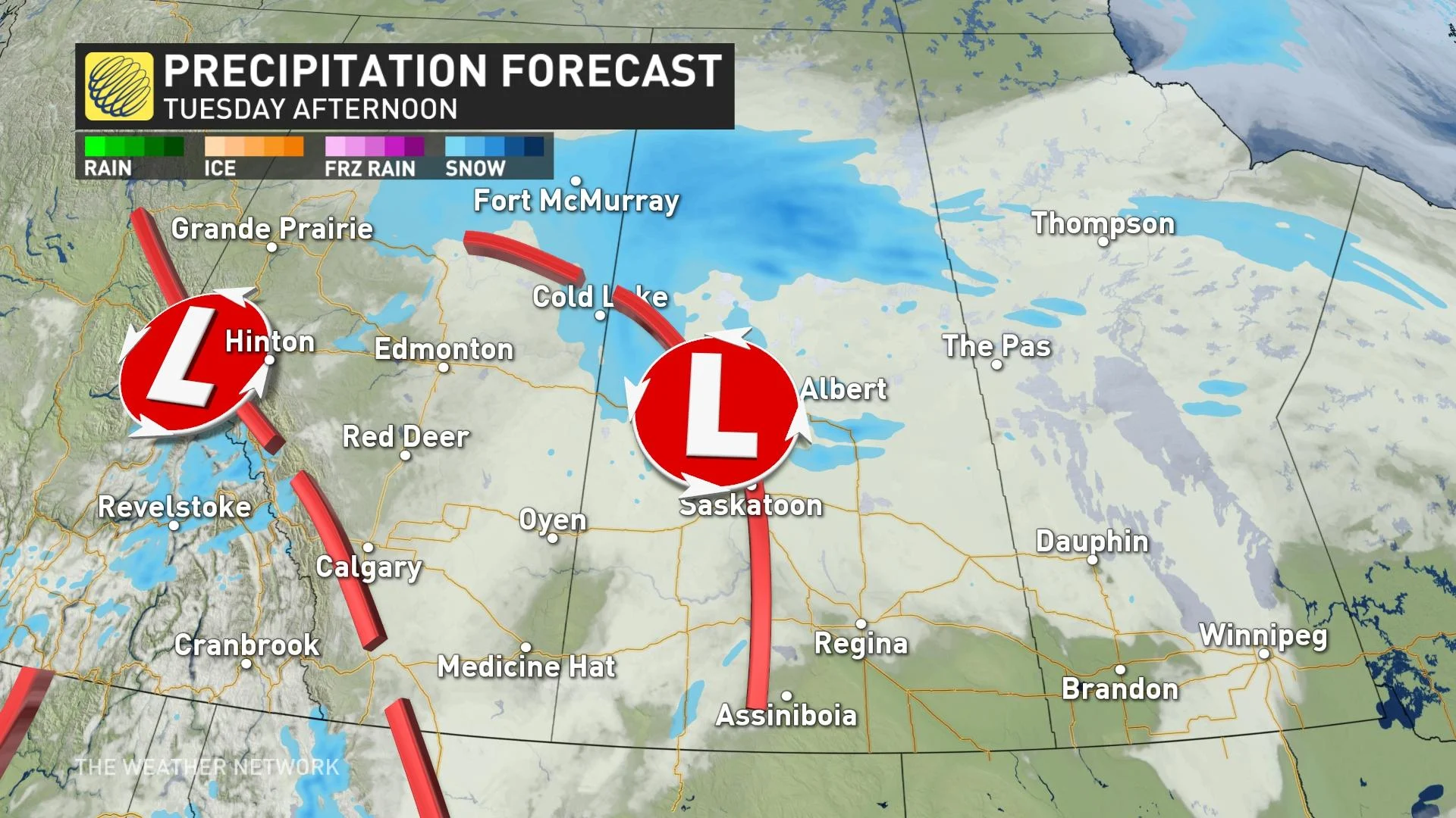
Snow will quickly track across Alberta through Monday evening. Calgary will see lighter accumulations, with up to 3 cm of snow, with a little higher totals east of the QE2. Higher totals are expected farther north in the province, where 10+ cm of snow is possible in Edmonton by Tuesday evening.
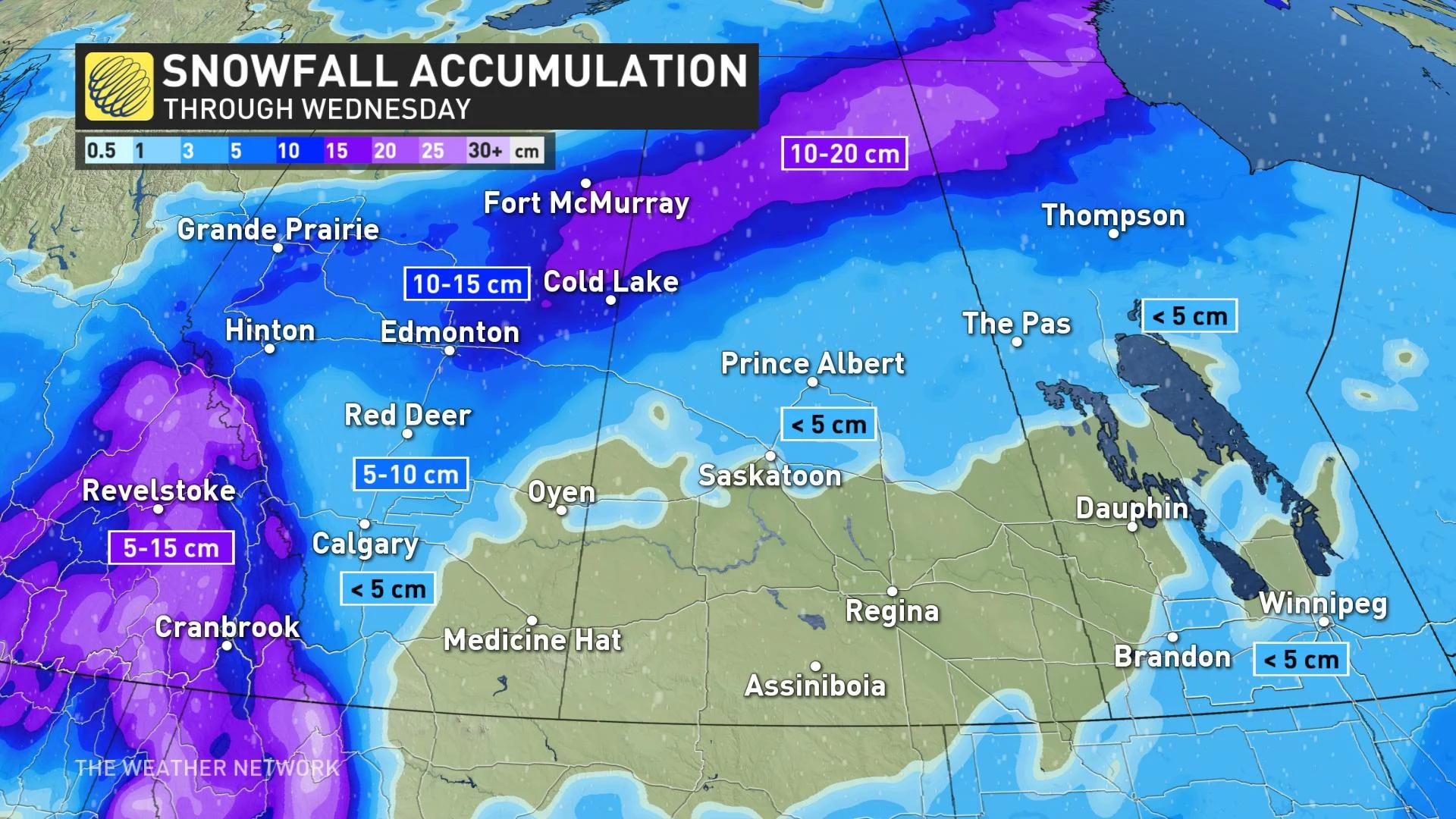
The system will then track into Saskatchewan heading into Tuesday morning, blanketing the northern half of the province with up to 20 cm of snow. The greatest accumulations will miss the major population centres, with less than 5 cm of accumulation possible in Prince Albert and little more than a dusting down in Saskatoon.
THROUGH WEEK’S END: A BITTER CHILL DESCENDS ON THE PRAIRIES
The quick hit of snow on the western half of the Prairies is the opening act for a deep freeze that will descend across the region through at least the end of the week.
Teeth-chattering temperatures are on the way for just about everyone in the coming days. Daytime highs will plummet into the -20s for a good chunk of northern Alberta and Saskatchewan, gradually spreading over the rest of the Prairies by the end of the week. It’ll be the coldest air of the season thus far for many areas.
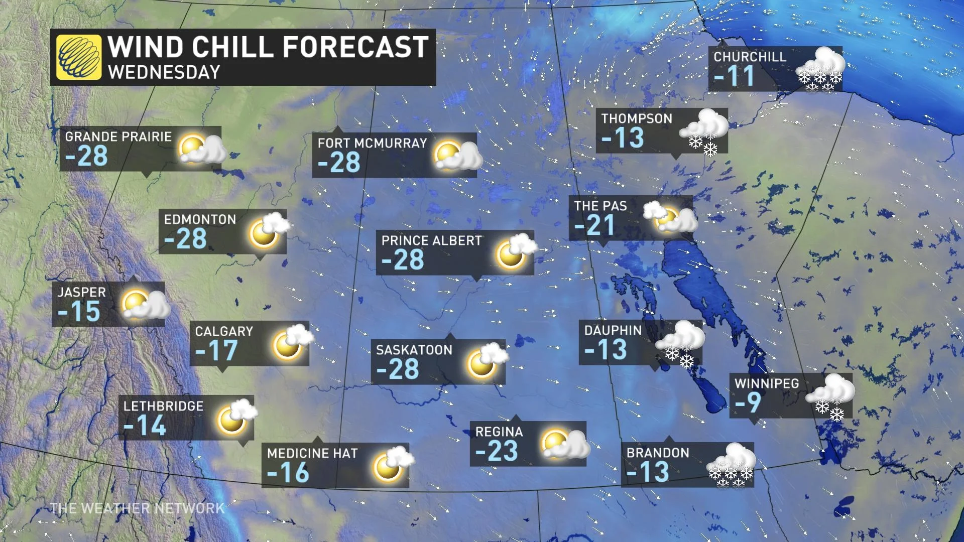
A brisk northerly wind will make temperatures feel even colder, and wind chills are forecast to be in the mid-minus 20s.
For some perspective on the cold headed toward the Prairies, a typical Dec. 15 in Edmonton features a high temperature of -4°C with an overnight low of -13°C. Wednesday will see a bitterly cold high of -23°C and an overnight low of -26°C.
Over in Regina, a seasonal Dec. 17 would see a high of -8°C and a nighttime low of -17°C. The city’s forecast temperatures for Friday include a high of -18°C with an overnight low of -21°C.
Beyond, forecasters are closely watching a Colorado low that’s expected to develop over the western United States early this week. The northern fringe of the storm will graze southern sections of Saskatchewan and Manitoba bringing in less than 5 cm of snowfall. As it rapidly intensifies into northwestern Ontario, strong winds and heavy snow are expected on the back side of the storm, with possible blizzard conditions.
However, if the storm tracks farther to the east, then the heavy snow will miss most of the region.
Arctic air will relax at times, but colder than seasonal temperatures expected to dominate through Christmas and beyond.
Check back as we continue to monitor this frigid Prairie forecast.