Travel remains tricky in southern Ontario as snow squalls persist

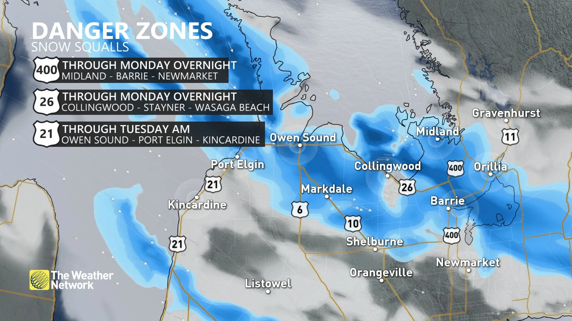
Snow squalls will continue through Monday overnight in areas near Lake Huron, making for some dangerous travel conditions before they wind down Tuesday.
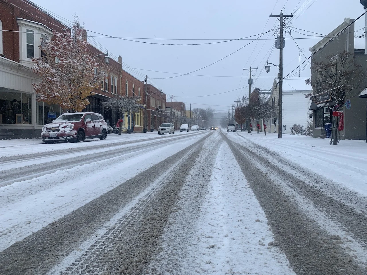
November is known for its snowy blasts in southern Ontario and this week is no exception. After an impactful start to the work week with potent lake-effect snow squalls hammering areas near Lake Huron and Georgian Bay, they will begin to wind down Tuesday afternoon, allowing for conditions to improve for mid-week. Some areas could pick up an further 5-15 cm of snow by the time they diminish. Temperatures will return to seasonal values by Wednesday, but snow squalls are likely to resurface at the end of this week. More on what's left to come from the snow squalls into Tuesday, below.
TUESDAY: SNOW SQUALLS TO EASE, TRAVEL REMAINS TRICKY
The snow squalls near Georgian Bay will begin to fizzle out Monday overnight, but expect travel to be tricky due to slippery road conditions.
However, the secondary band of snow near Lake Huron will continue to push south through Tuesday morning, leading to more difficult travel. By the early afternoon, the squalls will dissipate. Numerous weather advisories, and snow squall warnings and watches remain in effect.

Strong northwesterly winds will be in an issue still Tuesday morning, so travellers should expect commutes to be impacted by reduced visibilities at times due to blowing snow.
"Snow squalls cause weather conditions to vary considerably; changes from clear skies to heavy snow within just a few kilometres are common. Prepare for quickly changing and deteriorating travel conditions" Environment and Climate Change Canada (ECCC) says in the snow squall warning. "Visibility will be suddenly reduced to near zero at times in heavy snow and blowing snow."
Considerable snowfall amounts have already fallen Monday, but an additional 5-15 cm are expected through Tuesday morning in the band near Georgian Bay, while another 5-10 cm can be expected in the squalls pushing south from Lake Huron.
It also cautions that surfaces such as highways, roads, walkways and parking lots may become difficult to navigate due to the quickly accumulating snow.
LOOK AHEAD: TEMPERATURE RECOVERY MID-WEEK, FOLLOWED BY MORE UNSETTLED WEATHER
The chilly air mass will not be locked in place for very long, as seasonal temperatures return to the region by Wednesday.
Friday will be blustery and colder with scattered flurries expected, as bands of lake-effect snow set up across the snowbelt regions east and southeast of Lake Huron and Georgian Bay once again. Saturday and Sunday will be partly sunny and chilly with passing flurries, with the bands of lake-effect snow continuing across the snowbelts.
Though near seasonal temperatures are expected early next week, forecasters are closely watching the potential for a few days of very mild weather for the start of December.
Be sure to check back for updates on the forecast in Ontario.