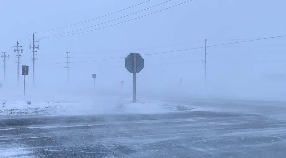
Snow squalls continue to impact travel in southern Ontario as cooler air hits

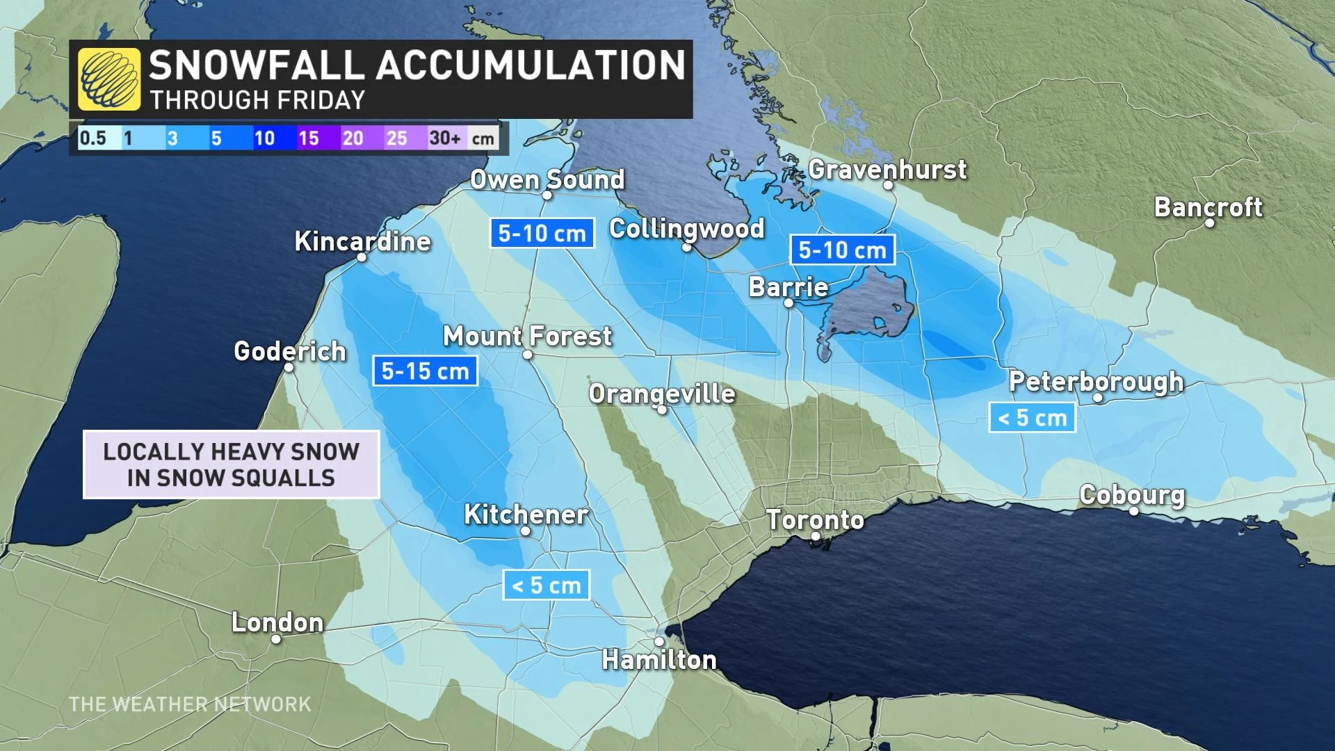
An additional 5-15 cm of snow is possible within squalls on Friday, with the threat for more difficult travel returning as early as Monday.
Winter weather travel advisories remain in effect for parts of southern Ontario on Friday, as lake-effect snow continues off of Lake Huron and Georgian Bay. Westerly winds gusting between 40-60 km/h will be the driving force for these bands, impacting travel and threatening 5-10+ cm of snow in some places. Hit and miss flurries are also possible through the west end of the Greater Toronto Area throughout the day. More on timing and impacts, and how soon the squalls will re-develop and cause more travel woes, below.
FRIDAY: LAKE-EFFECT SNOW PERSISTS, RISK OF REDUCED VISIBILITY
Cold westerly winds blowing over the still unfrozen Great Lakes triggered lake-effect snow bands Thursday, beginning in the morning off of Lake Superior and the afternoon in communities in the usual snow belts near Lake Huron and Georgian Bay.
While lingering rainfall limited the amounts near the shores of Lake Superior, in the south, some areas may be in line for 10-20 cm of snow before completely winding down through the day Friday.
"Travel is expected to be hazardous due to reduced visibility in some locations. Be prepared to adjust your driving with changing road conditions," warns Environment and Climate Change Canada in a snow squall warning. "Consider postponing non-essential travel until conditions improve."
Travel impacts along major routes are expected to continue into the afternoon hours on Friday, including areas along Highway 6, 8, 10 and 21, across the traditional snowbelts due to snow squalls that will be ongoing.
Westerly winds gusting between 40-60 km/h will be driving these bands, with hit or miss flurries also possible through the west end of the GTA as snow bands sink south throughout the day.
Winds will eventually weaken and meander as we head into the late afternoon and early evening hours, which is when these snow squalls are expected to end.
WEEKEND: NEAR SEASONAL TEMPERATURES, BUT WITH UNSETTLED CONDITIONS
A southerly flow dominates as we head into Saturday, allowing for the next system tracking into the Great Lakes to bring light rain showers to the south, but widespread snow to far northern areas by Sunday.
As temperatures drop on the backside of this system late Sunday and into early Monday morning, this will allow for snow squalls to re-develop and impact the region once again. Wind gusts of 50-70+ km/h are expected, with very difficult travel and the risk for whiteout conditions east of Lake Huron and Georgian Bay on Monday.
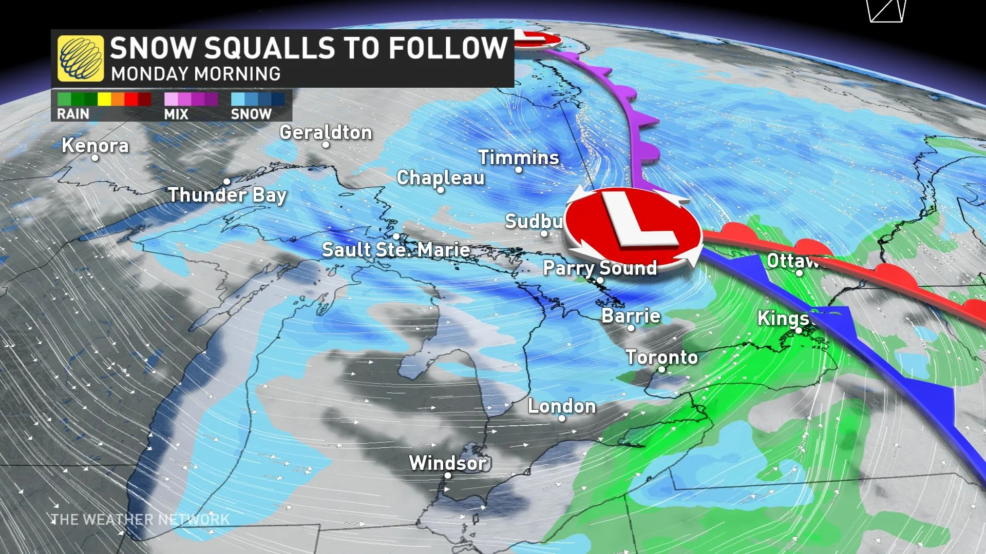
Bands of lake-effect snow will continue across the snowbelt regions through Monday night and into Tuesday. The coldest temperatures of the season thus far are also expected for Tuesday, with a gusty northwest wind.
Be sure to check back for updates on the forecast in Ontario.