Snow and ice hit parts of Ontario as moisture-packed storm rolls through

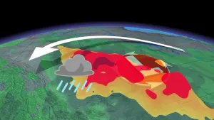
Widespread freezing rain warnings were issued early Thursday morning for a spring-like system that's accompanied by icy threats.
DON’T MISS: It may be mild but the snowiest months are just ahead for these parts of Canada
Environment and Climate Change Canada (ECCC) issued freezing rain warnings for the Ottawa Valley through Thursday night.
SEE ALSO: Mild winter pattern brings more rain than snow in parts of southern Ontario
"A prolonged period of freezing rain is expected for the Ottawa River Valley," ECCC advises in its freezing rain warning for Ottawa.

Warmer temperatures pushing in from the south will allow freezing rain to transition over to regular rain by Thursday night. Widespread rainfall totals of 15-25 mm are likely on Thursday, which could lead to localized flooding in spots with poor drainage.
The Grand River Conservation Authority (GRCA) advised Thursday that the rain would lead to "increased river flows and unsafe ice conditions throughout the Grand River watershed."
"The public is encouraged to exercise extreme caution around all local waterways," the GRCA said.
Precipitation will end overnight Thursday for southwestern Ontario, lingering into the first half of Friday morning for eastern Ontario.
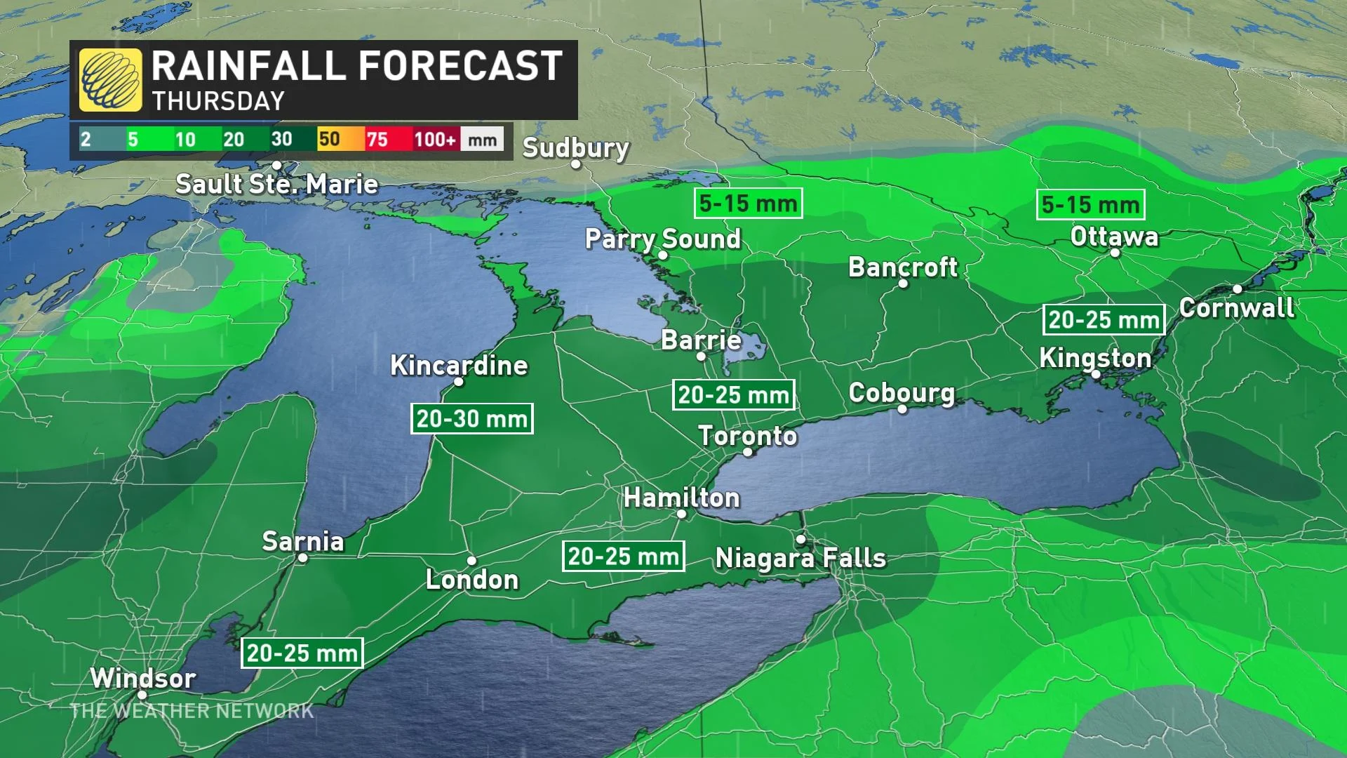
Colder air up north will allow for accumulating snow through the Nickel Belt and portions of cottage country. The heaviest swath of snow will slice through Sudbury, where 5-15 cm of snow is possible through Friday morning.
RELATED: How Colorado lows and Texas lows affect our weather in Canada
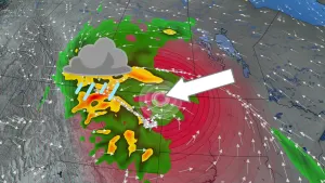
It’s not just the precipitation we have to watch out for. Gusty winds associated with this low-pressure system will lead to blustery conditions for all of southern Ontario through the day Thursday. Some areas, including the Niagara region, could see gusts of 70-90 km/h on Thursday.
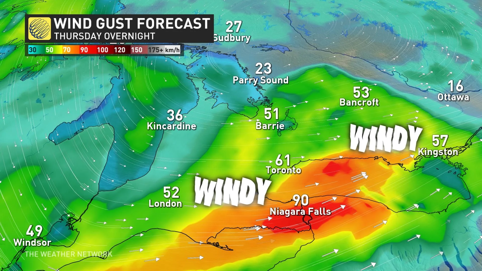
The combination of gusty winds and the weight of ice accretion could lead to power outages and fallen tree branches.
Additionally, we could see some convection across parts of southern Ontario as the cold front pushes through. There won’t be enough lift for thunder, but it could be just enough to mix some gustier winds down to the surface north of Lake Erie, leading to a risk for localized damaging wind gusts.
Mild weather wins out as we continue to move through February
Temperatures will rebound closer to seasonal by Saturday, with much warmer conditions arriving by Sunday. These above-seasonal conditions will stick around through next week, when we could see daytime highs more typical of March and April.
Conditions will also remain unsettled at times, meaning there is a risk for more rain with this milder pattern locked in.
Looking ahead to the Family Day long weekend, a couple days of colder weather are possible. Forecasters are monitoring the potential for a more wintry pattern to take hold during the final week of February and into early March.
WATCH: Canada, it might surprise you how much snow will still fall
Check back for the latest weather updates across Ontario this week.