Sneaky snow falls on parts of East Coast ahead of warm-up, gusty low

After a brief shot of snow, Sunday looks calmer and milder, and daytime highs will get a nice boost come Monday. But beyond is a potent low that will bring intense wind gusts and wintry precipitation.
People in parts of the Maritimes will be waking up to modest amounts of snow Sunday, after a fast-moving clipper system raced through overnight. Sunday itself features some calmer and slightly milder conditions before the next system moves in Monday afternoon. With this, the East Coast will see a bout of 15-30 mm of rain, snow and howling southerly wind gusts that could top 80 km/h. The good news is those strong southward winds will raise the temperatures quite a bit, perhaps reaching as high as the mid-teens in the Maritimes. More on Saturday's sneaky snow and the Montana low that will send temperatures and wind gusts flying, below.
Visit our Complete Guide to Winter 2022 for an in-depth look at the Winter Forecast, tips to plan for it, and much more!
SUNDAY: TEMPERATURES RISE AS SNOW WINDS DOWN
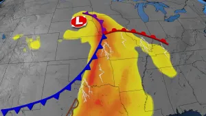
The fast-moving clipper system that approached the Maritimes Saturday will encounter temperatures cold enough to bring a dash of snow.
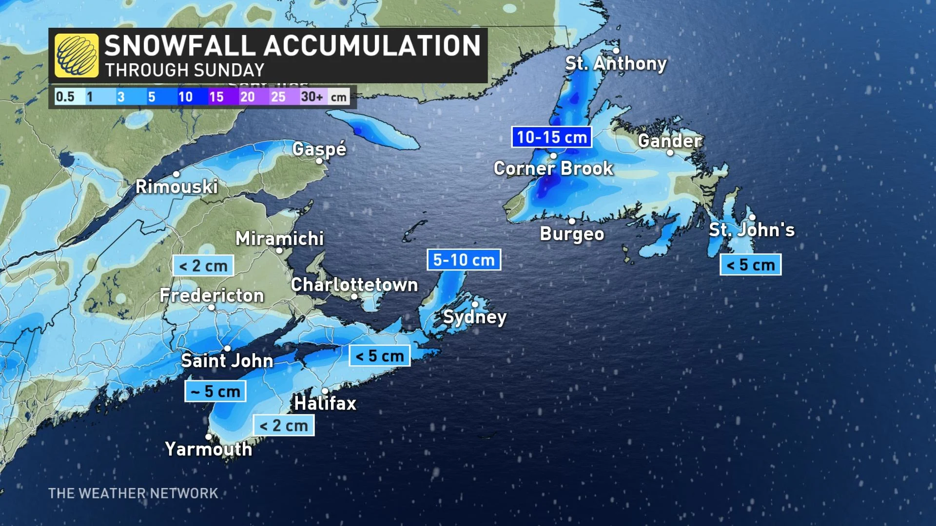
A sneaky 3-5 cm is expected by Sunday across Nova Scotia and southern New Brunswick. Sunday itself will be a transition day as the next system sets up on the doorstep for Monday.
Compared to the chilly temperatures of Saturday, Sunday will see a bit of a warm-up, with more communities in Nova Scotia and Newfoundland seeing above-freezing temperatures.
An even higher spike in daytime highs will be forthcoming early next week.
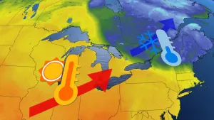
MONDAY AND BEYOND: WINDS RAMP UP, BRIEF SURGE OF WARMTH WITH NEXT LOW, FOLLOWED BY ANOTHER STORM LATE WEEK
Forecasters are also eyeing another storm early next week, with widespread rain, snow, howling wind gusts and soaring temperatures as warmth briefly pushes in.
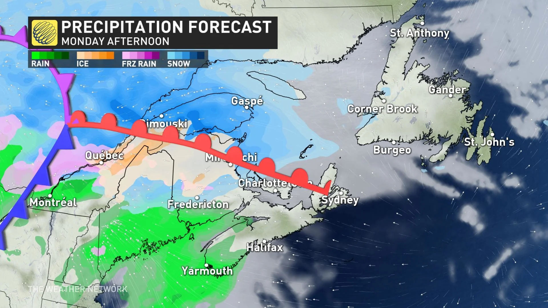
The strengthening Montana low will arrive Monday afternoon, with precipitation starting as snow for New Brunswick and rain for Nova Scotia. Rainfall and snowfall amounts won't be overly excessive, with the former totalling 15-30 mm across the board.
Snowfall amounts will be rather minimal. More than anything, New Brunswick will see a messy mix before switching over to rainfall, with some freezing rain possible for northern areas.
The main story, however, will be the strong southerly winds through the day, with gusts exceeding 80 km/h. As a result of the winds, temperatures will soar in the warm sector of the storm, with even the potential to reach the low to mid-teens late Monday night across the Maritimes and into the lower teens for Newfoundland on Tuesday.
However, the warmth will be fleeting. Conditions will turn colder as the storm departs the region mid-week.
Beyond, a Colorado low is expected to impact parts of the region late Wednesday through Thursday. The storm track is still uncertain, but this has the potential to bring a swath of heavy snow across southern parts of the region -- possibly including Halifax and around the Bay of Fundy. It is still early, but this could be the first significant winter storm of the season for many of the larger population centres.
*Be sure to check back for updates on the relentless storm parade across Atlantic Canada.