
Thunderstorm risk builds for parts of southern Ontario Thursday

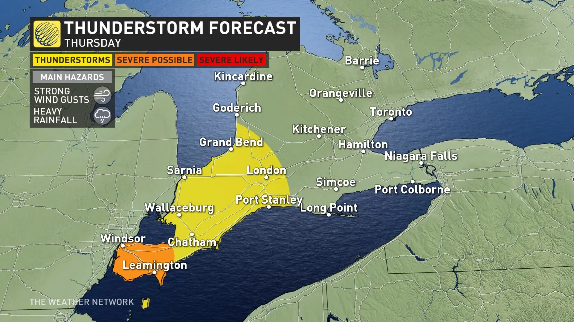
Some storms look to spill over into southwestern Ontario Thursday evening and overnight, with some slight severe potential.
More sunshine and warming temperatures will give a May-like feel to parts of Ontario through Saturday, though with a building thunderstorm risk for areas across the extreme southwest on Thursday. A slow moving Colorado low will bring showers and rumbles of thunder to the region, with the rain moving into parts of southern Ontario on Friday, though not enough to make for a washout. There is a slight chance that some isolated thunderstorms may turn severe Thursday, with heavy rain and strong winds being the biggest threats for places like Windsor. More on the timing and impact, below.
THURSDAY AFTERNOON INTO THE OVERNIGHT: SKIES DARKEN AS SYSTEM APPROACHES
It was evident early in the day that Thursday would be very spring-like, and indeed, daytime highs crept above 20°C in many communities.
A notable exception, however, will be communities along Lake Ontario: Temperatures near the shores will be markedly cooler, knocking several degrees off daytime highs.
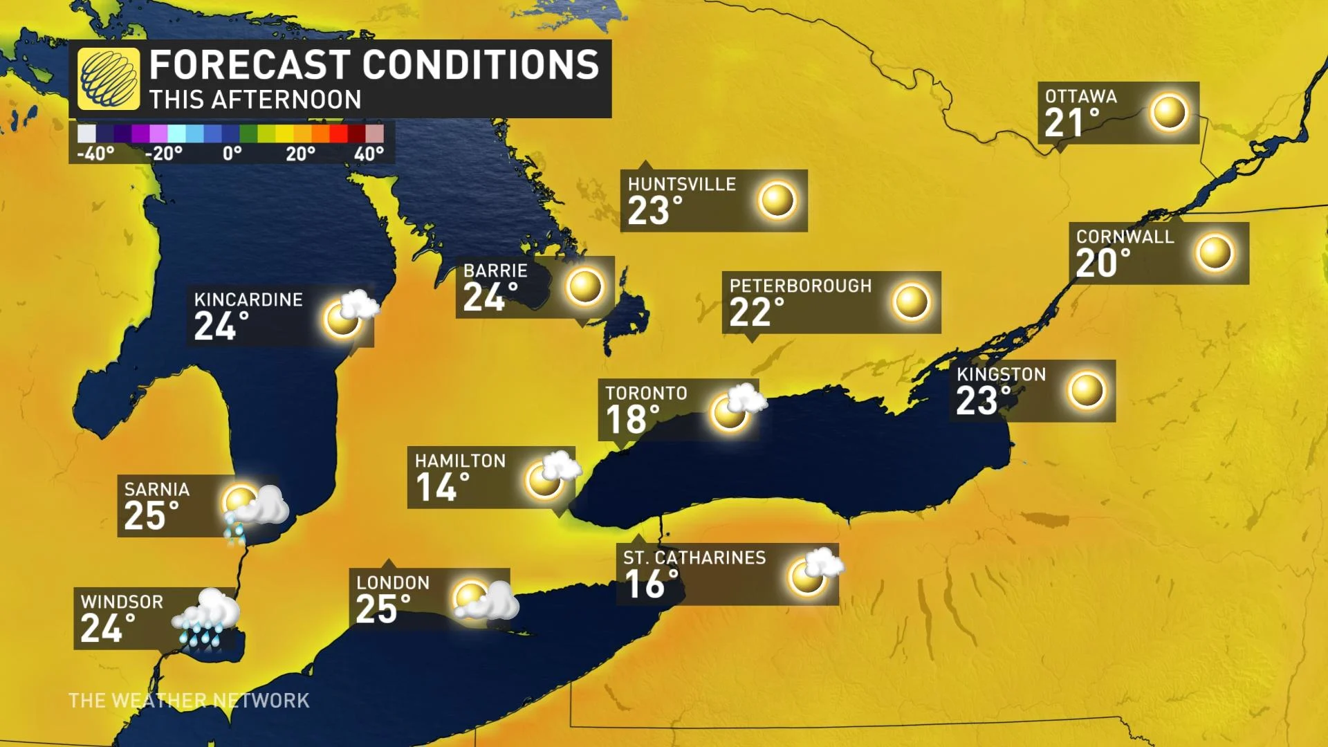
People will be able to enjoy the warmth, along with either clear skies or a mix of sun and cloud, for most of the day, with the effects of the incoming system only really arriving near the day's end.
That system, a Colorado low, will begin making its way into the province Thursday evening, lasting through the overnight hours. Its effects will stay largely confined to the southwest, however.
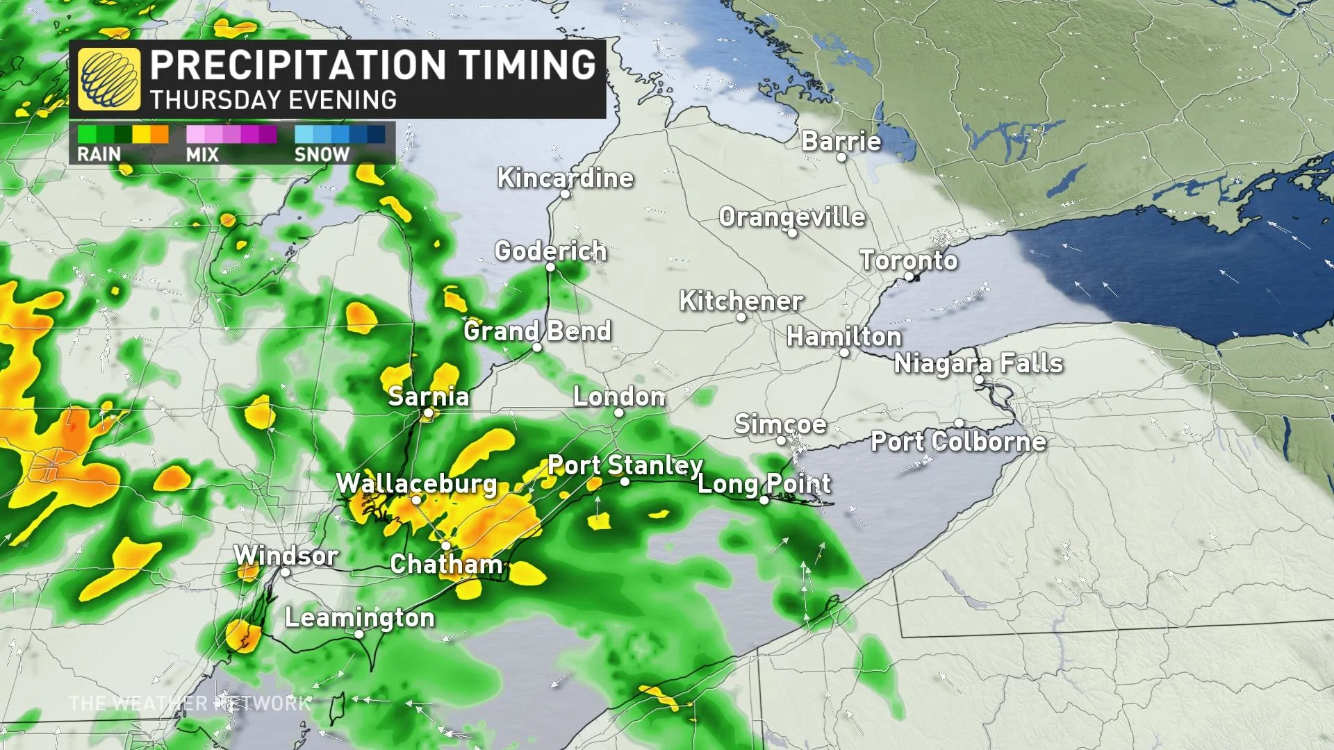
Where showers do occur, amounts won't be a washout by any means, but there will be enough moisture to potentially fuel some thunderstorms.
In fact, there's even a slight chance that one or two isolated thunderstorms may cross the severe threshold, with the risk zone largely near Windsor. Primary threats will be strong wind gusts and isolated pockets of heavy rainfall.
FRIDAY AND INTO THE WEEKEND: FEELING MORE LIKE MAY, AND EVEN EARLY JUNE
Showers may linger into early Friday morning from this Colorado low, but such as there are won't venture too far from the southwest.
But warm temperatures will continue to close out the week and into the early part of the weekend at least, feeling more like late May or even early June, with temperatures ranging as high as the mid-20s at the upper end of the scale.
However, temperatures will once again be cooler near the shores of Lake Ontario thanks to that lake breeze blowing in from the still quite chilly waters.
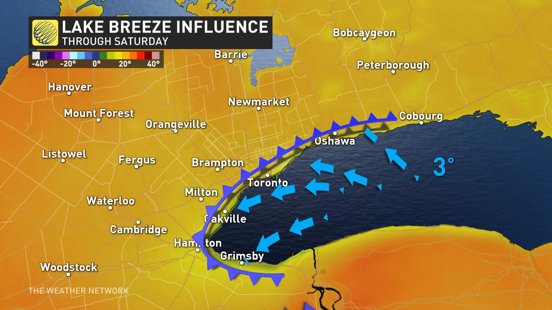
That will keep temperatures some 5-15 degrees cooler for those areas, though Saturday will see that cooling influence confined closer to the lake shore, and even then, temperatures will still be well above seasnal as winds ease somewhat.
Forecasters are also eyeing the potential of a Texas low tracking into the Great Lakes region Saturday night and Sunday, with a period of widespread soaking rain across southern Ontario, though with lesser totals in eastern parts of the province. Sunday doesn't look to be a washout as clouds will give way to some sunshine during the afternoon, but additional showers are possible once again later in the day.
MAJOR SHIFT IN THE PATTERN AS TEMPERATURES BECOME COOLER NEXT WEEK
There will be a major, but slow, shift in the weather pattern for next week, one that looks to bring much cooler conditions to Ontario.
"The third week of April looks rather chilly, which will be quite an unpleasant and disappointing contrast to what we have enjoyed so far this spring," says Weather Network meteorologist Dr. Doug Gillham. "Colder than seasonal temperatures are expected as we head into the second half of April."
Check back as we continue to monitor the latest forecast in Ontario.