Warnings issued as heavy snow makes a bold return to the Prairies

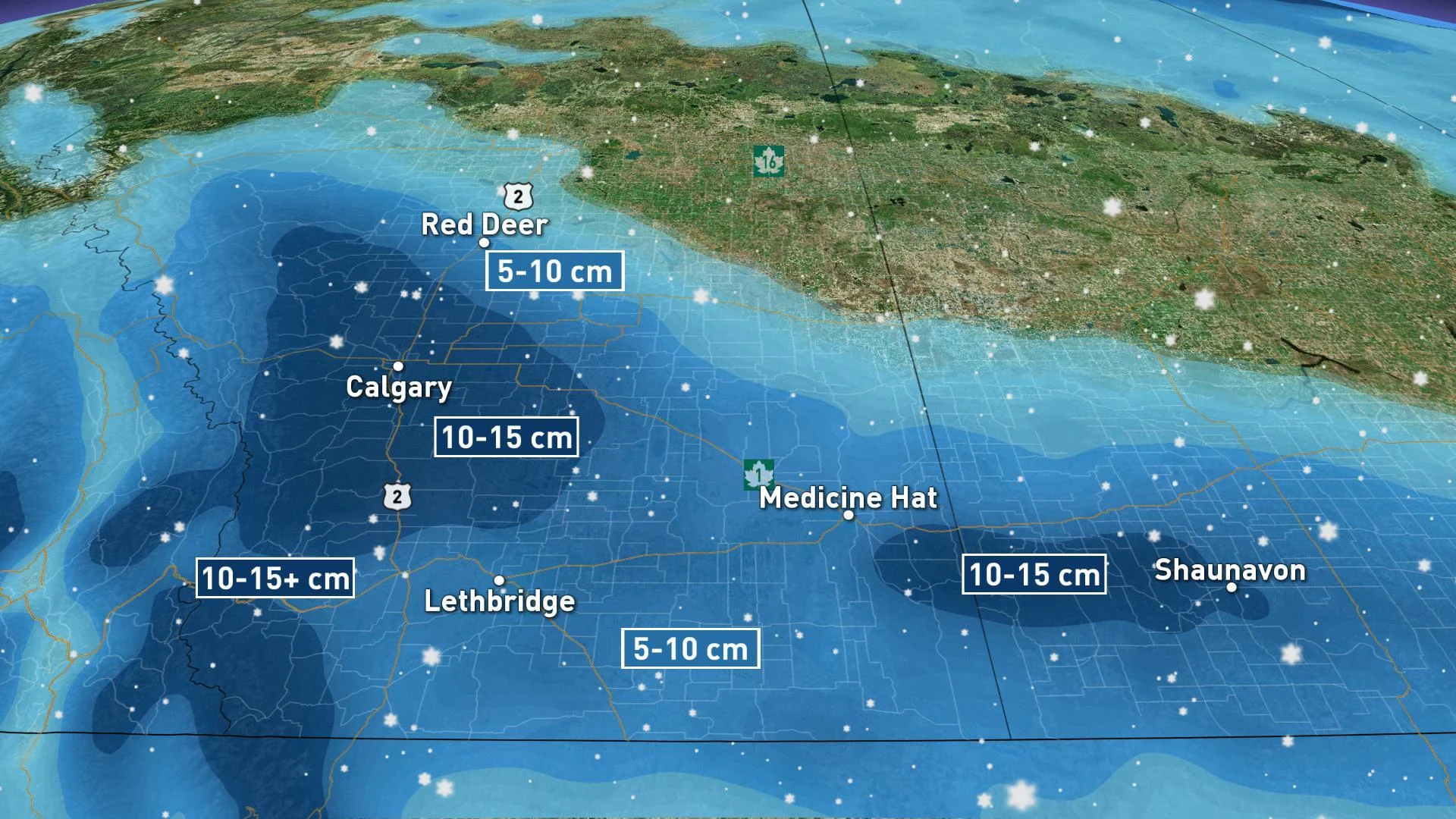
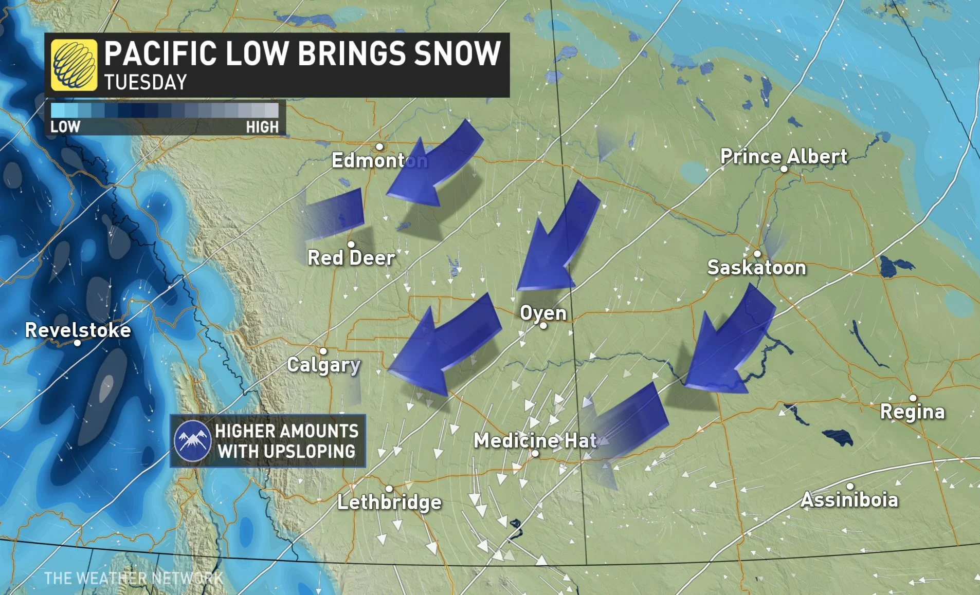
Snowfall warnings expanded across parts of southern Alberta and Saskatchewan early Tuesday morning as a potent Pacific system threatens the region with significant accumulations throughout the day. Drivers are urged to brace for quickly deteriorating conditions with as 20 cm is possible in the hardest hit areas by Wednesday morning. More on the timing of this system, plus a look at how quickly conditions rebound, below.
WEATHER HIGHLIGHTS
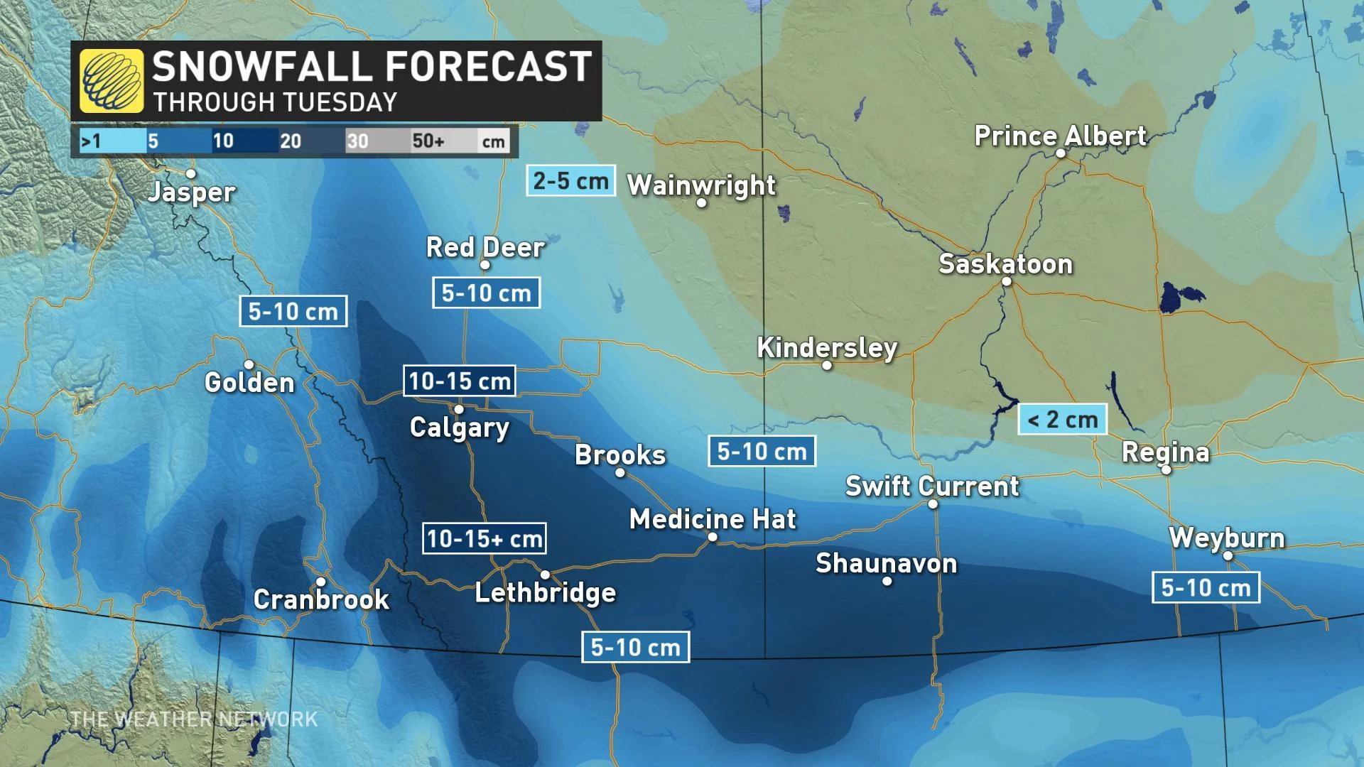
Snow continues to fall Tuesday morning and afternoon, up to 20+ cm possible with upslope and terrain enhancement
Snow spreads into southern Saskatchewan and southern Manitoba, although with accumulations confined to Highway 1 and south
Snow ends north to south by early Wednesday with a warming trend expected for the second half of the week
Stay on top of ALERTS in your area
WATCH BELOW: WIDESPREAD SNOW COVERS ALBERTA AND SASKATCHEWAN
After a milder day Monday and the recent above seasonal conditions, temperatures are taking a nosedive through Tuesday and will help to drive the heavy snow expected across parts of southern Alberta and Saskatchewan.
The snow began along the foothills Monday night, and will become more widespread through the afternoon hours on Tuesday. This will have an impact on commute times for the region, with Environment Canada warning of quickly deteriorating travel conditions.
"If visibility is reduced while driving, turn on your lights and maintain a safe following distance," says EC in the snowfall warning, which also covers the city of Calgary.
A widespread swath of 10-15 cm of snow is likely, with localized amounts of of 15-20 cm+ possible with upslope and terrain enhancement, impacting areas along the QE2, south of Calgary, including Lethbridge, Medicine Hat and Cypress Hills.
Rain will mix with snow at times across extreme southern Alberta as temperatures hover near the freezing mark for most of the day.
Snowfall warnings also cover parts of southwestern Saskatchewan, with the snow expected to become heavy through Tuesday night before tapering to light flurries on Wednesday morning. Snowfall amounts will diminish quickly for areas north of the Trans-Canada Highway.
KEEP IN MIND SNOW REMOVAL BY-LAW, CALGARY:
High pressure returns to the western Prairies by Wednesday with a warming trend expected for the second half of the week.
"We'll see near to slightly below seasonal conditions through the mid-week mark, but with temperatures rising above seasonal once again by late week and into the weekend," adds meteorologist Dr. Doug Gillham.