Major snowstorm on track to snarl Monday travel across Ontario

A sprawling winter storm south of the border will gather strength this weekend as it starts closing in on the eastern half of Canada. The system will spread heavy snow over much of southern and eastern Ontario overnight Sunday into Monday. It appears that heavier snowfall totals will creep into the Greater Toronto Area, threatening a dangerous, if not impossible, morning commute on Monday. More on the approaching winter storm and beyond, below.
SUNDAY NIGHT/MONDAY: SNOW ARRIVES, EXPECT MAJOR TRAVEL IMPACTS
The potent winter storm making a mess of things across a wide swath of the eastern United States will knock on Ontario’s door by Sunday night.
DON’T MISS: Why those wild weather maps you see on social media are probably bogus
Snowfall will begin in the overnight hours for the shores of Lake Erie and Lake Ontario. The snow will continue spreading into the Golden Horseshoe through early Monday morning.
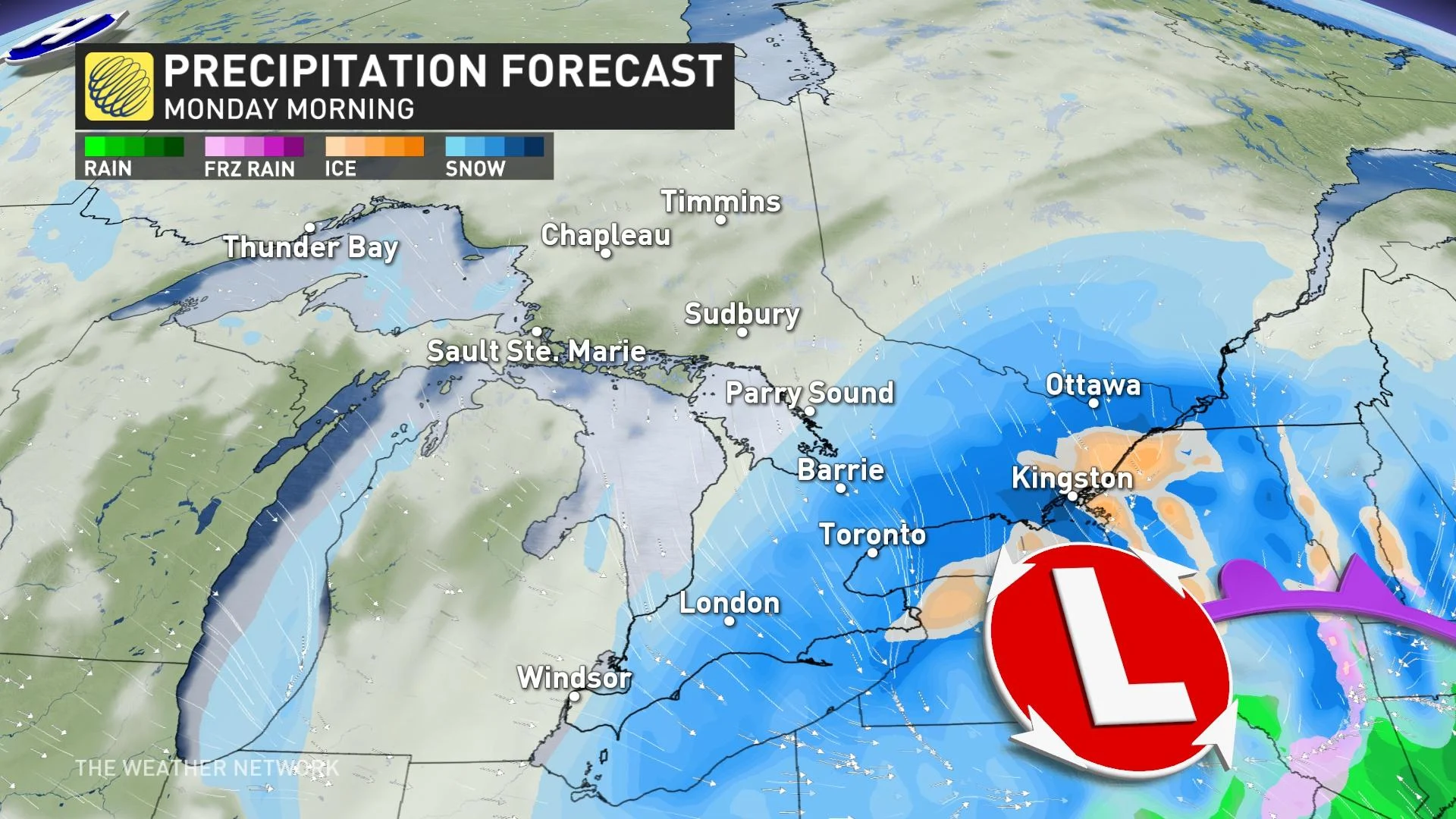
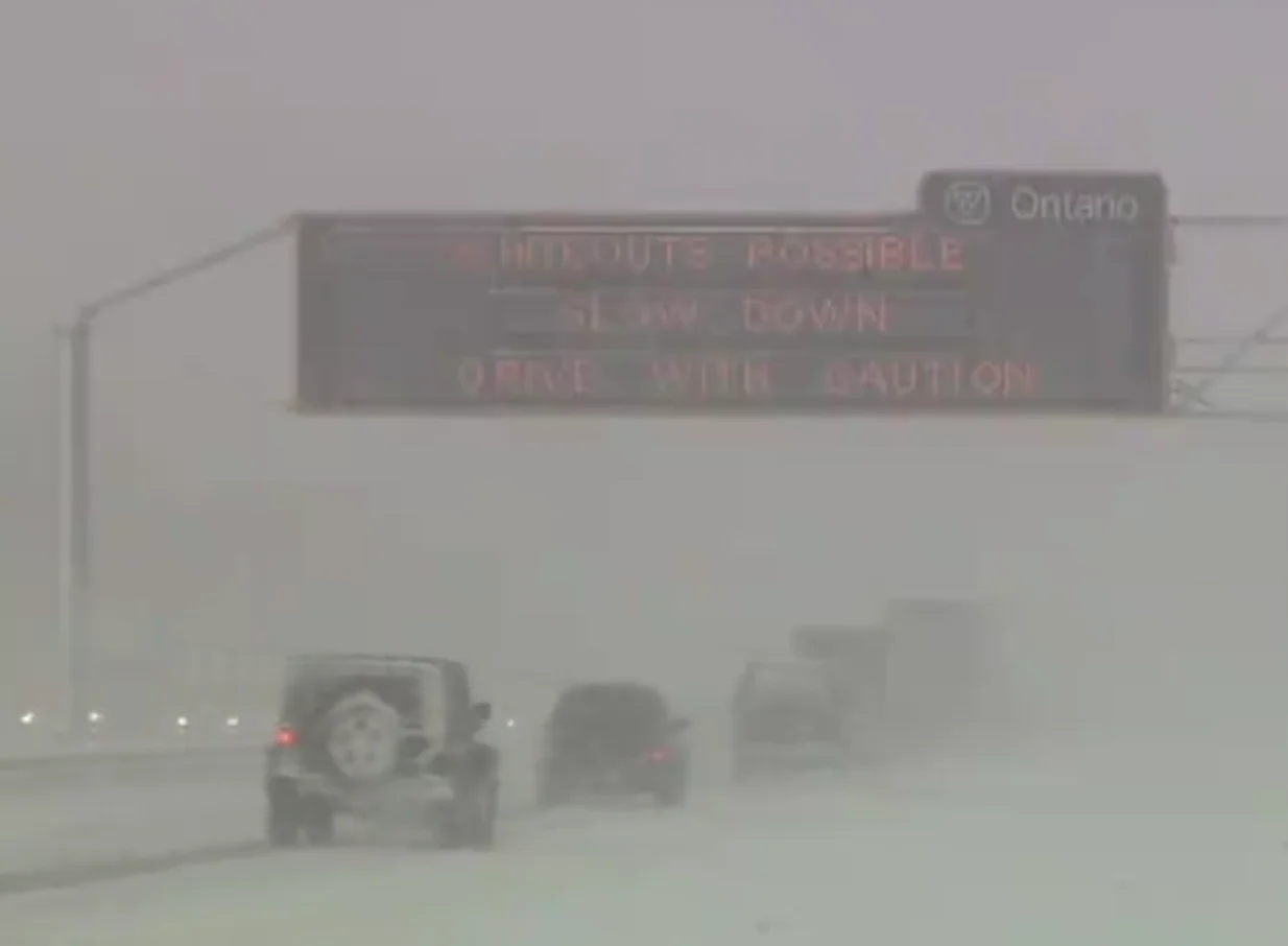
Heavy snow will quickly cover roadways, making for treacherous travel conditions throughout the GTA in time for the morning commute, especially along the QEW and highways 427 and 401.
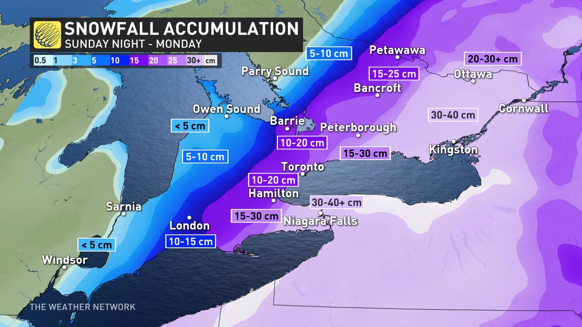
This system will feature a sharp snowfall gradient on the western end of the storm. Accumulations will differ significantly over short distances.
Storm total accumulations of 10-20 cm are expected across the GTA, with greater totals the farther east you go—a reversal from normal winter storm behaviour in this part of the country.
The heaviest bands of snow are likely to develop across the Niagara region and eastern Ontario. 30-40+ cm of snow could fall around Niagara Falls and St. Catharines, while widespread totals of 30-40 cm are likely in eastern Ontario, including Kingston, Cornwall, and Ottawa.
The good news is that this will be a quick-moving system, easing by Monday evening from west to east. However, impressive snowfall rates will afford the storm the potential to drop significant amounts of snow in a short period of time.
TUESDAY AND BEYOND: THE WINTRY PATTERN CONTINUES
The rest of next week looks rather wintry with temperatures near seasonal or on the cold side of seasonal.
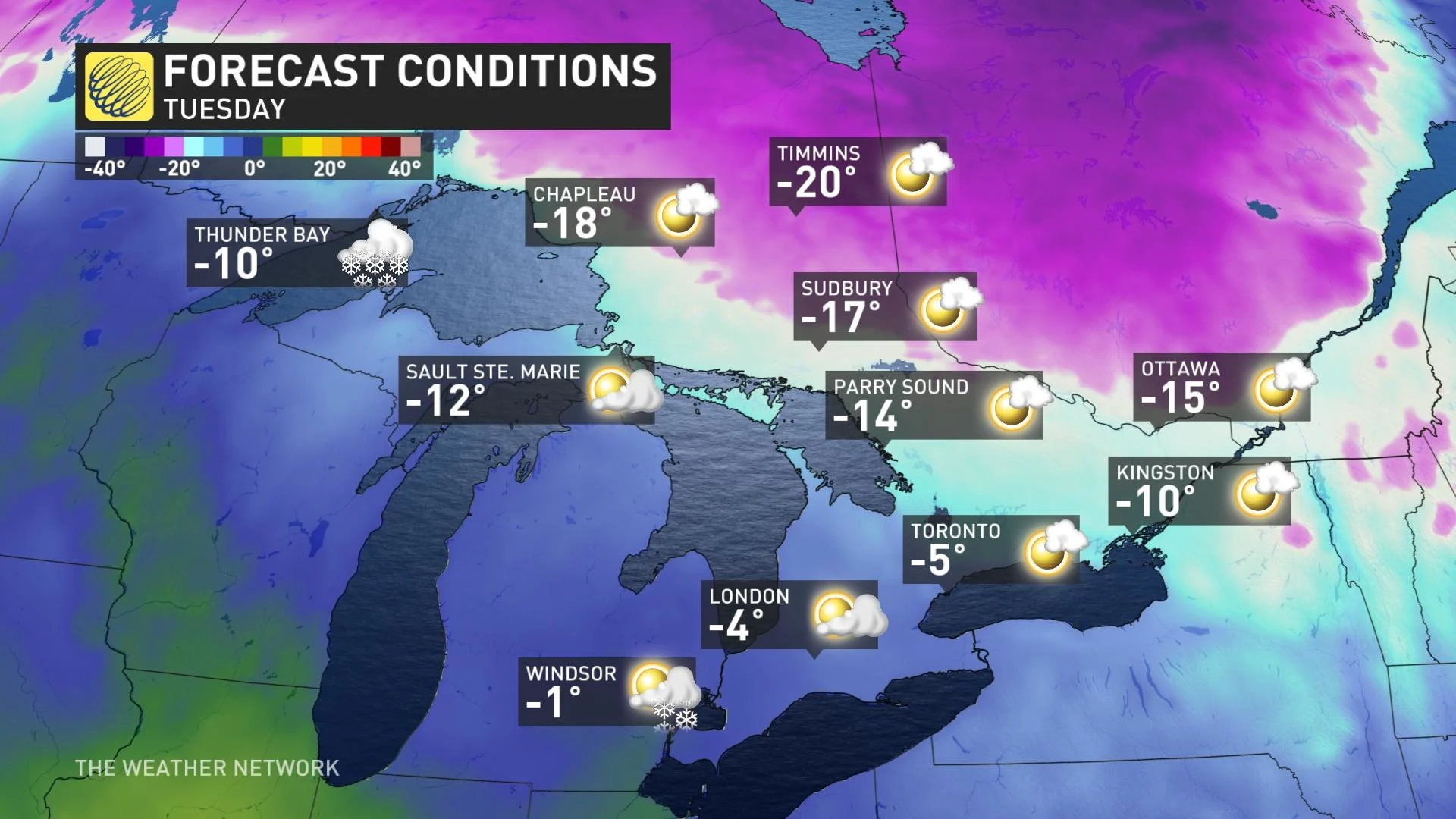
A clipper is expected Tuesday night and into Wednesday, followed by another shot of Arctic air for Thursday and Friday. This wintry pattern is expected to continue through the final week of January with a couple more blasts of frigid weather.
Stay tuned to The Weather Network for the latest forecast for Ontario.


