Tornado potential with severe storm threat in Manitoba, northwestern Ontario

The greatest threat for severe storms will largely be in northwestern Ontario Friday, with strong wind gusts, small hail, heavy rainfall and one or two tornadoes possible.
After a tornado occurred near Alexander, Man. Thursday evening, the severe weather risk, including the possibility of one or two tornadoes, continues in southern Manitoba and northwestern Ontario Friday. Saturday will see a lingering severe storm risk in northwestern Ontario, though less likely to reach those limits. Temperatures will cool down on the weekend in the east, while Alberta will experience a sizzling warmup that will continue into next week. A more detailed look, below.
WEATHER HIGHLIGHTS
Severe potential Friday in northwestern Ontario, southern Manitoba
Storm risk mostly lingers in northwestern Ontario Saturday, severe possible
Heating up in Alberta for the weekend, cooldown on the eastern Prairies
Keep an eye on severe weather ALERTS in your area
FRIDAY: SEVERE POTENTIAL MOSTLY IN NORTHWESTERN ONTARIO
Northwestern Ontario and southeastern Manitoba will once again be under the threat for severe weather on Friday. Early afternoon storms are expected to develop stateside and push through southeastern Manitoba and northwestern Ontario, continuing into the evening before dying out in the latter region overnight.
Some of the storms may be rotating, presenting the opportunity for the development of one or two tornadoes. Directional wind shear will be favourable. Other threats include strong wind gusts, heavy rainfall and small hail.
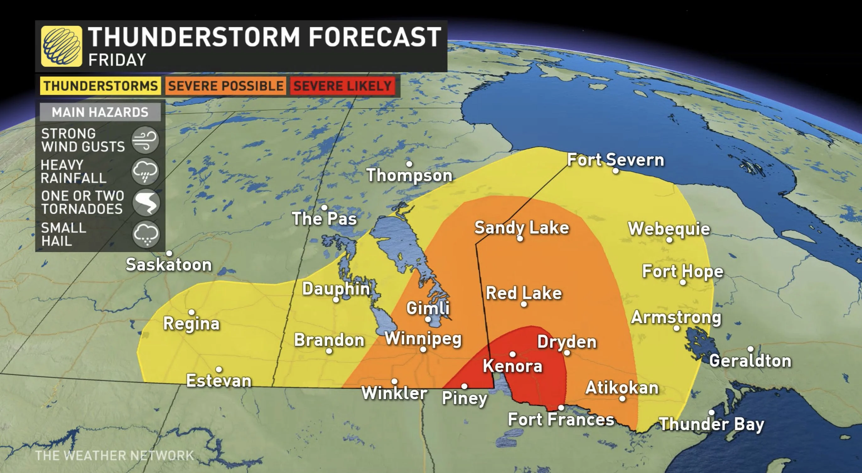
Areas along the western side of the surface low, extending from southeastern Manitoba to Red Lake, Ont. may get prolonged, torrential rainfall.
Meanwhile, the storm risk will extend westward into southeastern Saskatchewan, as well, but are expected to remain non-severe.
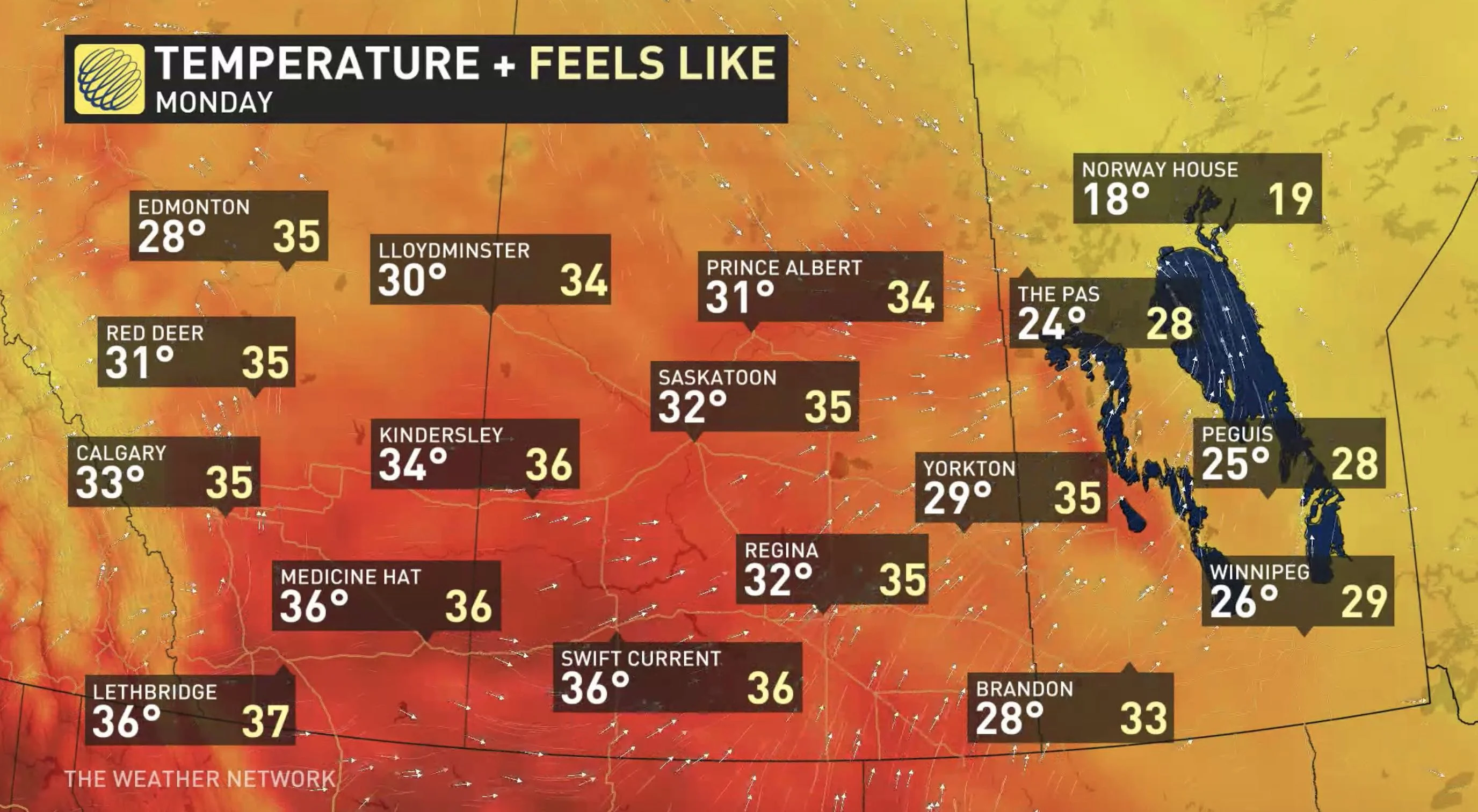
Temperatures won't stray too far from Thursday's and will be close to seasonal across the Prairies, though a little cooler in central Alberta as some locales may not crack the 20-degree mark. However, Alberta will warm up on the weekend.
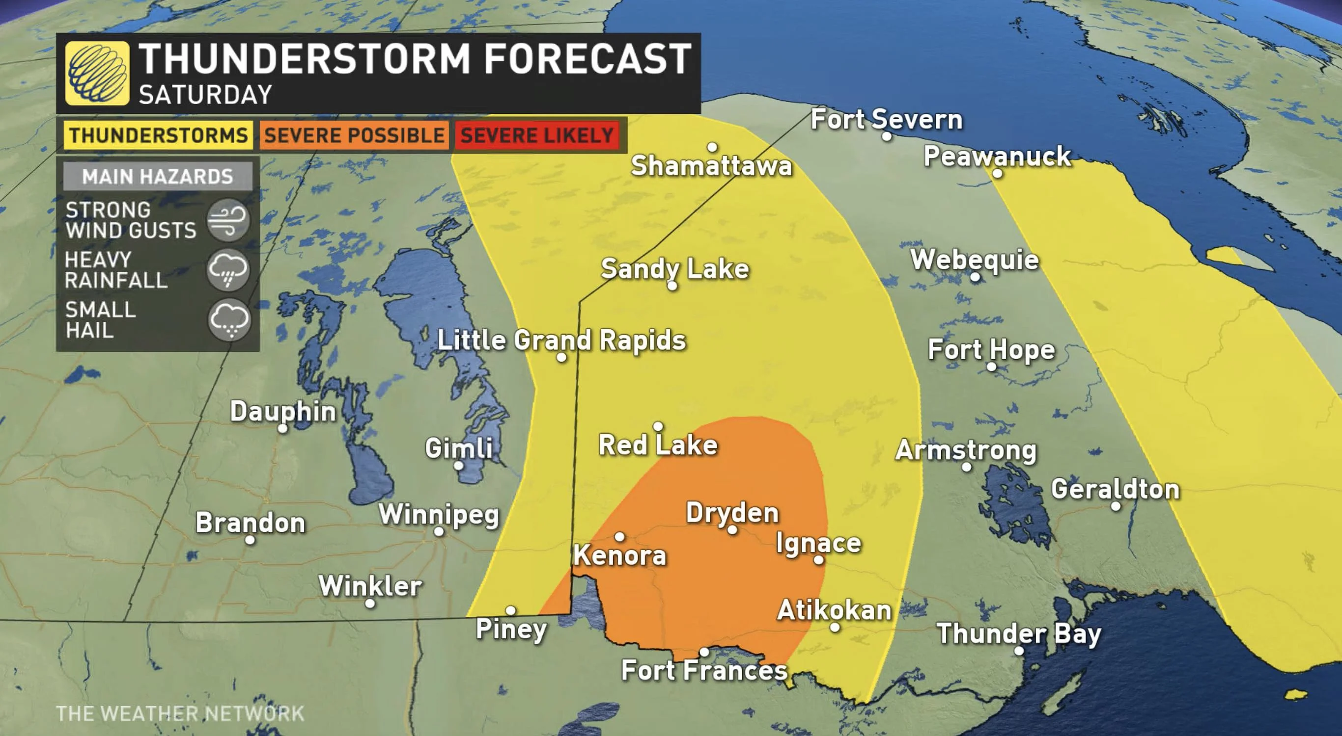
WEEKEND: STORM RISK EASES OFF, WARMING UP IN ALBERTA
On Saturday, the threat for severe weather will diminish somewhat in northwestern Ontario as the system continues to track east. However, a trough associated with an upper low will bring convection to the region in the afternoon, possibly triggering severe thunderstorms, though a lesser likelihood than in recent days.
Eastern Manitoba may see some non-severe storms fire up as a result of the lingering instability.
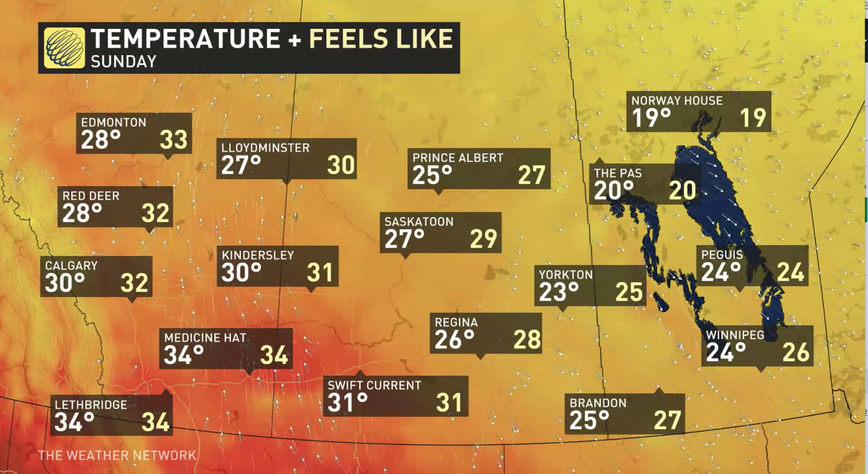
After a rather cool week across Alberta, the weekend will feature lots of sunshine and a warming trend that will see temperatures hitting the 30-degree mark by Sunday. Calgary may hit the mark for the first time this year.
LOOK AHEAD: WARMING TREND IN ALBERTA, WITH ACTIVE PATTERN IN SECOND HALF OF NEXT WEEK, COOLING IN THE EAST
Alberta's weekend warmup will continue into next week with a few days of hot and dry weather. A risk for thunderstorms should return to central and northern areas during the second half of next week.
For the eastern Prairies, temperatures will climb back to above seasonal temperatures for most of next week, but they won't be as hot as on the western Prairies. Another cold front is expected to swing through at the end of the week with thunderstorms and cooler temperatures.
Check back as we continue to update the forecast.
See a tornado? Report it to Northern Tornadoes Project if it's safe to do so. Find out more on how to become a citizen storm spotter, here.