Tornado warnings ended, severe risk continues in southern Ontario

Residents are advised to plan in case of power outages and prepare to take shelter when severe weather strikes.
Tornado warnings were briefly issued in southwestern Ontario, however, those have since ended. Meteorologists are closely monitoring a line of thunderstorms that are tracking through southern Ontario and have the potential to create significant damage. In addition to torrential rain, large hail and powerful wind gusts, there is also the potential for one or two tornadoes. Details and timing, below.
Visit our Complete Guide to Summer 2020 for an in-depth look at the Summer Forecast, tips to plan for it and much more
WEATHER HIGHLIGHTS:
Severe storm risk for the evening and overnight for southwest, southern and central Ontario, including the GTA
Damaging winds, supercells, and heavy downpours possible
Plan for power outages
Humidity making it feel like 40 for most, cooldown follows storms
Keep on top of weather ALERTS in your area
WEDNESDAY: WIDESPREAD SEVERE STORM RISK
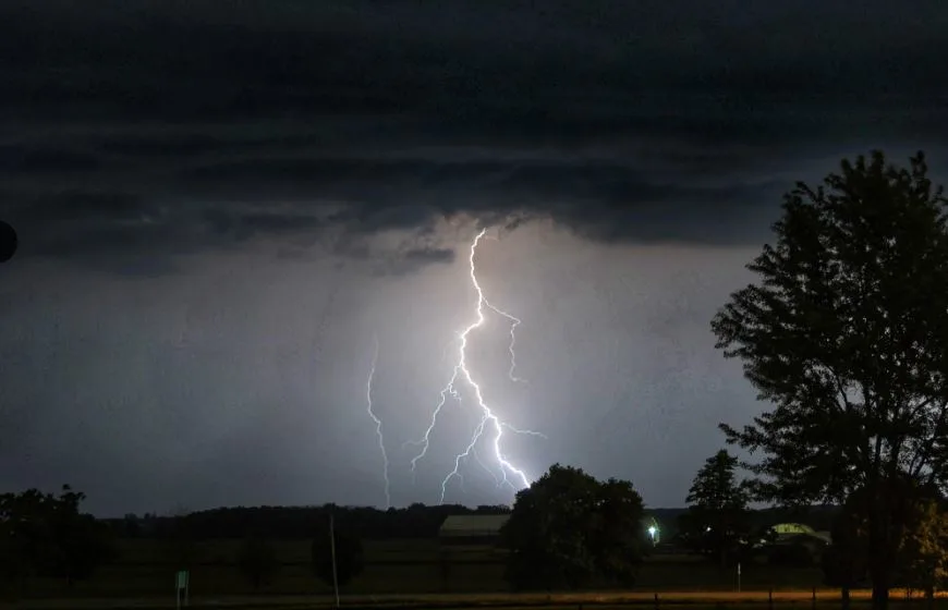
Severe thunderstorms are tracking across southern Ontario and many regions have seen torrential rainfall, hail and powerful wind gusts. Meteorologists are closely tracking the potential for a tornado or two that could occur this evening.

DON'T MISS: Watch vs. Warning - How we communicate severe weather in Canada
At 11:10 p.m. EDT meteorologists are monitoring the squall line that is currently impacting the Durham region and will reach Kingston and eastern Ontario several hours after midnight.
A squall line is a narrow band of convective storms that can produce damaging winds, heavy rain, frequent lightning and occasionally hail and tornadoes. Wind gusts up to 110 km/h and torrential downpours are possible, along with 2 cm hail.
Toronto Pearson Airport recorded wind gusts of 70 km/h just before 10:30 p.m. EDT.
The Weather Network meteorologist Tyler Hamilton describes this as a "high-end severe weather event for southern Ontario."
Some of the damages that have been reported include downed power lines and large tree branches that have been knocked over in Goderich.
There were several reports of possible tornadoes in Belmont and Glencoe. Footage of these possible tornadoes were captured and will be reviewed by Environment Canada.
Windsor, Sarnia, London and other southwestern regions are seeing the highest risk for severe weather in the evening hours. These impacts include torrential rain, hail, strong winds and even the chance of a tornado or two.

Even though the squall line will have weakened by the time it reaches the National Capital Region, severe thunderstorms and the associated hazards are possible this evening.
Torrential downpours could suddenly reduce visibility to near zero and could cause flash floods and water pooling on roads and other low-lying surfaces.
Meteorologists recommend charging electronics and preparing flashlights in the event of a power outages as well as securing outdoor gazebos and trampolines, which could be impacted by high winds.
Strong wind gusts can toss loose objects, damage weak buildings, break branches off trees and overturn large vehicles.
LOOK AHEAD: SHARP TEMPERATURE DROP LOOMS
Behind the system, much cooler weather looms for the end of the week and unusually chilly weather is expected for the weekend with temperatures 5-10 degrees cooler than seasonal. The below seasonal temperatures will continue into early next week, but with abundant sunshine, followed by a warming trend for the middle of the week.
Stay tuned to The Weather Network for the latest forecast updates.