Heat drops in Ontario after weekend of severe storms

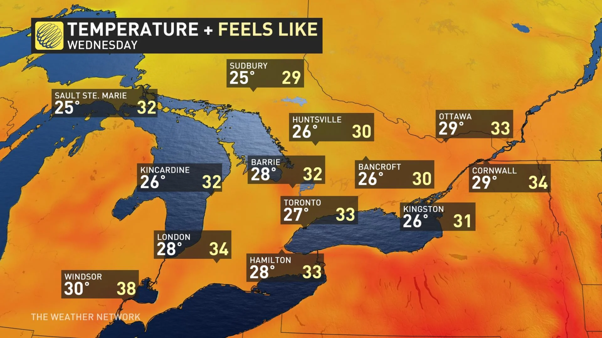
After a weekend of active weather, which included a tornado-warned storm, relief is in site for central Canada. There will be a break from the high heat and humidity as temperatures keep around seasonal as we start the last week of July.
After a stormy weekend in parts of Central Canada, the threat of active weather will be minimal as we look ahead to a beautiful start to the work week. Expect relief from high heat and humidity as temperatures will keep around seasonal as we start the last week of July. For more on what to expect for the week, read below.
MUST READ: Get equipped for summer DIY with this comprehensive list of gear
Looking ahead: Beautiful start to the last week of July
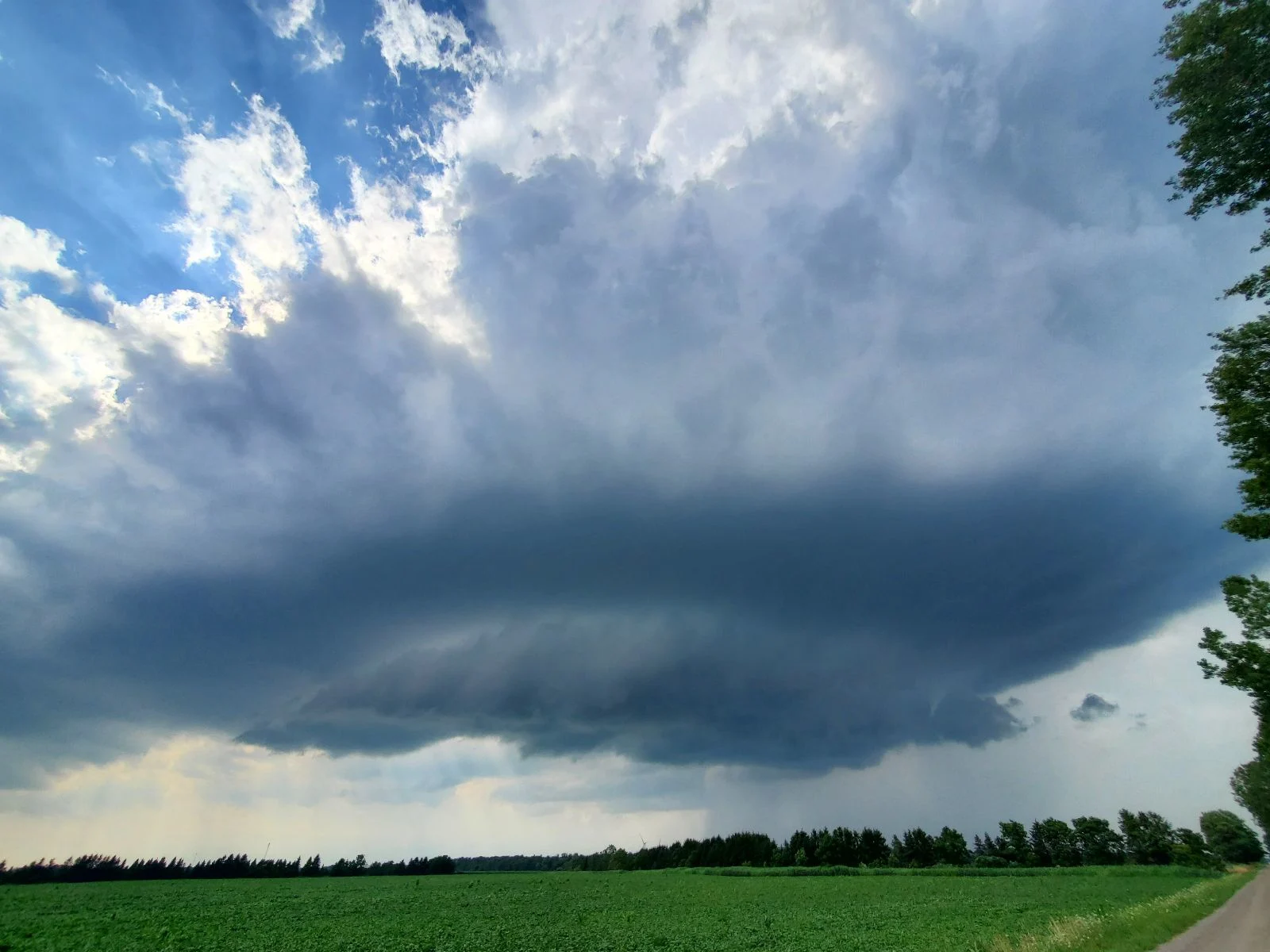
The weekend ended with active weather for part of southern Ontario as a tornado-warned storm brought strong wind gusts and heavy rain. Conditions will grow calmer and a touch cooler behind the cold front come Monday. We can expect lower humidity and temperatures around seasonal as we start the last week of July, a change that’ll feel downright refreshing after this past week.
Our next opportunity for active weather will arrive by late Wednesday or Thursday, followed after by a return to pleasant conditions and near-seasonal temperatures heading into the long weekend. Looking ahead, there is the potential for a rather warm pattern across the region during the first week of August.
DON’T MISS: Protect yourself from the strong summer sun with these fantastic products
Stay tuned to The Weather Network for the latest on conditions across Ontario and Quebec.