
Risk of heavy rain in parts of southern Ontario, 30-50 mm possible for some

The unsettled weather will continue into the weekend across Ontario as a boundary tracks in and fuels the potential for thunderstorms. Remnants from the former Hurricane Laura will move into the region and could result in some areas seeing heavy downpours with 30-50 mm of rain from Friday afternoon into Saturday. Temperatures will be relatively close to seasonal before warmer temperatures arrive next week. Details and timing, below.
WEATHER HIGHLIGHTS
Stormy weather Friday with the risk of heavy rain ahead of a weekend cooldown
Keep on top of severe weather ALERTS in your area
FRIDAY: HEAVY RAIN, THUNDERSTORM RISK
A boundary will track south Friday and fuel the potential for severe thunderstorms in the afternoon and evening in southwestern areas. While there is a risk for non-severe storms across southern Ontario, most areas will be rain-free.
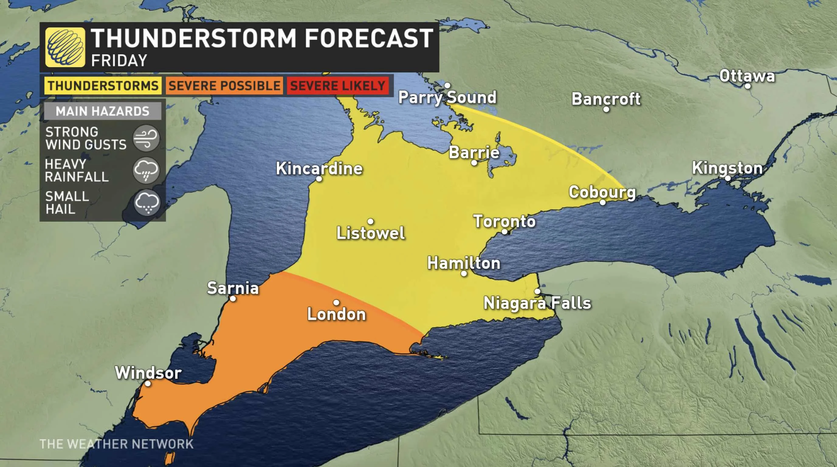
However, the boundary will lift northwards on Friday night, bringing in widespread rain and thunderstorms into the overnight hours. The rain will linger into early Saturday morning in southern, eastern and central Ontario.
The system will tap into Gulf of Mexico moisture associated with the remnants of Laura, so parts of southern Ontario could see 30-50 mm of rain through Saturday.
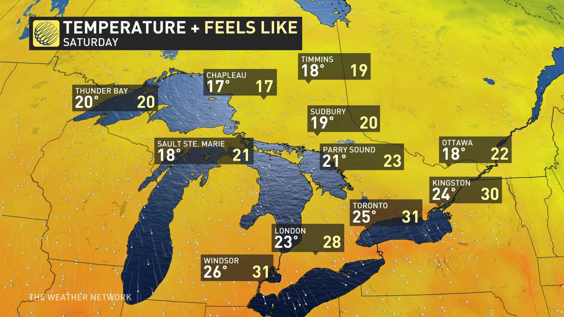
Temperatures will be slightly cooler, but still muggy, with humidex values in the low- to mid-30s in the south. Daytime highs will be cooler in the eastern and cottage country areas, with temperatures in the low 20s, with more comfortable humidity levels.
LOOK AHEAD: WEEKEND COOLDOWN, BUT TEMPERATURES TO REBOUND BRIEFLY
Following the passage of the system, cooler temperatures and gusty winds will move in, along with lake-enhanced showers Saturday night and Sunday morning. Conditions will be fair and cool for the start of next week, but then a warming trend is expected by mid-week.
There is also the potential for a brief return to very warm and humid conditions late week, but then becoming more unsettled as a cold front approaches, with a system or two possible along the boundary. At this point it looks like cooler weather will return during the Labour Day weekend.
Keep an eye on the forecast as we continue to monitor Ontario's weather outlook.


