Brief break between systems before the next one arrives in B.C. Thursday

B.C. is firmly stuck in an active pattern, with yet another messy system sliding in later Thursday after a brief break.
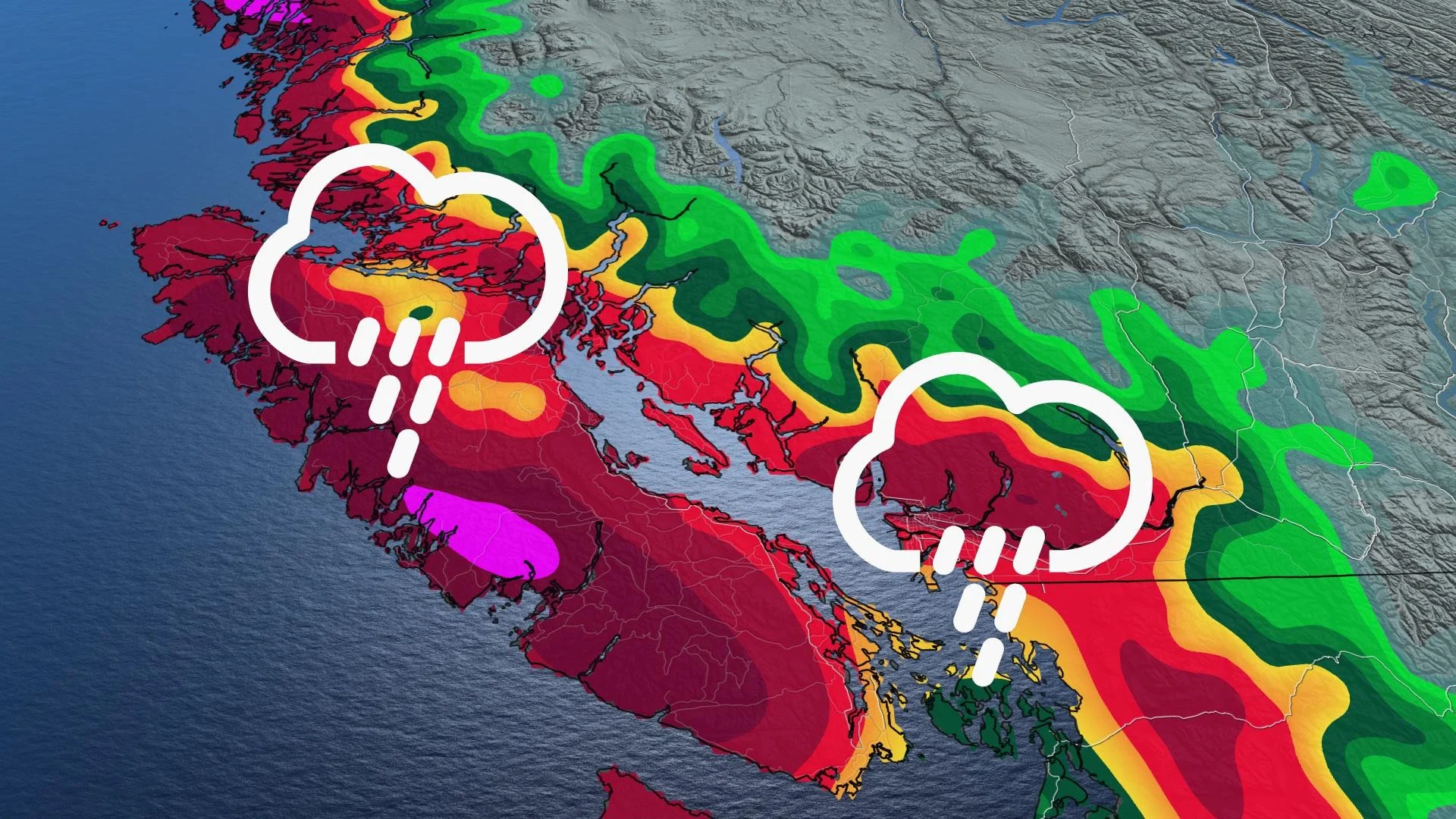
B.C. is in the midst of yet another long-lived soggy period, with regular shots of snow for the higher elevations and rounds of rain for Vancouver Island and the coasts. The round that started Wednesday will be tapering off Thursday morning, but the next shot slides down the coast for the late afternoon and evening. Details and timing on the next system, and what's still to come, below.
WEATHER HIGHLIGHTS
Current system tapers off Thursday morning, next one slides down the coasts by the afternoon and evening
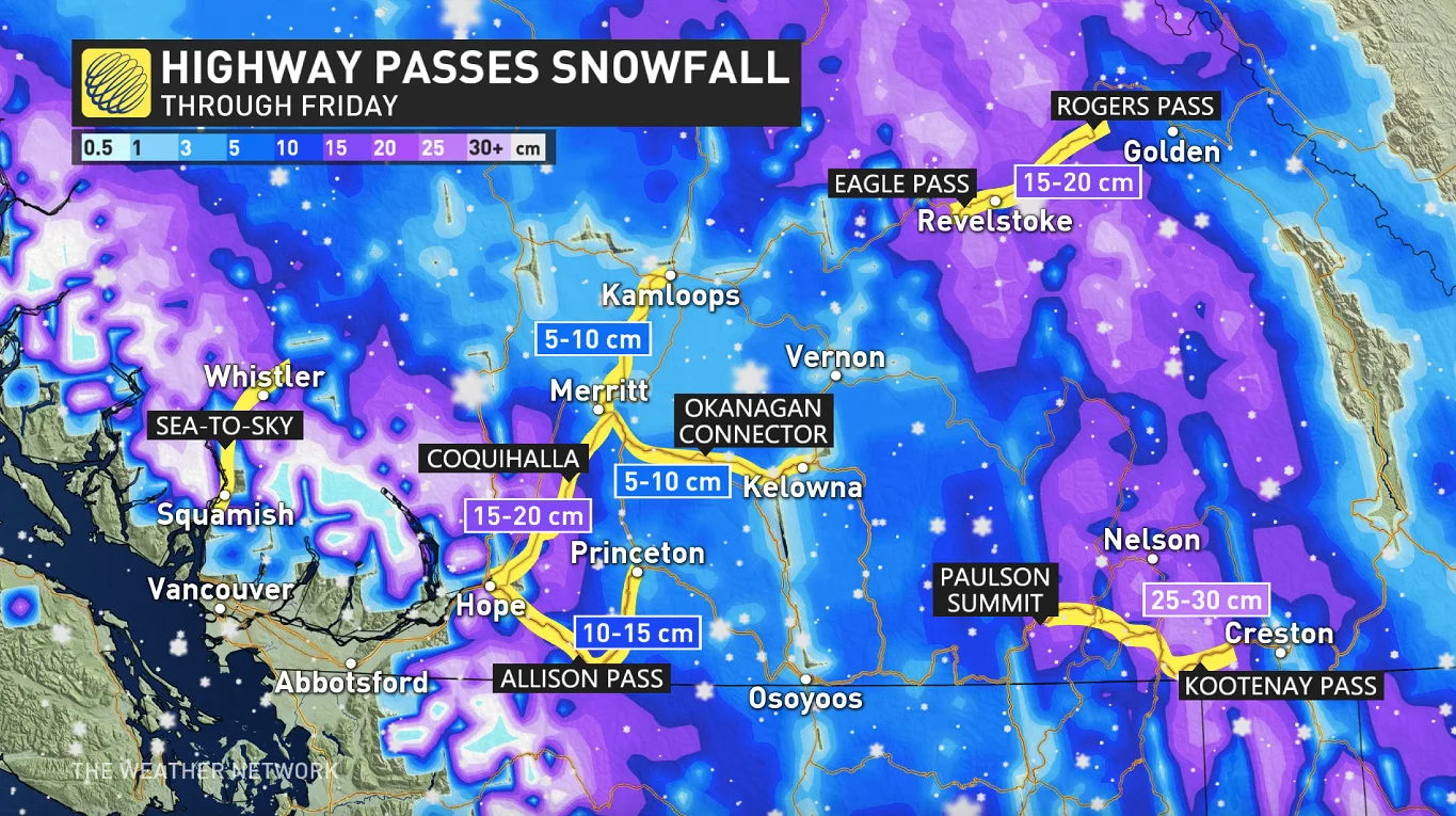
Showers at the coasts, 10-20 cm of snow for the mountain passes
More wet and snowy weather for the weekend
Visit our Complete Guide to Winter 2021 for an in depth look at the Winter Forecast, Canada's ski season, and tips to plan for everything ahead!
THURSDAY: BRIEF BREAK BEFORE NEXT SYSTEM ROLLS IN
The last of the previous system's precipitation will be tapering off Thursday morning, but the break beyond won't be a long-lived one.
By the late afternoon and early evening, the next round will be sliding southward along the coast, bringing more rain to Vancouver Island and the coasts. As for the mountains, it will be another difficult night for travellers, with up to 20 cm of snow for the mountain passes, and up to 30 cm for the Kootenay Pass.
BEYOND: RISK OF LOCALIZED FLOODING, LANDSLIDES
The unsettled weather continues through Friday, with breaks in between.
It's part of a multi-day rainy pattern that isn't done yet. By Saturday, much of the Lower Mainland will have seen as much 100 mm of rain over the course of the week, but 200 mm is possible for western Vancouver Island.
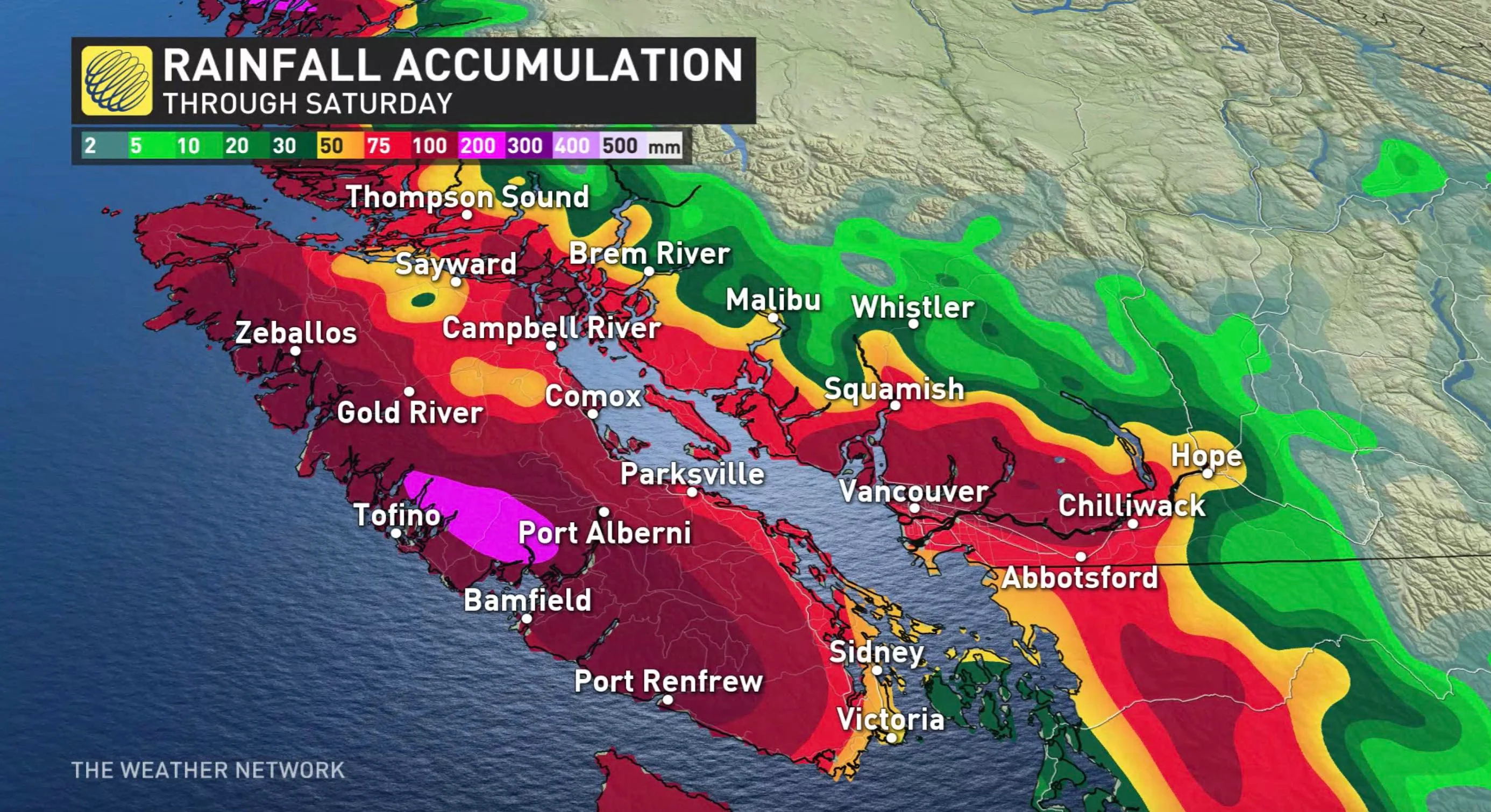
With all this rain, localized flooding and the potential for landslides are possible this week in areas that are seeing significant amounts of rainfall.
More snow is also likely for the Interior to end the week, and on the weekend as well.
"A few days of drier weather next week, but watching the potential for a significant storm around Christmas – most likely bringing rain to coastal areas and heavy snow to the mountains," Weather Network meteorologist Dr. Doug Gillham says.
Check back as we continue to monitor the forecast for B.C.