See why these spiky hailstones are battering the U.S. South
When we're talking about hailstones larger than baseballs, what shape they take may not be the primary consideration. But whether the stones are smooth or spiky can tell us a lot about the nature of the storm that forms them.
While you might picture white marbles when you think of hail, hail actually comes in all shapes and sizes, thanks to the different processes that take place when it forms inside a large thunderstorm.
Visit our Complete Guide to Spring 2019 for an in depth look at the Spring Forecast, tips to plan for it and much more
Generally speaking, you need a fairly significant thunderstorm to form hail -- that is, one with a healthy updraft, or rapidly rising air within the storm. The stronger the updraft, the taller the storm, with the most powerful storms reaching the top of the troposphere (the layer of the atmosphere closest the ground, where we live).
At these higher levels in the atmosphere, droplets pulled up within the cloud will start to freeze, beginning the process of hail formation, as Tyler explains in the video above.
What the hailstones look like when they fall has to do with how long they stayed at these freezing levels, and the path they took through the cloud as they rode updrafts and downdrafts.
Opaque, rounded hailstones indicate that there was more super-cooled water in the cloud -- water droplets that remained liquid below the freezing mark -- and that these droplets froze when they came into contact with other, already frozen droplets. One meteorologist compared it to the effect of rolling up a snowball; the longer you roll, the bigger it gets.
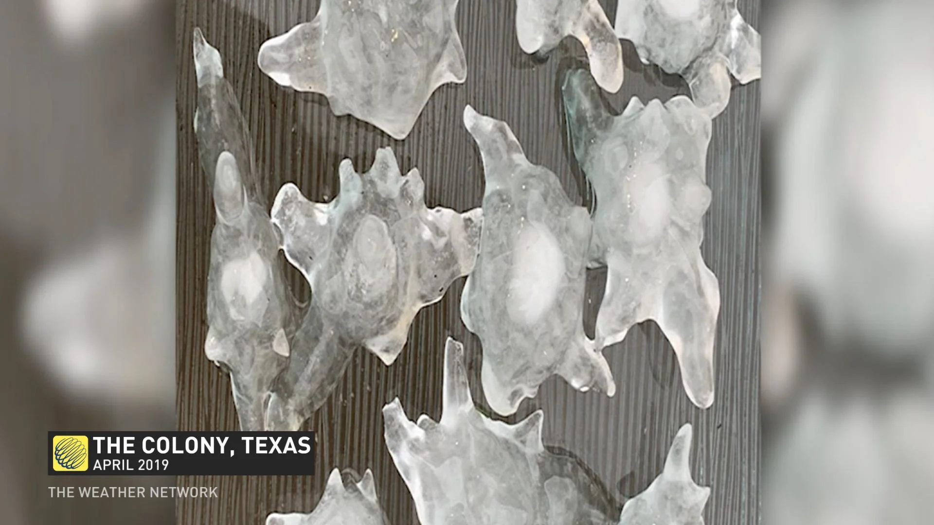
Spiky, unusual shapes form when forming hailstones clump together in what's known as aggregation hail. Think of that as taking separate snowballs and mashing them together.
Misshapen hail -- like the stones that fell over the U.S. South this weekend -- tends to suggest ferocious updrafts that were dragging moist air from the bottom of the storm well up to the top of the troposphere.
DON'T MISS: Our country is warming two times faster than the rest of the planet. The Weather Network and Canada's leading experts on climate bring you 2xFaster, an exclusive series premiering Tuesday, April 16.
Thumbnail courtesy CNN