Harsh conditions as snowstorm threatens 50 cm, treacherous travel

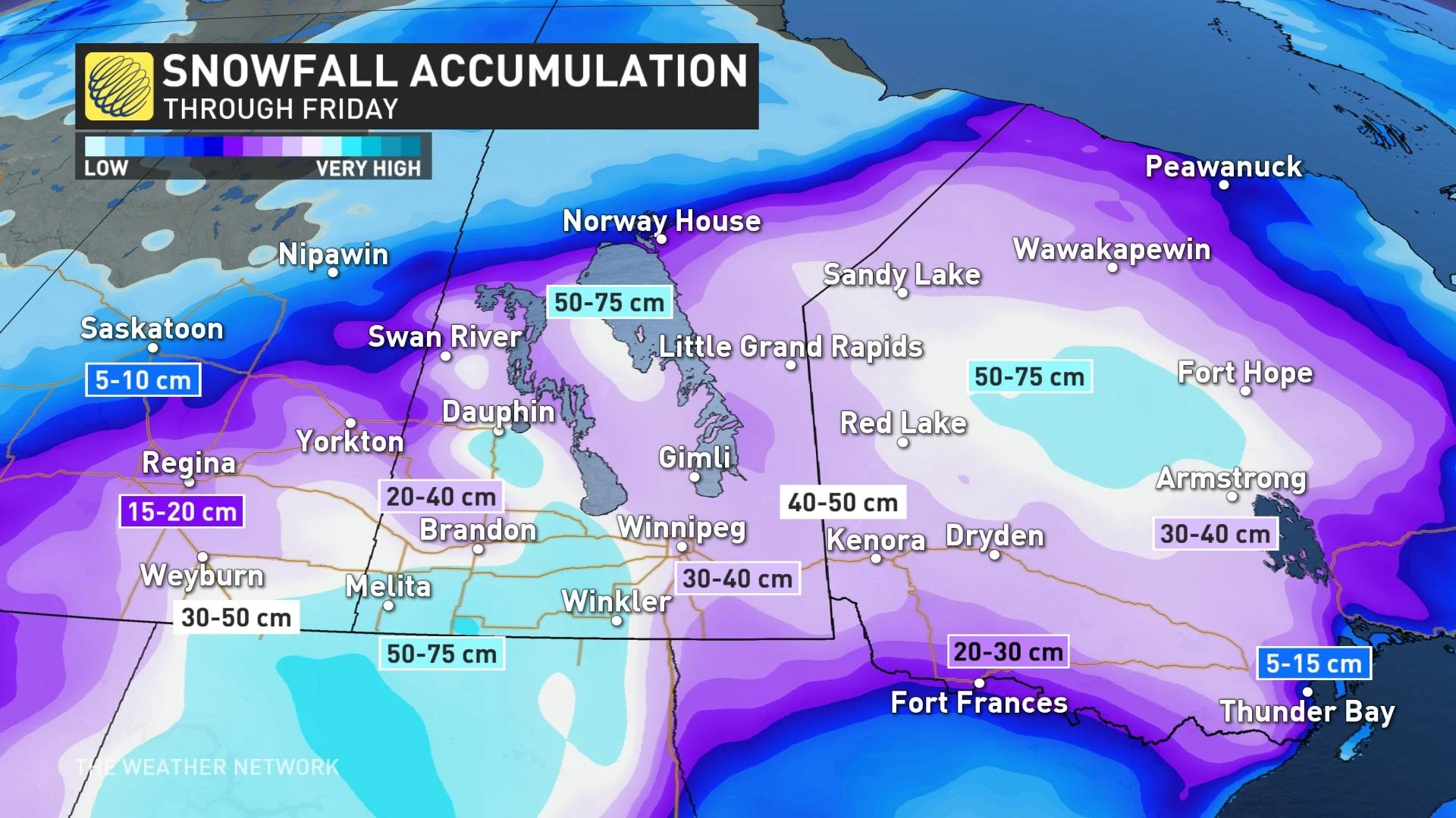
A potent spring storm is underway, with 50+ cm of snow set to have a significant impact across the eastern Prairies and northwestern Ontario.
Widespread winter storm warnings continue to cover the eastern Prairies and northwestern Ontario as a powerful system brings significant snow and dangerous blizzard conditions.
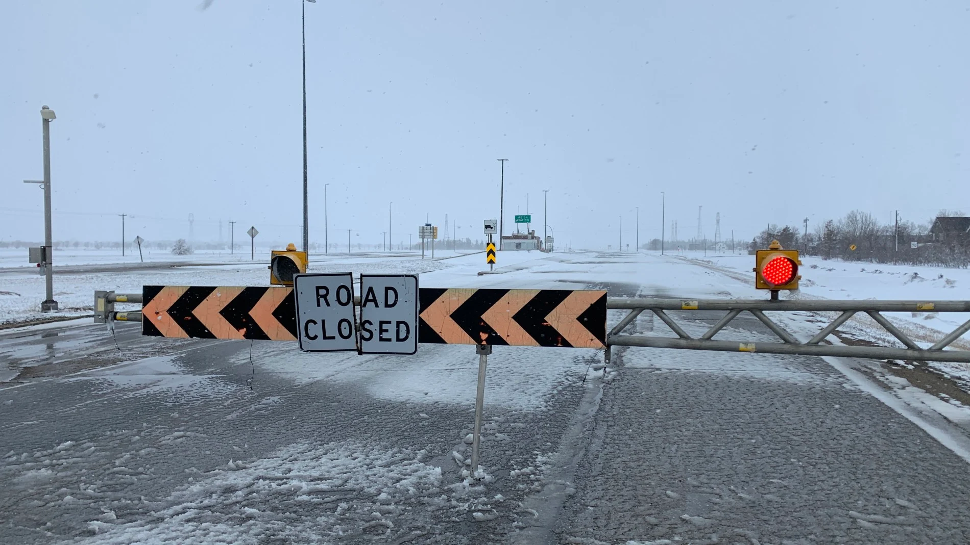
This is shaping up to be a high-impact, historic storm with steep snowfall totals and gusty winds that are creating periods of dangerous whiteout conditions in many areas. Blizzard warnings are also in effect.
Snowfall will continue for southeastern Saskatchewan, southern Manitoba, and northwestern Ontario on Thursday. Most of the snow from this system will have fallen on Wednesday, but many areas will continue to see more snow throughout the day on Thursday. Accumulations will be higher in certain areas due to potent snow bands that will develop from the northerly flow.
DON'T MISS: Snowstorm forces all Winnipeg schools to close doors for 1st time in 25 years
Winds will also continue to be quite strong with gusts of 50-70 km/h. These winds can cause blowing snow, which can lead to reduced or even zero visibility.
“Travel is expected to be extremely hazardous due to reduced visibility. Rapidly accumulating snow will make travel difficult,” Environment Canada and Climate Change said in the blizzard warning for Dauphin on Wednesday evening.
Snowfall rates will start to wind down throughout the latter half of Thursday and become more localized by Friday morning. There will still be localized snow bands with strong gusts that could catch drivers off guard as roads begin reopening on Friday.
WATCH BELOW: A LOOK AT THE MID-APRIL SNOWSTORM
Widespread snowfall totals of 30-50 cm are possible, with a few spots possibly picking up as much as 50-75 cm by the time all is said and done. However, it may be difficult to measure the exact snowfall amounts because of blowing and drifting snow.
Strong northerly winds with gusts as high as 70 km/h will persist into Friday morning as the low slowly pivots through Minnesota on its way into northwestern Ontario.
Power outages are likely and rural areas in particular should be prepared for extended outages. As well, school cancellations are widespread.
It's been 25 years since all metro Winnipeg schools were forced closed due to weather. On Tuesday night, it was announced that all schools and administration offices across the city will be closed Wednesday and Thursday, and that staff are encouraged to just stay home.
MUST SEE: Cold temperatures should prevent major flooding after storm, experts say
In Estevan, a 30+ cm snowstorm after April 11 has only happened twice since 1902, with officials noting that this storm will likely become "historic."
The weekend weather will be a well-deserved break from the harsh conditions. On Saturday there will still be some blustery winds at times, but by Sunday, conditions will finally be much calmer.
"It looks like a favourable temperature trend beyond this system to help the flooding concerns, with daytime highs forecast to remain below freezing until at least mid next week," says Kelly Sonnenburg, a meteorologist at The Weather Network.
Stay tuned to The Weather Network for all the latest on conditions across the Prairies.