Hurricane Sam continues to churn, swells and winds expected in Newfoundland

Hurricane Sam is beginning to weaken as it takes a path over the North Atlantic and will stay away from Newfoundland at a safe distance, but the edges of the storm will be close enough to bring dangerous swells and breezy winds to parts of the island.
Hurricane Sam is slowly losing power as it tracks out further into the North Atlantic. Once a Category 4 storm, it is now down to a Category 2 as of Sunday evening, with further weakening expected in the days ahead. In fact, it is anticipated to become a powerful post-tropical cyclone on Monday.
MUST SEE: A drone sailed into the centre of Hurricane Sam to make future forecasts even better
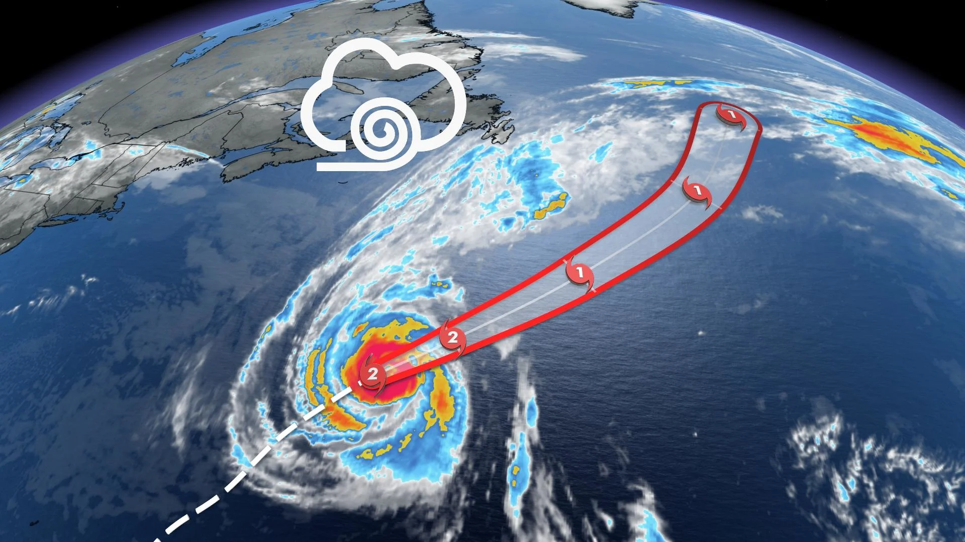
On its current trajectory, Sam will move over the far North Atlantic and will stay southeast of Newfoundland. However, it doesn't mean Newfoundland will get off impact-free, as there will be some blustery winds, showers, and hazardous swells.
Sunday evening’s update from the U.S. National Hurricane Center (NHC) stated that Hurricane Sam about 900 km south-southwest of Cape Race, Newfoundland and is trekking east-northeast at around 26 km/h. It has lost quite a bit of its strength and now is down to a Category 2 storm, with maximum sustained winds near 155 km/h with higher gusts.
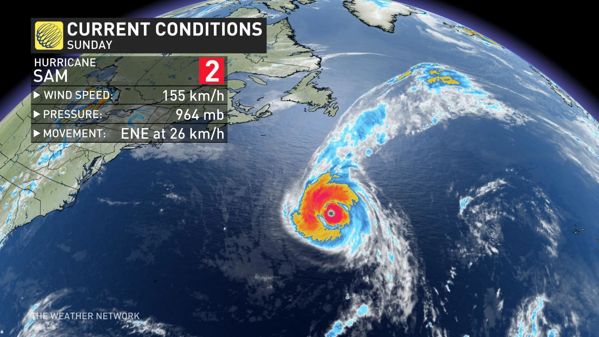
“Gradual weakening is forecast during the next few days, and Sam is expected to transition into a powerful post-tropical cyclone by late Monday," the NHC says.
Though now far distant from the Caribbean, swells generated by Sam will impact the northern Leeward Islands, the Greater Antilles, the Bahamas, the eastern United States and Atlantic Canada for the next couple of days. These swells could cause life-threatening surf and rip current conditions.
Sam is the seventh hurricane of the 2021 Atlantic season. Hurricane season traditionally runs from the beginning of June through the end of November.
SAM TO VEER WELL EAST OF NEWFOUNDLAND, DANGEROUS SEAS STILL EXPECTED
Even though Sam’s track is forecast to stay well away from Newfoundland, it is likely to have some Canadian impacts, but nowhere near the recent damage that was caused by Hurricane Larry.
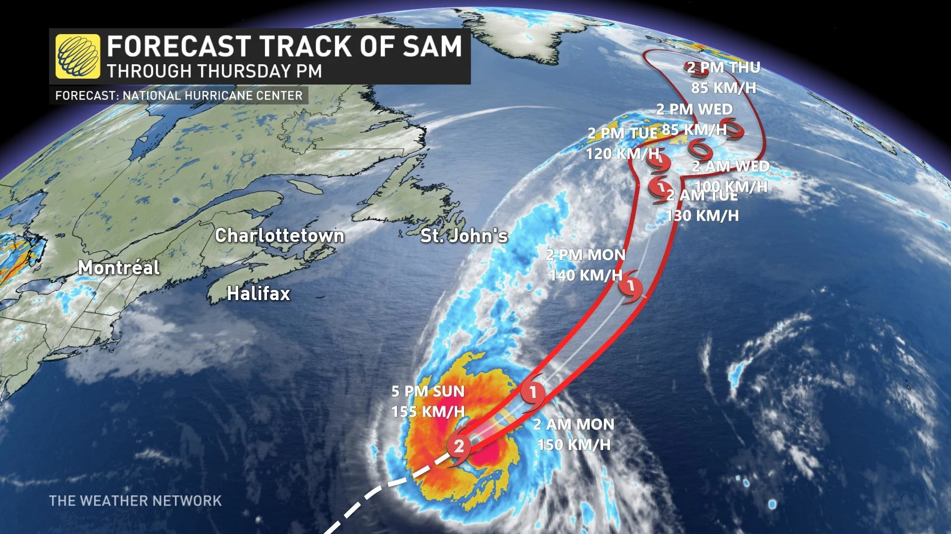
Hurricane Sam continues to weaken and is expected to transition into a powerful post-tropical cyclone on Monday.
"Hurricane Sam will track well east of Newfoundland, but close enough to bring showers, wind gusts of 80+ km/h, and very dangerous seas to the eastern coastline of Newfoundland," says Dr. Doug Gillham, a meteorologist at The Weather Network.
RELATED: Hang on safely through the Atlantic hurricane season with these tips
The winds will pick up Monday afternoon, with the stronger gusts expected in Tuesday afternoon, then subsiding through the evening hours.
Sam isn’t the only storm in the Atlantic anymore, either.
Tropical Storm Victor formed in the far eastern Atlantic Ocean last Wednesday. Victor is now a tropical depression and remains far from land with maximum sustained winds at 55 km/h. The NHC says that Victor will weaken over the coming days and will quickly dissipate after it becomes a remnant low, which is expected to occur on Monday.
Following Victor’s formation, there’s just one name left on this year’s list of Atlantic storm names. The next and final name on the list is Wanda.
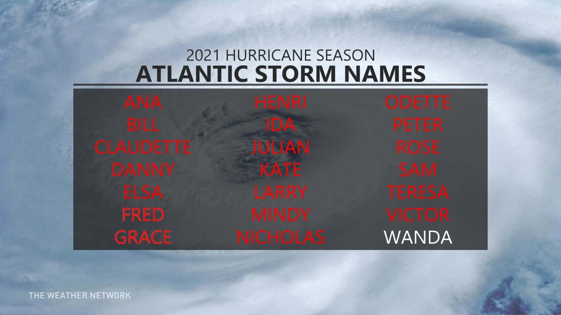
Once we exhaust this year’s official list of names, all subsequent storms will be named using an alternate list, beginning with Adria. This will be the third year since 2005 where such an overflow will occur, and the second in a row.
LOOK AHEAD: Hurricane season is heating up again. What happens when we run out of names?
With its 20 named storms, this year is tied for third place (with 1933, in the pre-satellite era) for most active hurricane season on record, with two months left to go. The year 2020, with its 30 named storms, remains in the top spot.
According to Philip Klotzbach, a meteorologist at Colorado State University, Sam maintained its major (Category 3 or higher) hurricane status for seven days in a row. Only six Atlantic hurricanes in the satellite era — from 1966 onwards — have held major hurricane strength for longer consecutive spans.
"Unfortunately, we have not reached the end of the tropical season - it looks like our hyperactive hurricane season will continue well into the second half of October," Gillham says.
Be sure to check back for the latest updates on the Atlantic hurricane season.