Atlantic: Even more storms lined up in the very stubborn, active pattern

After a stormy week, this pattern of back-to-back storms will continue right into the weekend with powerful winds and heavy snow the biggest threats with this latest storm through early Saturday. More on the timing of this active pattern, and if the storm track shows any signs of finally changing its target spot, below.
Visit our Complete Guide to Winter 2019/2020 for an in depth look at the Winter Forecast, tips to plan for it and a sneak peek at the spring season next year
WEATHER HIGHLIGHTS:
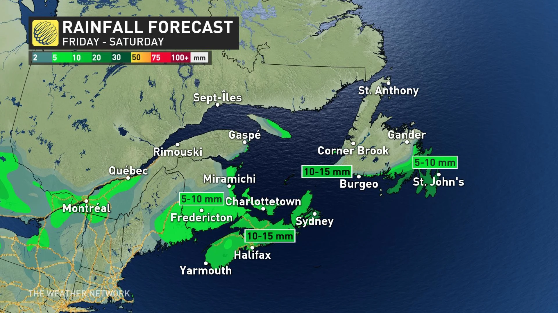
Rainfall reaches Newfoundland by Saturday morning, moving out in the afternoon
Sea-effect snow possible through the day for western Cape Breton and southern Newfoundland
Next system approaches Maritimes Sunday evening
Stay up-to-date on the ALERTS in your area
WATCH BELOW: PARADE OF STORMS PERSIST ACROSS THE EAST
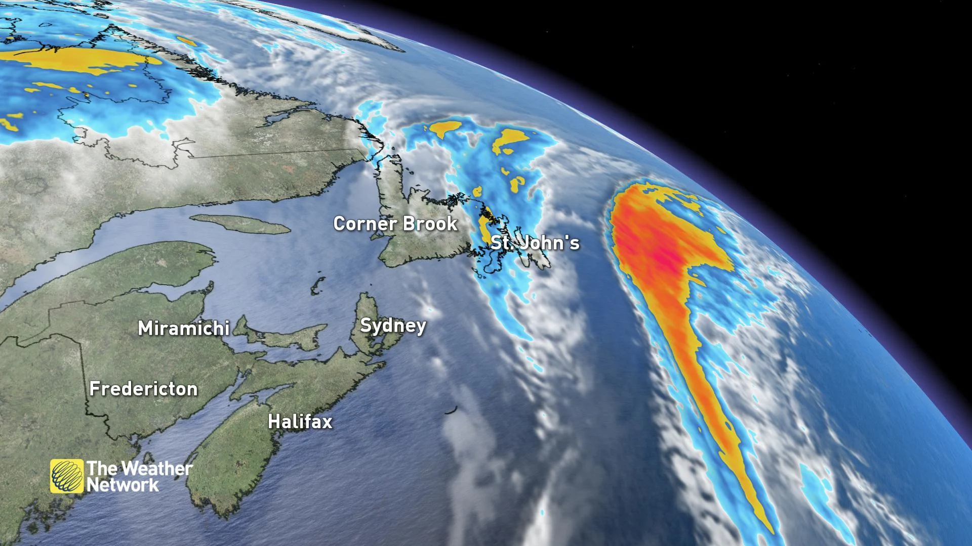
This system, the third of the week, began Friday and was set to bring heavy rainfall across Nova Scotia overnight, reaching Newfoundland Saturday morning and tracking across the province before the boundary moves out by the afternoon.
Through Saturday morning, and as a new centre to the low forms in the Gulf, winds will quickly shift to the west and strengthen with gusts over 100 km/h expected along western Cape Breton and the Newfoundland's south coast. This will result in some unorganized sea-effect snow through the day Saturday with the potential for flurries into the Avalon by the evening.
NEXT SYSTEM FOLLOWS CLOSELY ON SUNDAY
There will be a brief break before the next system approaches Nova Scotia from the south on Sunday evening with more widespread gusty winds expected overnight into Monday. An additional 20-30 mm of rain is also expected for parts of the province.
Current computer models are, once again, keeping the rain/snow line through southern New Brunswick, which could mean around 10 cm of snow for Fredericton while Moncton stays as straight rain.
Yet another system tracks into the region by late Wednesday, with a track further north limiting the heavy snow to northern New Brunswick and western Newfoundland. Strong winds and rain are also likely elsewhere.


