
Alberta getting two Pacific lows that will 'let it snow'

Rounds of snow will pick back up again in Alberta. Starting Thursday evening, snow cold, arctic air will funnel in from a low pressure system from the Rockies. This bout of snow will stay around through Saturday morning. Another blast of snow arrives Saturday night and should stay around until Sunday evening. Just how frigid things will get, below.
WEATHER HIGHLIGHTS:
First round of snow starts Thursday eve and lasts until Saturday night
Another round of snow begins Saturday night and staying strong until Sunday
Temperatures remain below freezing for Calgary and Edmonton this weekend, potentially hitting near record-cold values
THURSDAY EVE INTO SATURDAY: MORE SNOW AND NEAR-RECORD COLD
On Thursday night, a low pressure system drags in moisture across the Rockies, bringing snow to the Elbow Region. The snow spreads down the Foothills and into southern Alberta through Friday.
The snow then overstays its welcome and starts in the Calgary area pre-dawn Friday, with even some light accumulation through the morning. Some of that snow will be mixed with rain in late morning, then return to light snow Friday night and ending Saturday morning.
For areas ranging from Edmonton to Red Deer, some light snow will start around dawn on Friday and continue until the afternoon. Winds from the Foothills will create blowing snow for a perfect winter-fall scene.
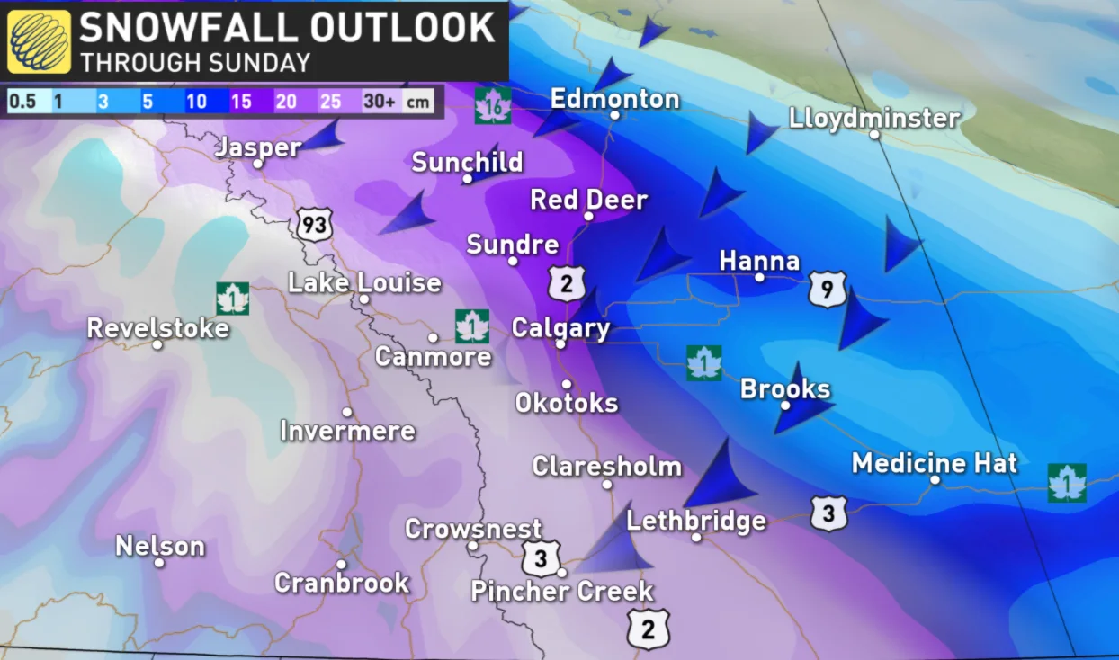
Much more significant snow amounts of 15-30 + cm are expected for the higher terrain in the Rockies, but 10-20+ cm could also fall in parts of the foothills and adjacent areas just south of Grande Prairie to Hinton and Nordegg.
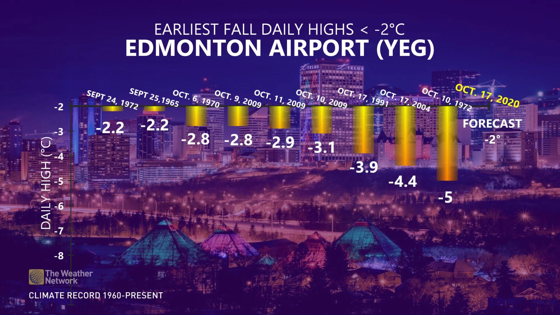
Talking temperatures, they'll likely to plunge well below the freezing mark as Saturday's afternoon highs sit more than 13 degrees colder than normal in some places.
In fact, if the forecast high for Edmonton stays below -2°C on Saturday, it'll be one of the top 10 coldest early fall days on record.
"This is unusually early in the season to have such an extended stretch of sub-freezing temperatures," says Weather Network meteorologist Dr. Doug Gillham.
SATURDAY EVE INTO SUNDAY: WIDESPREAD SNOW POTENTIAL
With all of this cold air in place, there's yet another chance for more snow to reach southern Alberta on Sunday.
Another Pacific low is coming in through southern Britsih Columbia, pushing moisture into southern Alberta with snow beginning across the lower Foothills Saturday evening.
Snow spreads along the Foothills and toward the QE2 through Saturday night.
Up to 10 cm of snowfall starts in Calgary Saturday night and continues through Sunday. Edmonton could see some of that snowfall as well.
On Sunday, the snow also spreads into the Cypress Hills area of Saskatchewan.
"There's the potential for widespread snow as a weak system tracks south of the region along with a reinforcing blast of arctic air and upslope flow," Gillham says. "Several centimetres of snow are possible for Calgary with heavier snow, between 10-20 cm, near the foothills of southwest Alberta."
Be sure to check back as we continue to fine tune the weekend forecast.
While autumn snow isn't unheard of in Alberta at this time of year, even northern sections of the province have been sitting above seasonal for most of this month. Therefore, drivers are urged to adjust to the changing conditions and be prepared for any quickly accumulating snow at times.


