
The last 20 degree blast of 2020 awaits in southern Ontario

Gearing up for what's likely the last 20 degree day of the year in southern Ontario, though with a few more showers first.
There's one more day of showers to endure for southern Ontario, though quite a bit heavier in the Nickel Belt. Beyond, a very rosy Friday beckons, with daytime highs near or beyond the 20-degree mark. Soak it up while you can, however: a cooldown begins later in the day Friday, and the weekend looks clear, but chilly. A closer look, below.
WEATHER HIGHLIGHTS
Showers Thursday for much of the province, heaviest in the Nickel Belt, periods of light snow in the north
Daytime highs above 20° for most of the south, feeling like the mid-20s with the humidity
Sharp cooldown Friday afternoon, chilly but clear weekend
THURSDAY: MORE SHOWERS FOR THE SOUTH, SNOW IN THE NORTH
Morning showers gave way to drier conditions across much of southern Ontario through much of Wednesday evening, but the next shot of rain is in the hopper for Thursday.
Showers look to move into the province through the morning in the southwest, likely reaching the GTA by the noon hour.
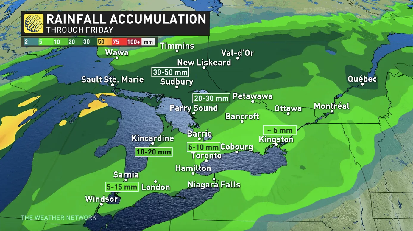
For the south, it won't be a washout by any means, and there will be dry periods. For the Nickel Belt, however, it will be somewhat more substantial, with 20-50 mm of rain possible by the time the last drops fall early Friday.
For more northern areas, Thursday evening may see the intrusion of some snow, with some relatively light accumulations possible, if not periods of a rain/snow mix, ending through Friday morning.
FRIDAY AND BEYOND: SINGLE 20°C DAY AHEAD OF POTENT COLD FRONT
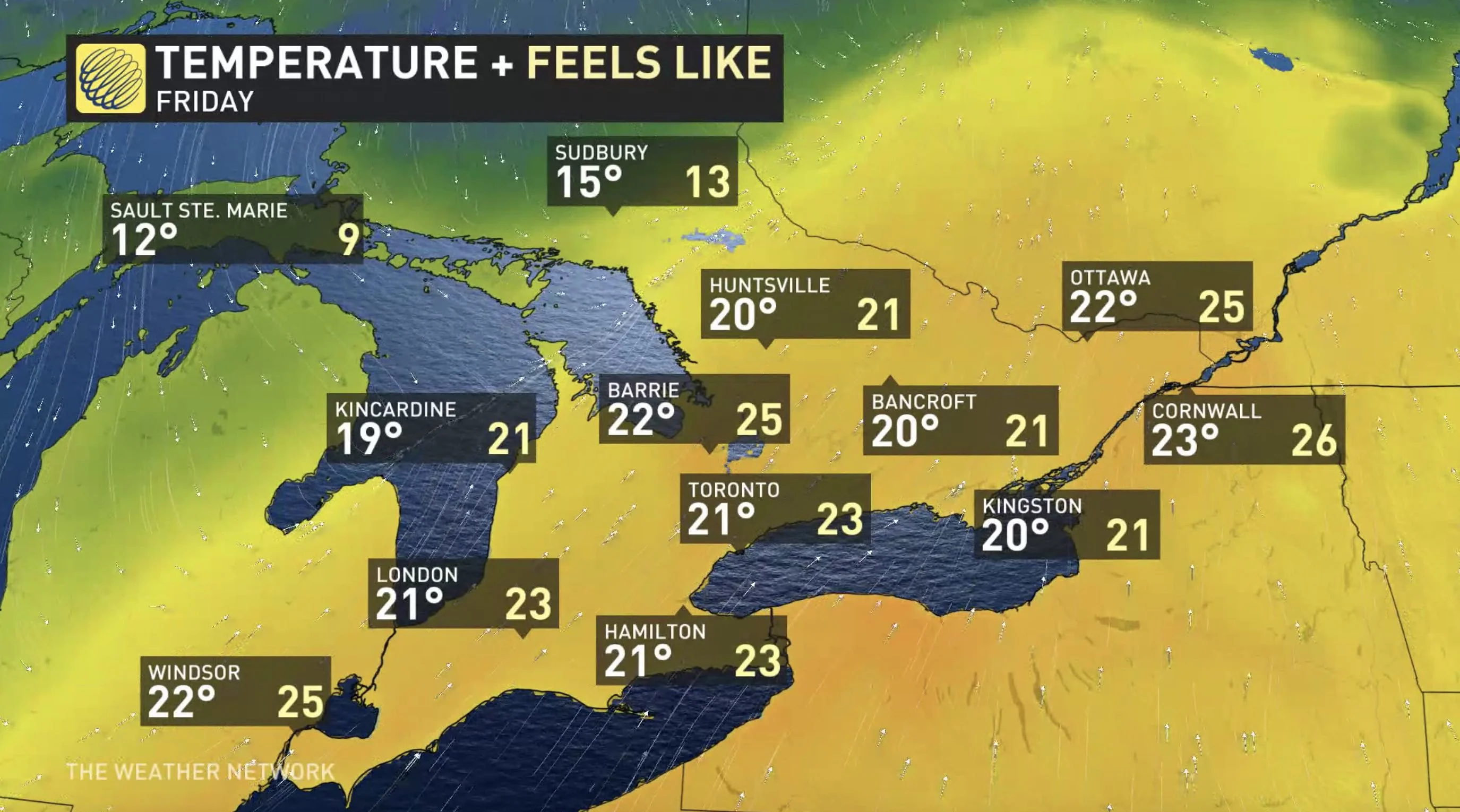
Thursday's temperatures will be a touch cooler than Wednesday, but Friday features a real and impressive bump in daytime highs.
In fact, almost all of southern Ontario can count on reaching or exceeding 20°C, likely their last shot at that threshold for the year. Factor in the humidity, and some southwestern and GTA communities may even feel as warm as the mid-20s.
But beyond, a return to reality beckons, with a cold front crashing southward late Friday afternoon, bring a chance of showers and perhaps even a late-year rumble of thunder as it passes. Behind it, high pressure keeps the skies clear for the weekend, but with chilly temperatures.
"Colder than seasonal temperatures will dominate next week and weekend and into the first few days of November, but we're watching the potential for a somewhat milder pattern to develop during the first week of November," Weather Network meteorologist Dr. Doug Gillham.
Stay tuned to The Weather Network for the latest forecast details.