Dangerous travel as early season snow blankets parts of Alberta

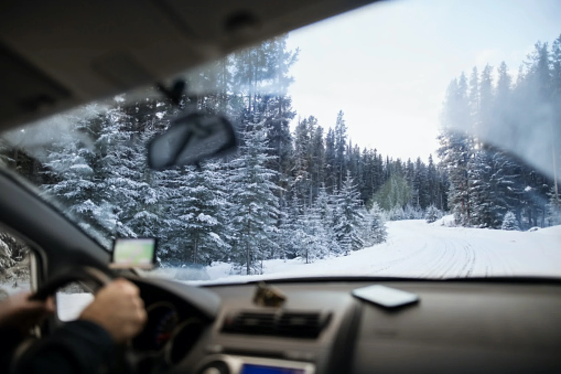
Friday was not a day to be driving through the mountains to or from Alberta, which is seeing some significant snowfall Friday at higher elevations, with some totals also possible as far down as Calgary. Snow continues through to early Saturday morning in some places. Behind this snowy system, widespread cooler temperatures will span the Prairies this weekend, with daytime highs struggling to climb over the freezing mark. While not unusual for this time of year, this will be by far, the coldest weather of the season to date. More on the significant chill, plus a look at Friday's swath of snow, below.
MUST SEE: How spooky is your Halloween forecast? Here's what to expect Sunday
FRIDAY NIGHT: BRACE FOR TRICKY TRAVEL WITH SOME OF THE FIRST SIGNIFICANT SNOW OF THE SEASON SO FAR
Pacific moisture is streaming over the Rockies into Alberta, combining with cool temperatures to bring loads of snow at the mountain peaks and higher elevations, with even some flakes expected as far down as Calgary.
A stream of Pacific moisture is once again pointed at B.C., and while it manifested there as very heavy downpours, and snow at that province's higher elevations, there was plenty left over to spill across the Rockies into Alberta.
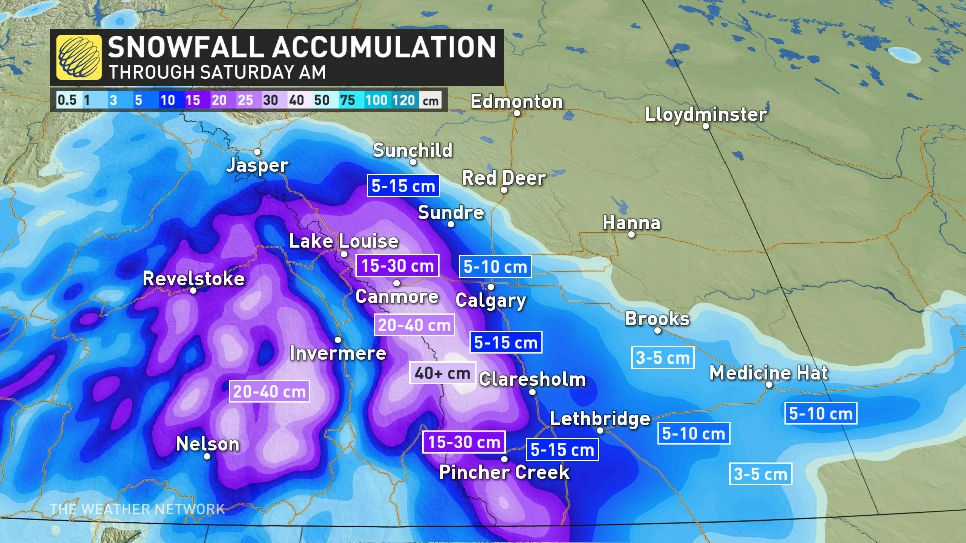
"Totals will be elevation dependent, with 20-40+ cm possible for the higher terrain. There will be a tight gradient along and west of the QE2, where totals will climb from near 5 to over 15 cm," says Michael Carter, a meteorologist at The Weather Network.
In Calgary, accumulations will range from 5 to 10 cm through early Saturday.
Snowfall warnings are in place for some of the mountains and foothills, some the first of this season, and periods of dangerous travel remain likely through the night.
"Be prepared to adjust your driving with changing road conditions," says Environment and Climate Change Canada in the snowfall warning. "Visibility may be suddenly reduced at times in heavy snow. If visibility is reduced while driving, turn on your lights and maintain a safe following distance."
RELATED: When should you switch to winter tires? Provincial breakdown, here
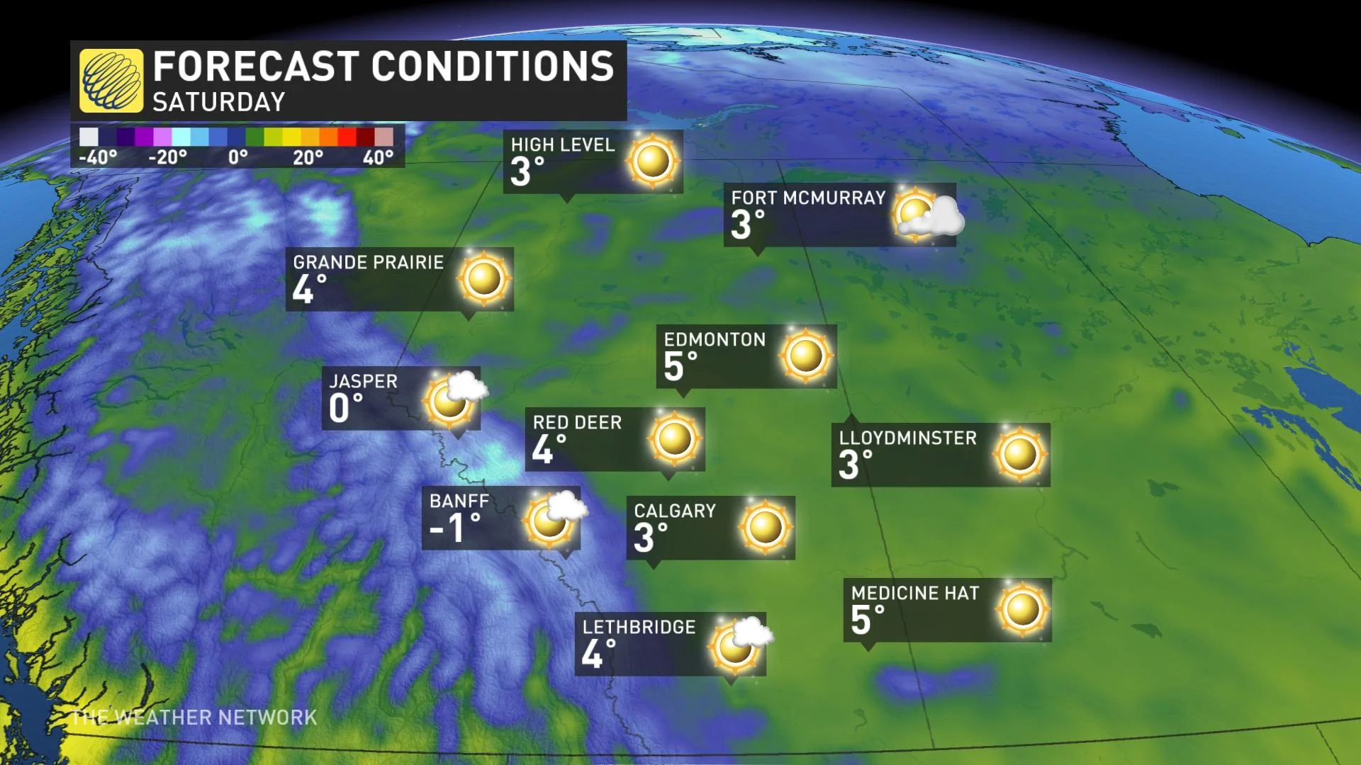
WEEKEND: SIGNIFICANT CHILL SETTLES IN BEHIND THE SNOWY SYSTEM
The snow finally eases during the pre-dawn hours on Saturday, as high pressure moves back into the region and sweeps the skies clear.
Temperatures will fall significantly, with cities like Calgary and Edmonton even struggling to crack the freezing mark. Overnight lows will fall deep into negative territory.
"This could lead to snow accumulations sticking around for a while in areas that see heavier totals," says Carter.
Be sure to check back for the latest updates on this snowy system for Alberta.


