Widespread rain, cool pattern stretches across the west, risk of alpine snow

A wet and cool pattern takes hold of much of Western Canada this week
Unsettled, wet and cool. That will be the best way to describe much of Western Canada this week with a fall-like pattern sending temperatures tumbling and delivering a widespread rain to the region. More on the timing of the incoming rain (and potential snow), plus a look at if this week's weather signals a free fall right into autumn, below.
WEATHER HIGHLIGHTS:
Upper low tracking into the B.C. South Coast brings showers through Tuesday, risk of thunderstorms from Vancouver Island, onto the Lower Mainland and across the interior
Heaviest rainfall from the Caribou Mountains down through the southern Interior
Stationary boundary draped from the Rockies combined with a low pressure tracking across the northern plains of the U.S., will push a swath of widespread rain from Alberta to Manitoba Tuesday.
Temperatures below seasonal to start the week, threat for alpine snow for the Rockies
Stay on top of ALERTS in your area
A series of systems will keep most of Western Canada unsettled for much of this week, as temperatures cool far enough to bring the threat for some high elevation snowfall.
REX BLOCK PATTERN SETS UP OVER B.C.
You can thank the Rex Block for this week's wet weather in B.C.
"With a Rex Block, high pressure situates itself north of low pressure and the pattern remains somewhat stationary or locked in for a number of days," says Weather Network meteorologist Kelly Sonnenburg. "This prevents weather systems from typically progressing from west to east across the country."
An upper level low positioned over southern B.C. will bring widespread scattered rain showers and the risk for thunderstorms Tuesday.
"Periods of moderate to heavy rain are expected at times through the Rockies through Tuesday morning," says Sonnenburg.
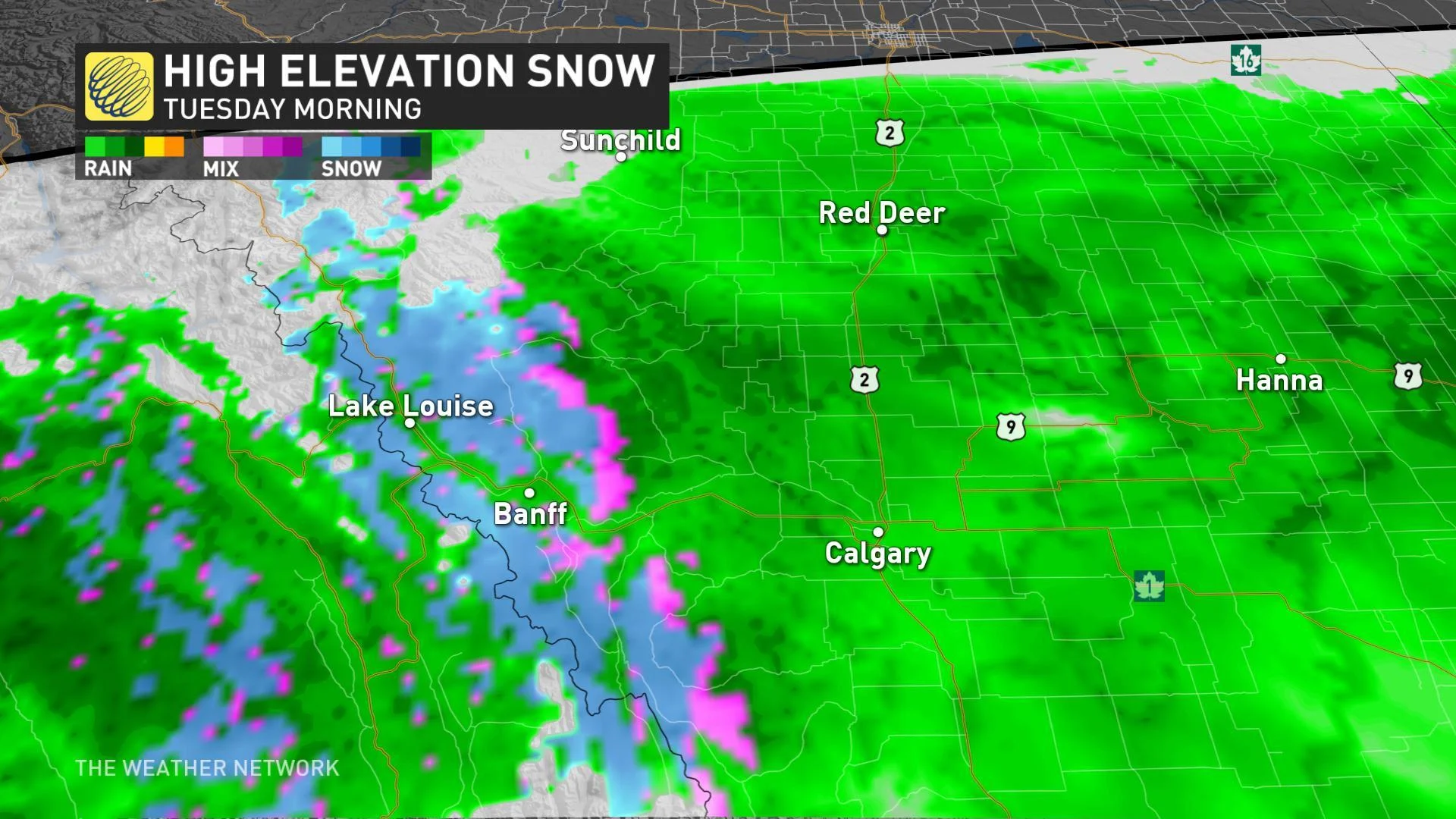
Temperatures will also cool enough overnight into the pre-dawn hours Tuesday for elevations more than 1800 metres to see some mixing or snow, likely near Banff and parts of Kananaskis.

RAIN SPREADS INTO THE PRAIRIES ON TUESDAY
A series of troughs swinging north from the U.S. will also make for a wet pattern across the southern Prairies this week.
"A U.S. system forcing itself north will get squished south from high pressure positioned north and this will spread 10-20+ mm of widespread rain across southern Alberta, Saskatchewan and southern Manitoba through Tuesday," adds Sonnenburg.
Daytime highs across the Prairies will also struggle to reach the mid-teens right through Wednesday.

NEW LOW CLIMBS NORTH THURSDAY
Temperatures will marginally rebound across Alberta by Thursday, still remaining cool across southern Saskatchewan and Manitoba due to a new low climbing north from the U.S.
WATCH BELOW: COLORADO LOW TARGETS EASTERN PRAIRIES
This Colorado Low will spread rain into southeastern Saskatchewan and across southern Manitoba, tracking towards the Great Lakes through Friday. An early look at rain totals suggests 30-50 mm could fall locally. A thunderstorm risk will also accompany this low into Manitoba on Thursday.
"Then we will see a new Pacific system track into the B.C. coast Thursday and Friday as heavy rain and gusty winds target much of the coast into the weekend," says Sonnenburg. "Temperatures will remain chilly and below seasonal across B.C. through the weekend."

Parts of the Prairies will see some warmer weather for the weekend with even warmer conditions expected for the central and eastern Prairies by early next week.