Arctic chill settles in Alberta, ushering in prolonged snowfall

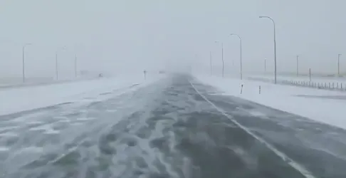
Arctic air has settled in over parts of the Prairies this weekend, pressing pause on spring and edging a bit backwards into winter. Part and parcel of that temporary reversal will be the snow, which began later Saturday and is set to continue into Sunday, heaviest in the foothills of Alberta, though places as far east of there as Calgary and Lethbridge will see some flakes as well. More details, along with a peek ahead to milder weather, below.
INTO SUNDAY: SIGNIFICANT SNOW IN PARTS OF ALBERTA, TEMPERATURES DIVE
The snow that began in the mountains and foothills is set to spread even further overnight into Sunday. This will be a somewhat long-lived event: a weak, but persistent, upsloping flow will help keep the snow falling through Sunday evening.
The highest accumulations will be focused along the foothills, with the threat for 10-15 cm by the time the snow finally diminishes. Snowfall warnings are in effect.
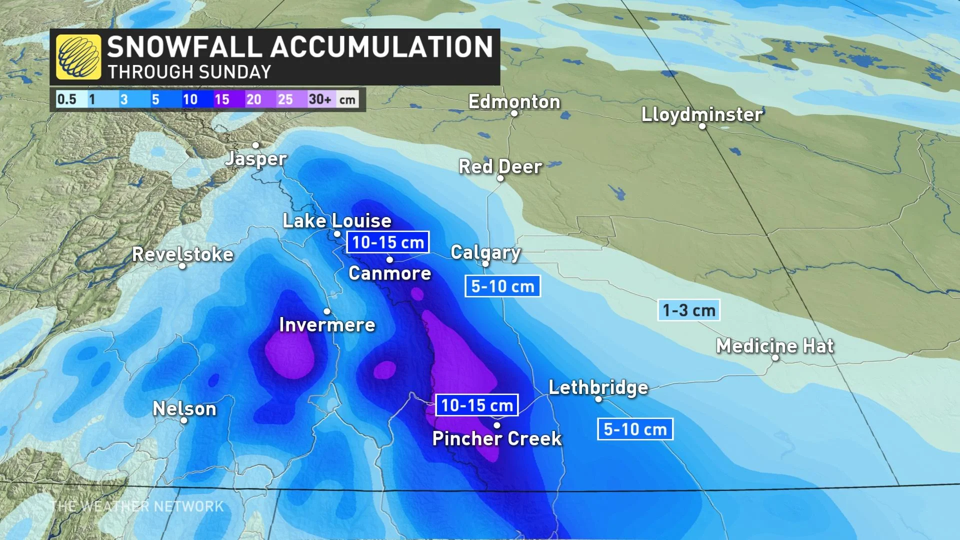
The Calgary area, along and south of the QE2, may see 3-5 cm, enough to catch some drivers off guard and make for tricky travel at times throughout the weekend.
Sunday will see the light snow venture east of Highway 2, drifting into Saskatchewan. The snow will gradually diminish by Sunday evening.
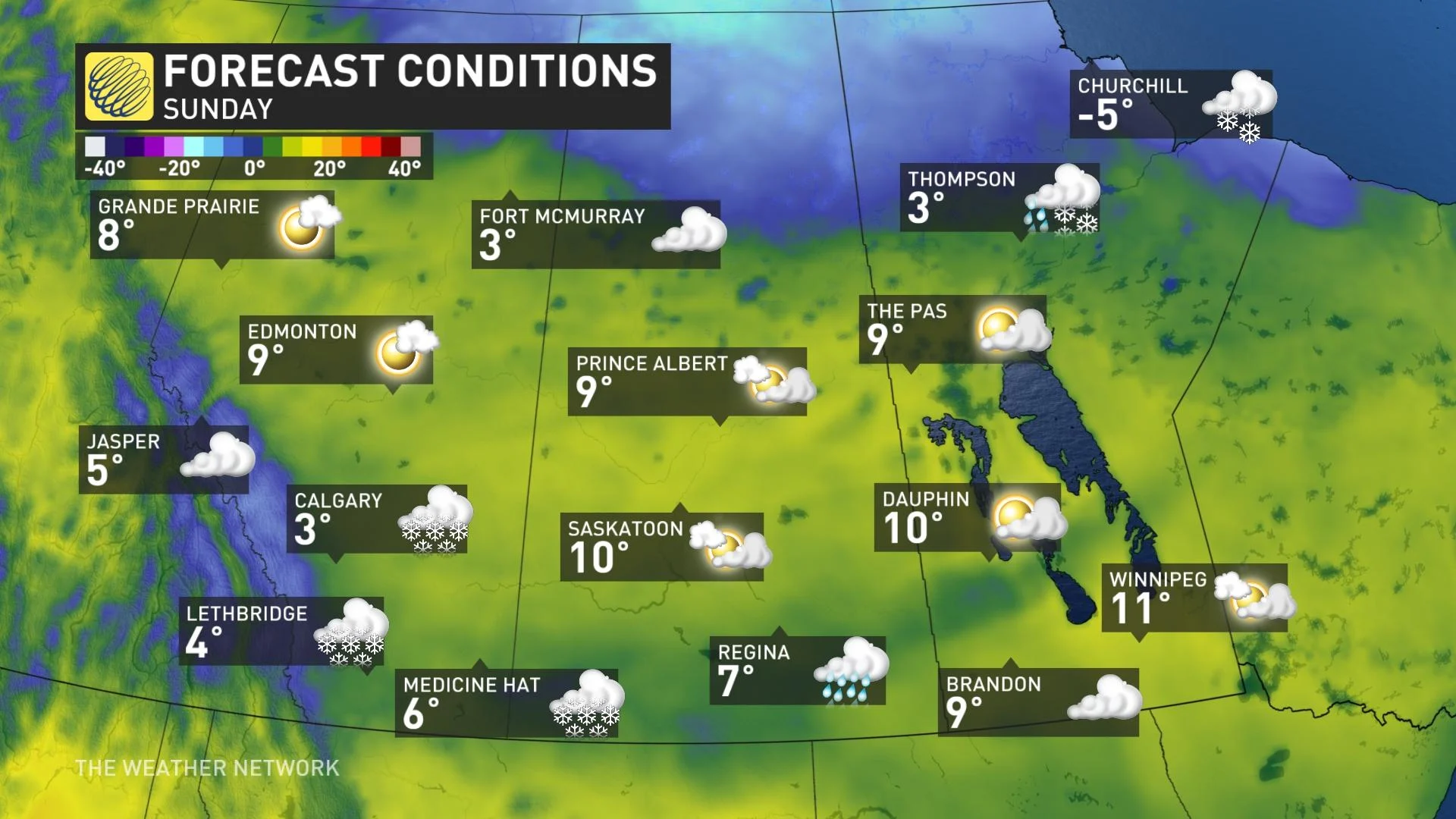
Temperature-wise, Sunday's daytime highs will reach little higher than and mid single digits for much of southern Alberta, and a few degrees warmer in northern Alberta and elsewhere in the Prairie region.
LOOK AHEAD: CHANGEABLE TEMPERATURES, MILDER AIR SURGES IN SOUTHERN AREAS
A weak ridge will build over the northwestern U.S. to start next week, bringing a return to seasonal temps across the southern Prairies. They will be changeable across the region as Arctic air builds again across northern areas, while milder weather surges into southern areas at times.
There is the potential for significant snow near or just north of the Yellowhead in Alberta Monday night into Tuesday, along with the sharp temperature gradient. Cooler air returns mid-week, but then much warmer weather is possible for parts of Alberta by late week.
Be sure to check back for the latest updates on this latest swath of weekend snow.


