After a soggy Boxing Day, East Coast temperatures fall back to Earth

The soggy start to the weekend, in the form of a passing system that brought rain and a dash of snow to some areas, will be largely winding down by Sunday morning, but so will most of the last of the warmth. A rebound is ahead mid-next-week, though accompanied by another soggy system. A glimpse ahead, below.
WEATHER HIGHLIGHTS
Last of the system's effects end region-wide Sunday morning
Temperatures fall into Sunday, remaining cool Monday
Mid-week recovery accompanied by another system, with showers and limited snow
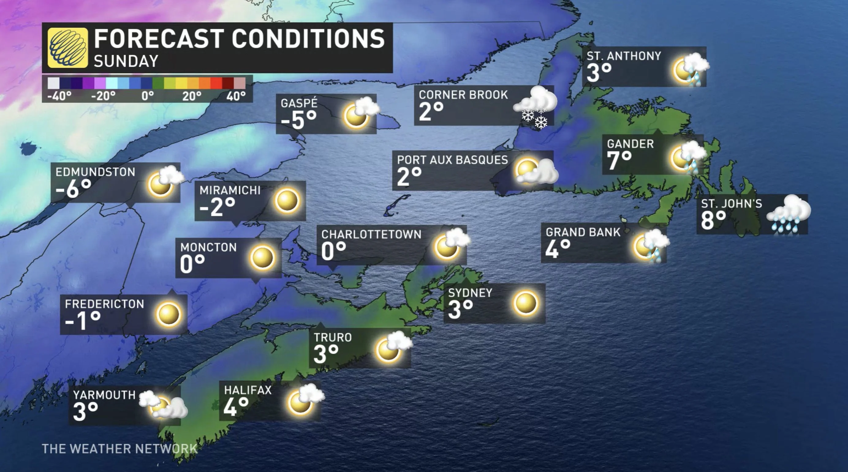
SUNDAY: SYSTEM ENDS, TEMPERATURES COOL
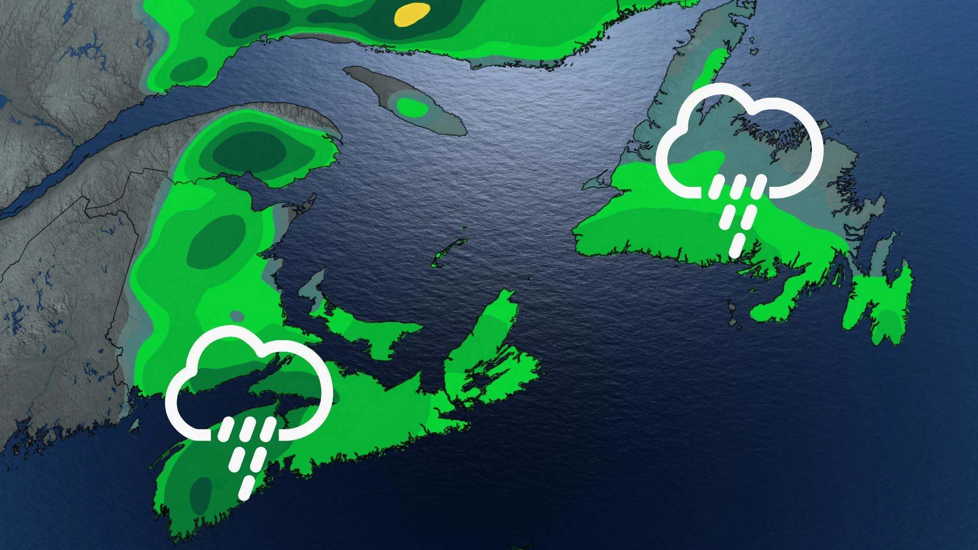
This latest system that brought showers (and, for some areas, a brief shot of snow) will be exiting the region entirely by early Sunday morning, and the stiff winds accompanying it will be well on the wane as well.
But temperature-wise, Sunday looks considerably cooler in most of the Atlantic region, as cooler air filters into the region behind the passage of the low-pressure system. Warmer air will hang on in Newfoundland a bit longer, keeping daytime highs in the upper single digits.
BEYOND: MILDER, WITH A NEW MIDWEEK SYSTEM
Monday looks similarly chilly across the region, and the last of the above-zero temperatures won't hang around much longer for Newfoundland either.
The good news is another relatively mild period beckons for the midweek, but coinciding with another system that will be arriving Monday night.
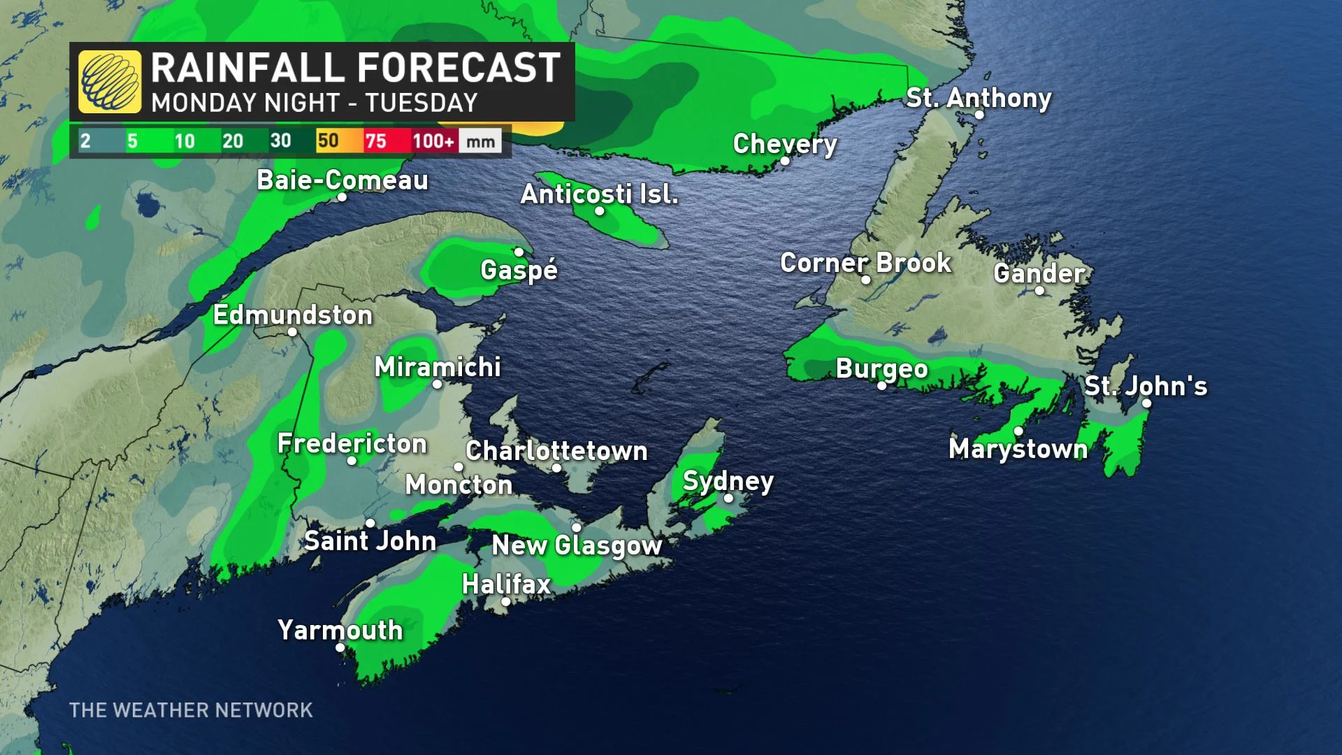
That system won't be too much of a rainmaker, with scattered showers across much of the Maritimes, along with southern Newfoundland and the southern Avalon.
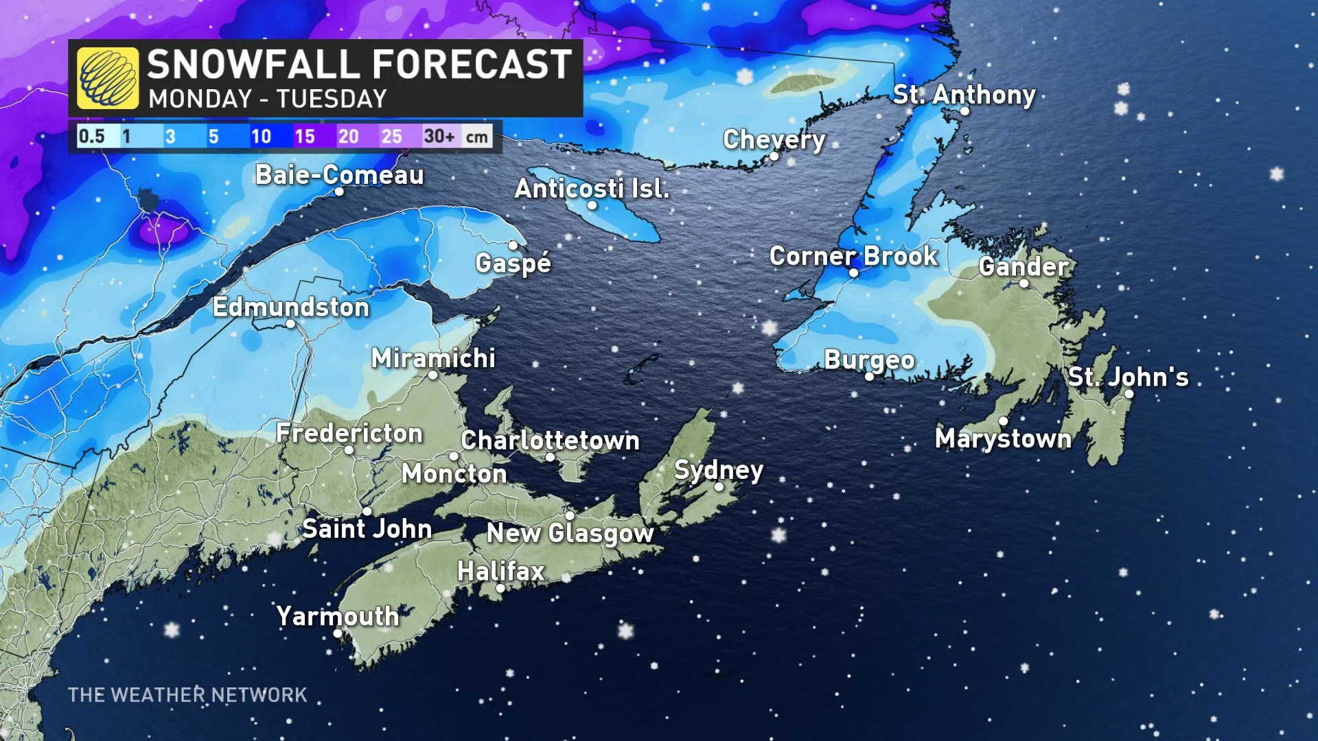
A dash of snow is also in the cards, though limited to northern New Brunswick and western Newfoundland, boosted slightly in the latter by sea-effect squalls but not amounting to excessive amounts.
RECORD CHRISTMAS DAY WARMTH
Some records were set on Christmas Day. Fredericton had its warmest December day on record, clocking in at 17.4°C. That temperature was warmer than areas in Florida, which only reached 14°C.
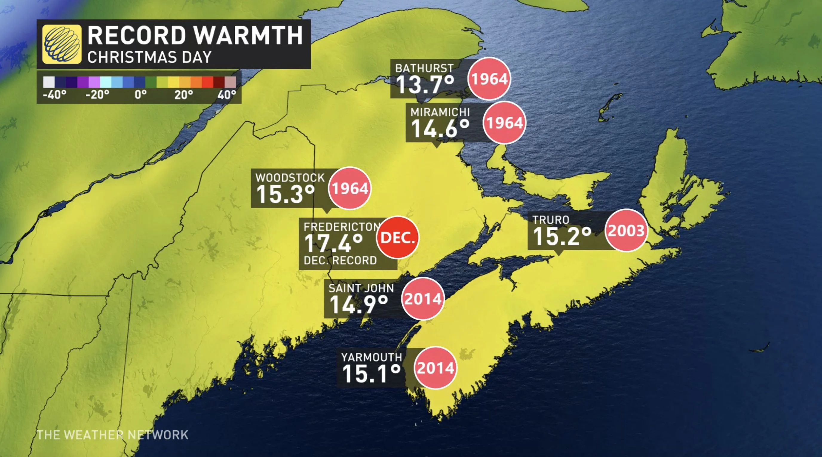
These areas had their hottest Dec. 25 on record:
New Brunswick
Miramichi 14.6°C
Saint John 14.9°C
Bathurst 13.7°C
Fredericton 17.4°C
Labrador
Happy Valley-Goose Bay 9.6°C
Nova Scotia
Yarmouth 15.1°C
Truro 15.2°C
Stay tuned to The Weather Network for the latest forecast details.


