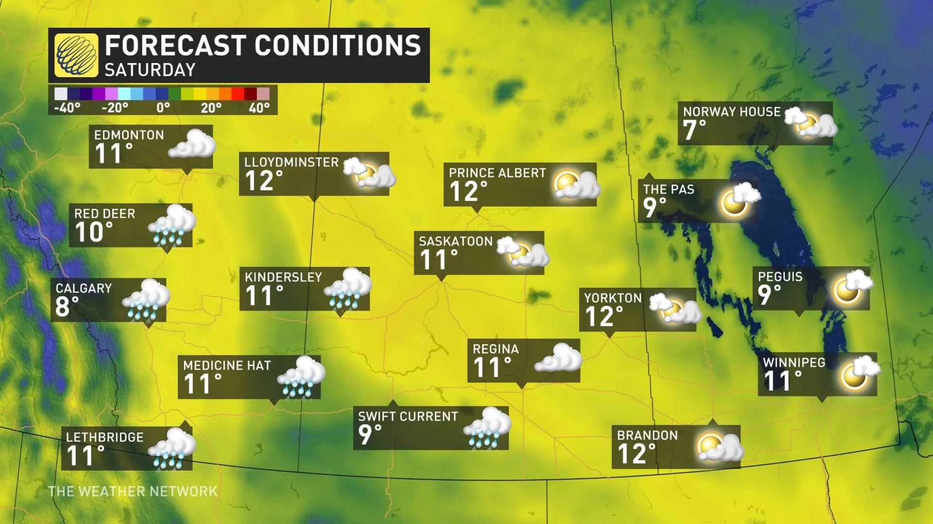
Thunderstorm threat pushes into Alberta, watching for some much needed rain

Eyes are to the skies across the Prairies, a region that's facing a growing drought problem that is considerably worse in some spots more than others. This is despite the fact May has a favourable pattern that could bring some much-needed precipitation. There is some relief on the way this week, with a bit of rain and a risk of thunderstorms through Tuesday, though the rainfall will be hit-and-miss and many areas won't see a drop. There's a more widespread chance by the end of the week, with a significant snow threat also creeping in for the central Rockies. More on the timing and impact, below.
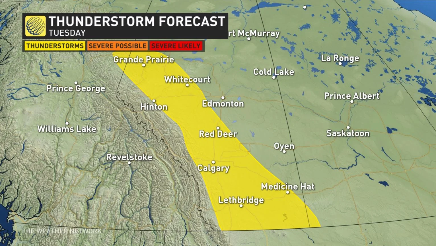
TUESDAY: THUNDERSTORM THREAT CREEPS INTO ALBERTA, NON-SEVERE RISK
The good news is that some Pacific moisture is finally reaching the Rockies and communities east, though in short supply. A surface trough will develop and slide down the Rockies Tuesday, bringing hit-and-miss rain and the chance of non-severe thunderstorms along the foothills.
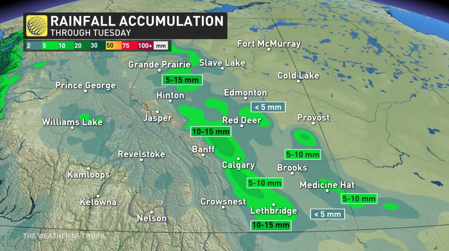
The rainfall won't be nearly enough to overcome the deficit that the region is experiencing, but every drop is certainly welcomed. Not everyone will see rain, but 10-15 mm could fall along the foothills in Alberta, with 5-10 mm in more populated centres, as well as into extreme western Saskatchewan along the border.
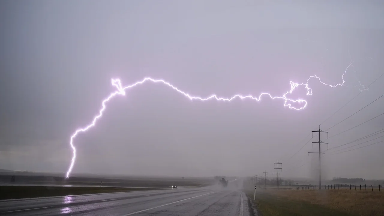
Instability will build along the boundary Tuesday afternoon, so there will be the threat of thunderstorms for a narrow section of Alberta -- extending from Grande Prairie to the Montana border. Any storms that do pop up will be non-severe in nature, with threats of small hail and gusty winds.
Cooler temperatures will prevail Tuesday, with daytime highs ranging from single digits to low teens. They will remain that way through mid-week before warming up considerably in Alberta on Thursday for a short period of time.
MUCH OF THE PRAIRIES STUCK IN A DROUGHT
The Tuesday setup will prevent Saskatchewan and Manitoba from seeing any rainfall this time around. Most of the Prairie region is caught in a significant drought.
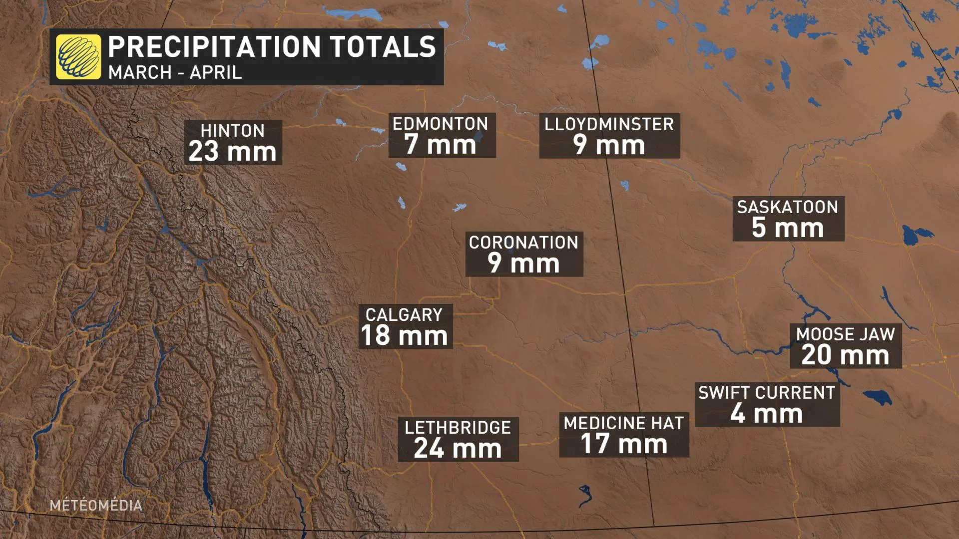
For example, Saskatoon has only seen 5 mm of precipitation over the past two months. Swift Current has only seen 5.5 mm of precipitation in 2021, a mere nine per cent of its average.
LATE WEEK: BETTER CHANCE FOR MORE WIDESPREAD RAIN, HEAVY SNOW IN THE ROCKIES
Another round of much needed rain will push into southern and central Alberta and parts of southern Saskatchewan on Friday and Saturday as a system develops east of the Rockies.
Heavy snow is also expected for the central Rockies, parts of the southern Rockies, foothills and western high plains of Alberta including the Jasper area, Hinton, Rocky Mountain House and into the Canmore/Banff area.
Widespread rainfall totals of 15-30+ mm are expected, with heavy snow falling for the central Rockies, the foothills and western high plains of Alberta.
Below seasonal temperatures are expected through the week, with daytime highs being near or on the cool side of seasonal into next week.
"The May pattern will be conducive to seeing much-needed rain, and possibly even some snow, across the region, but precipitation totals will not reverse the growing deficits across the region," says Dr. Doug Gillham, a meteorologist at The Weather Network, in the May outlook. "This is concerning given the expectation that southern areas will see a hot and dry pattern during the summer months.".
Be sure to check back for the latest updates on the Prairies forecast.


