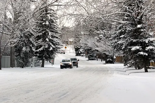
Blast of snow piles up across the Prairies as extreme, dangerous cold locks in

The familiar and unwelcome bitterly cold has returned to the Prairies, set to keep the region in a deep freeze for days. Temperatures and wind chills will be firmly into the -20s and -30s, respectively, throughout this first full week of January. Meanwhile, a fast-moving clipper will zip across Saskatchewan and Manitoba Tuesday, bringing 5-15 cm of snow across the two provinces. By the end of the weekend, milder Pacific air will finally flush out the hazardous cold. More on the snowy system and dangerous cold, below.
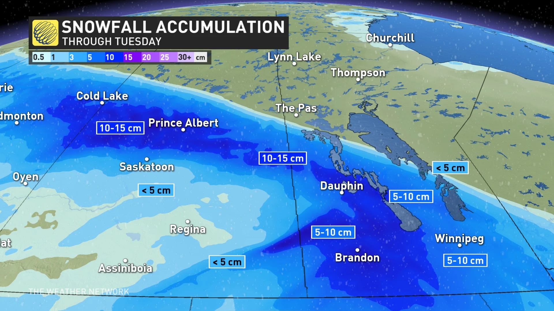
TUESDAY: CLIPPER BRINGS A BLANKET OF SNOW AS DEEP FREEZE LOCKS IN
A clipper tracking across the Prairies will continue to bring heavy snow to Saskatchewan and Manitoba Tuesday, while tapering off in Alberta through the first half of the day.
Widespread totals of 5-10 cm are expected across the Prairies. But parts of central Saskachewan may see 10-15 cm by the time it winds down Tuesday evening. Snow in Manitoba will linger until Wednesday morning as the clipper treks out of the province.
Arctic air will then rush across the Prairies behind the system, ushering in a return to the bitterly cold temperatures we saw just a few days ago.
Afternoon highs on Tuesday will plant firmly in the -20s for just about everyone on the Prairies, with wind chill values easily dipping into the -30s, even hitting -40 in some northerly locales.
LOOK AHEAD: DANGEROUS COLD STAYS LOCKED INTO THE WEEKEND BEFORE SOME MUCH NEEDED RELIEF
Temperatures will fall even more for Wednesday, with a high of just -30°C in Edmonton and -26°C in Regina. Winds could make the air feel like -40 or colder, especially in parts of Alberta and Saskatchewan.
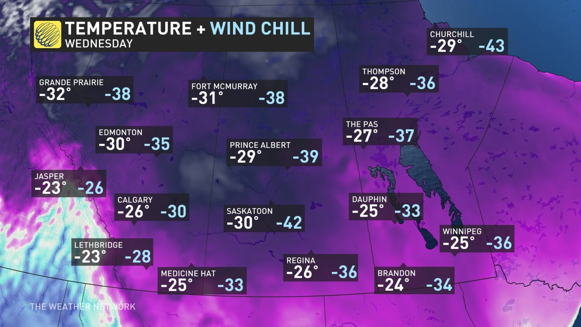
Frigid temperatures and dangerously cold wind chill values will persist across the region through the weekend.
Temperatures this cold are dangerous even for folks acclimated to extreme winter weather. A relatively benign event like a vehicle breaking down could easily turn into a life-threatening ordeal when air temperature readings and wind chill values fall into the -30s and -40s.
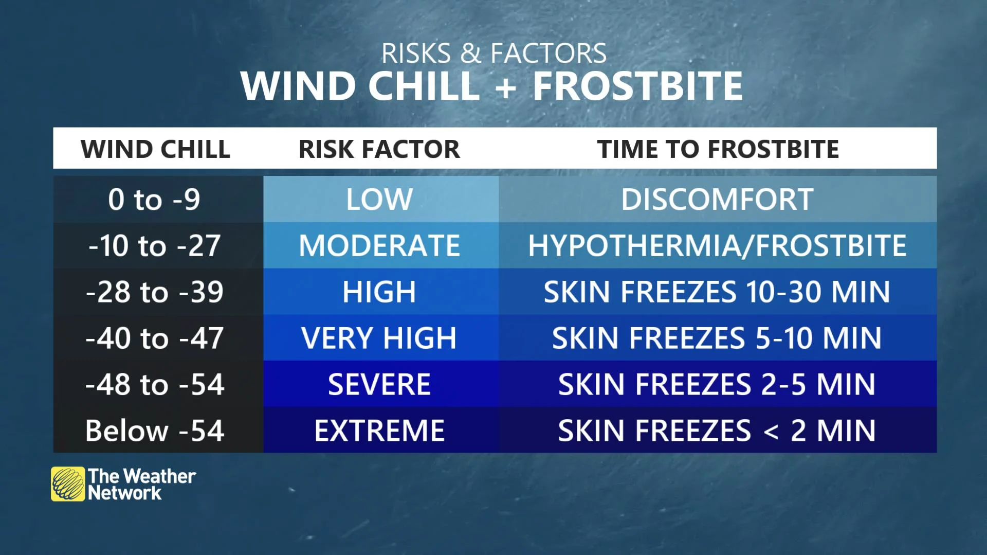
Remain mindful of the signs of frostbite and hypothermia. With wind chill values dipping into the -30s and -40s, it can take as little as 5-10 minutes for exposed skin to freeze in this Arctic airmass, and hypothermia can set in not long after.
Milder Pacific air will finally spread across the region late weekend and next week. A couple systems will bring some snow to southern areas late week, but the bigger concern will be the blowing snow with strong winds. Very strong winds will be possible for southern Alberta.
Check back for the latest on the snow and frigid conditions on the Prairies.
Thumbnail image credit: Getty Images/Stock photo


