Prairies: Snowy, chilly Sunday on tap, but relief is coming

The snowy, chilly conditions will continue on the Prairies Sunday with the heaviest snow tracking through the central regions. There is also a threat for freezing rain and ice pellets across southern Manitoba. For more on the chilly temperatures and who will see the heaviest snow, see below.
Visit our Complete Guide to Spring 2020 for an in-depth look at the Spring Forecast, tips to plan for it and much more
WEATHER HIGHLIGHTS:
Widespread moderate to heavy snow across central Prairies Sunday
Warmer and clearer next week
Stay up-to-date on the ALERTS in your area
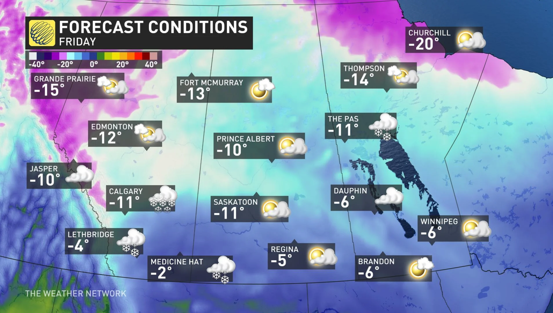
SUNDAY: TEMPERATURES REMAIN BELOW SEASONAL, SNOW WILL EASE OFF IN THE EVENING
Most of the Prairies will see chilly temperatures well below zero on Sunday, thanks to a shot of cold air from the Arctic.
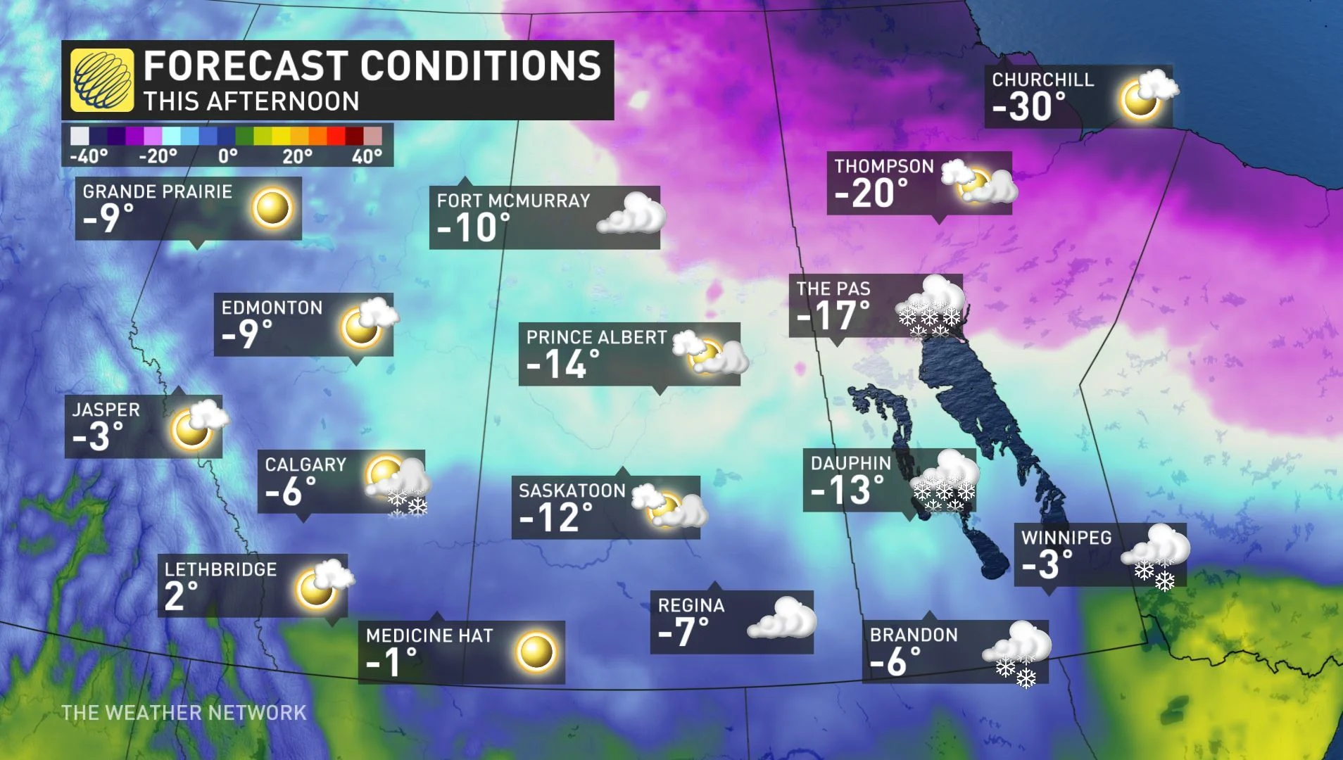
Along with the cold air, snow will be widespread as a low-pressure system tracks across the region.
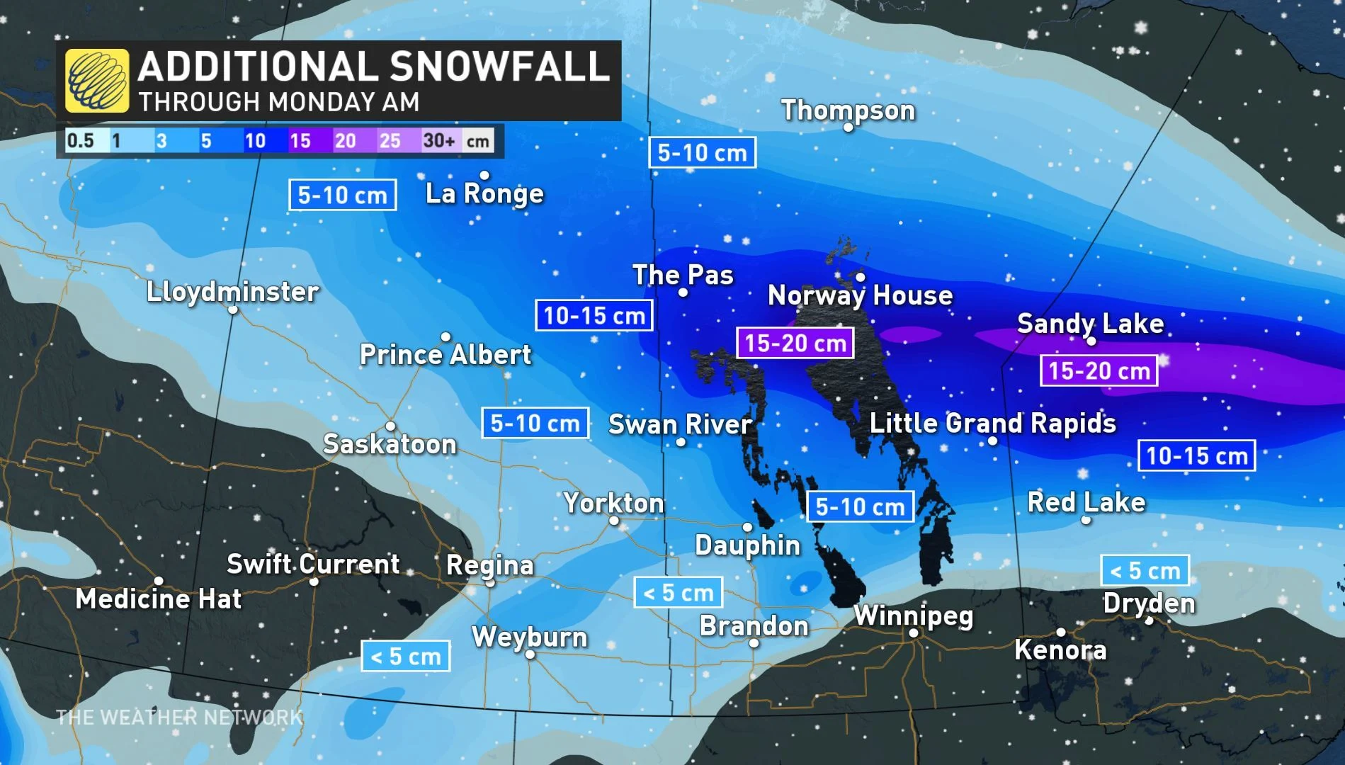
The heaviest snowfall totals will be along a stretch of central Saskatchewan and Manitoba. Between 20 to 30 cm of snow will accumulate through these central areas, while southern regions will see around 5-10 cm.
The risk for freezing rain and ice pellets will be the greater threat for southern Manitoba. Sunday could be a little icy on the Trans-Canada Highway across Manitoba and northwestern Ontario.
MONDAY AND BEYOND: WARMER TEMPERATURES RETURN BEFORE ANOTHER SHOT OF COLD AIR
The colder weather will continue into the start of next week, but with a warming trend back to above seasonal conditions returning for the middle next week before another blast of cold air settles in for the weekend.