Prairies: Alberta, Saskatchewan light up with thunderstorms

Severe storm threat eases on Thursday but some thunder still expected
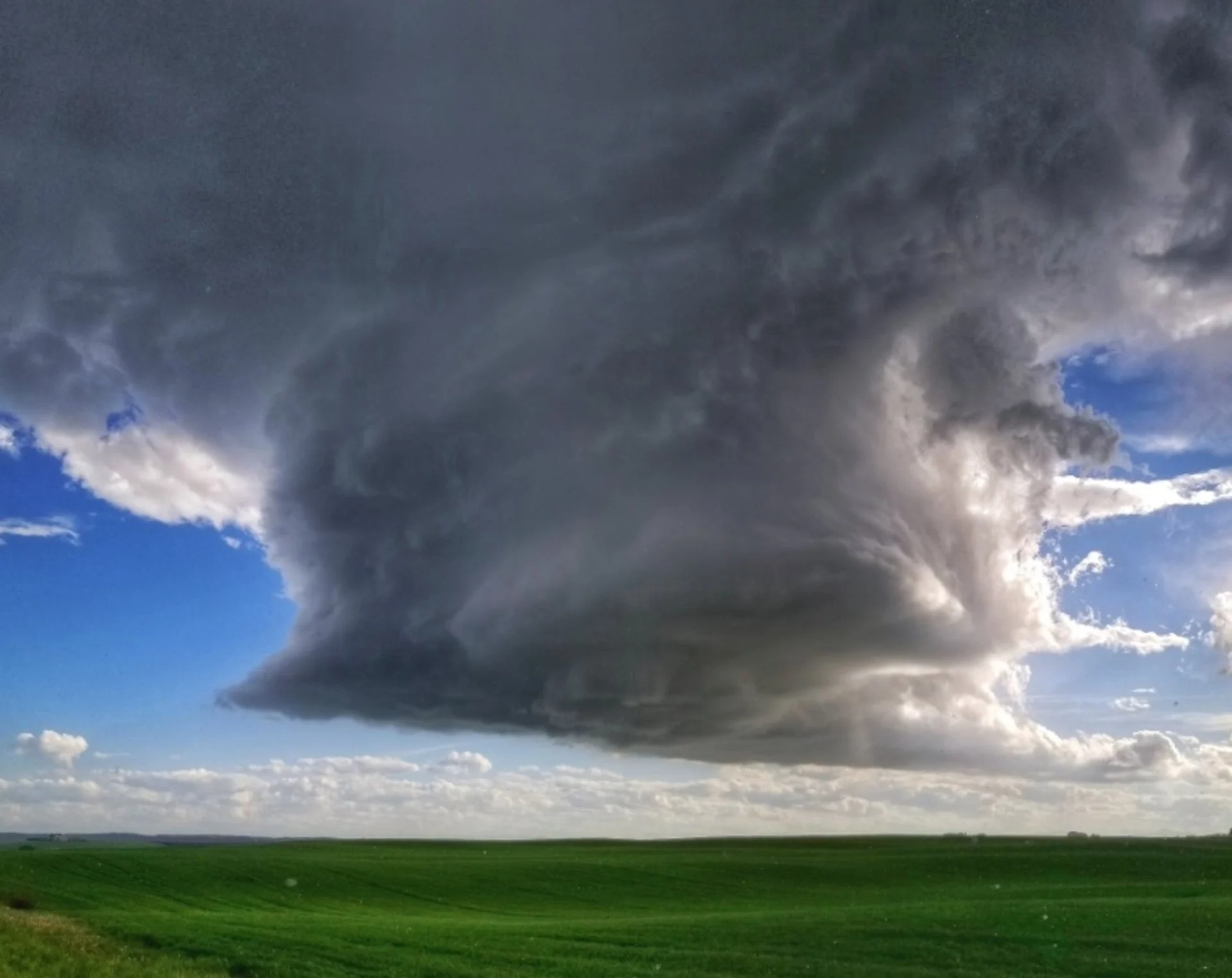
Storms fired up once again for Saskatchewan and Alberta on Wednesday as a large-scale upper-level disturbance remained locked on the region. While that disturbance is set to linger as we close out the work-week, the severe weather risk diminishes through early Thursday morning. That's not to say thunderstorms are completely off the table, however. We take a look at what's left of this active, stormy weather, below.
Summer revealed! Visit our Complete Guide to Summer 2019 for an in-depth look at the Summer Forecast, tips to plan for it and much more
WEATHER HIGHLIGHTS:
Line of storms continues moving east through early Thursday morning for Sask.
Isolated storms also linger along foothills, B.C. Interior in very unstable atmosphere
More heavy rainfall persists through Friday
Latest watches and warnings for your area HERE
WATCH BELOW: MUST-SEE TIME-LAPSE OF THE ALBERTA STORMS ON TUESDAY (WOW)
Another band of strong storms sparked along the Alberta/Saskatchewan border from Lloydminster to the U.S. border Wednesday afternoon, and it's those storms that will be with Saskatchewan residents through the early overnight hours into Thursday.
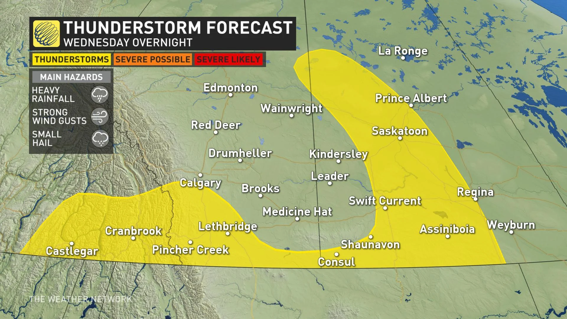
While the risk for severe weather, like large hail, will be much diminished through the overnight hours, the most likely risk with Wednesday's storms will be localized flash flooding as storms 'train' -- that is, separate storm cells track over the same region again and again, boosting rainfall totals dramatically over a relatively small area. This threat is largely focused on southwestern Saskatchewan.
WATCH BELOW: THIS WAS THE SCENE IN SWIFT CURRENT, SASKATCHEWAN ON TUESDAY
On Tuesday, about 30 mm of rain fell within just hours in Swift Current, turning city streets to rivers as overwhelmed sewer systems struggled to keep up. According to Swift Current Mayor Denis Perrault, rainwater at one point was actually going OVER the hood of parked cars.
DAYS OF RAIN AHEAD
The bulk of this round of severe weather behind may be behind us, but the active weather isn't. Heavy rain begins to fill in across central and northern Alberta with a non-severe thunderstorm threat lingering across the region through Thursday.
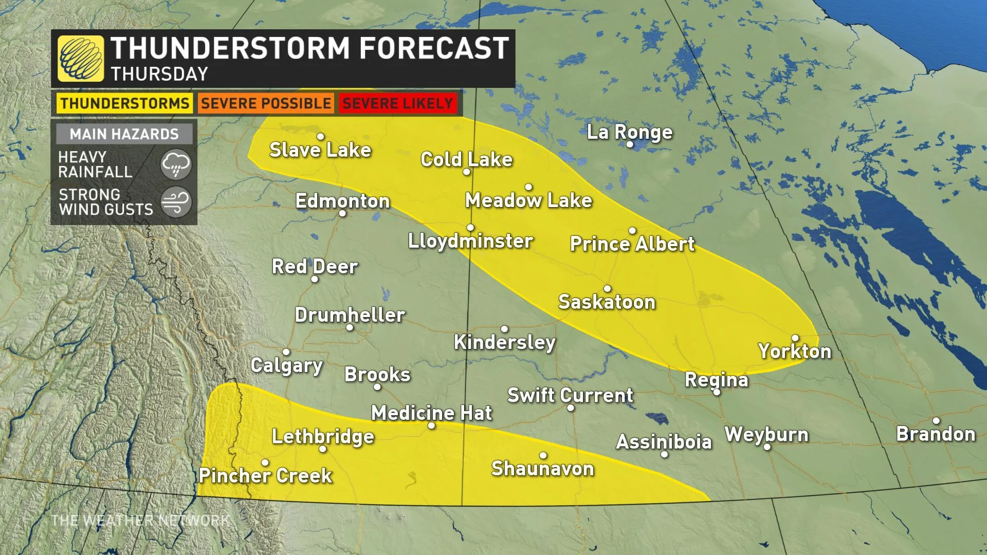
That has prompted both rain and high-elevation snowfall warnings with upwards of 75 mm possible through Friday. Across the Rockies, we're watching for 10-20+ cm of snow.
Check here for the latest on this pattern change that may take Alberta and Saskatchewan from a drought scenario to flooding.
Stay with us here at The Weather Network for your latest forecast updates.