Prairies: Threat for severe weather lingers in Manitoba before temperatures drop

Manitoba will see one more day of summer-like warmth and severe storm potential Saturday before a pattern change also bumps up temperatures in Alberta.
After consecutive days of severe storm risks, the potential is coming to an end thanks to a pattern change for Sunday. The threat will hang on in Manitoba through Saturday afternoon and evening, with areas between Brandon and Winnipeg at greatest risk of seeing them develop. The below-seasonal chill in Alberta will also hang on before a return to more seasonal norms Sunday, as daytime highs drop in Manitoba. A closer look, below.
WEATHER HIGHLIGHTS:
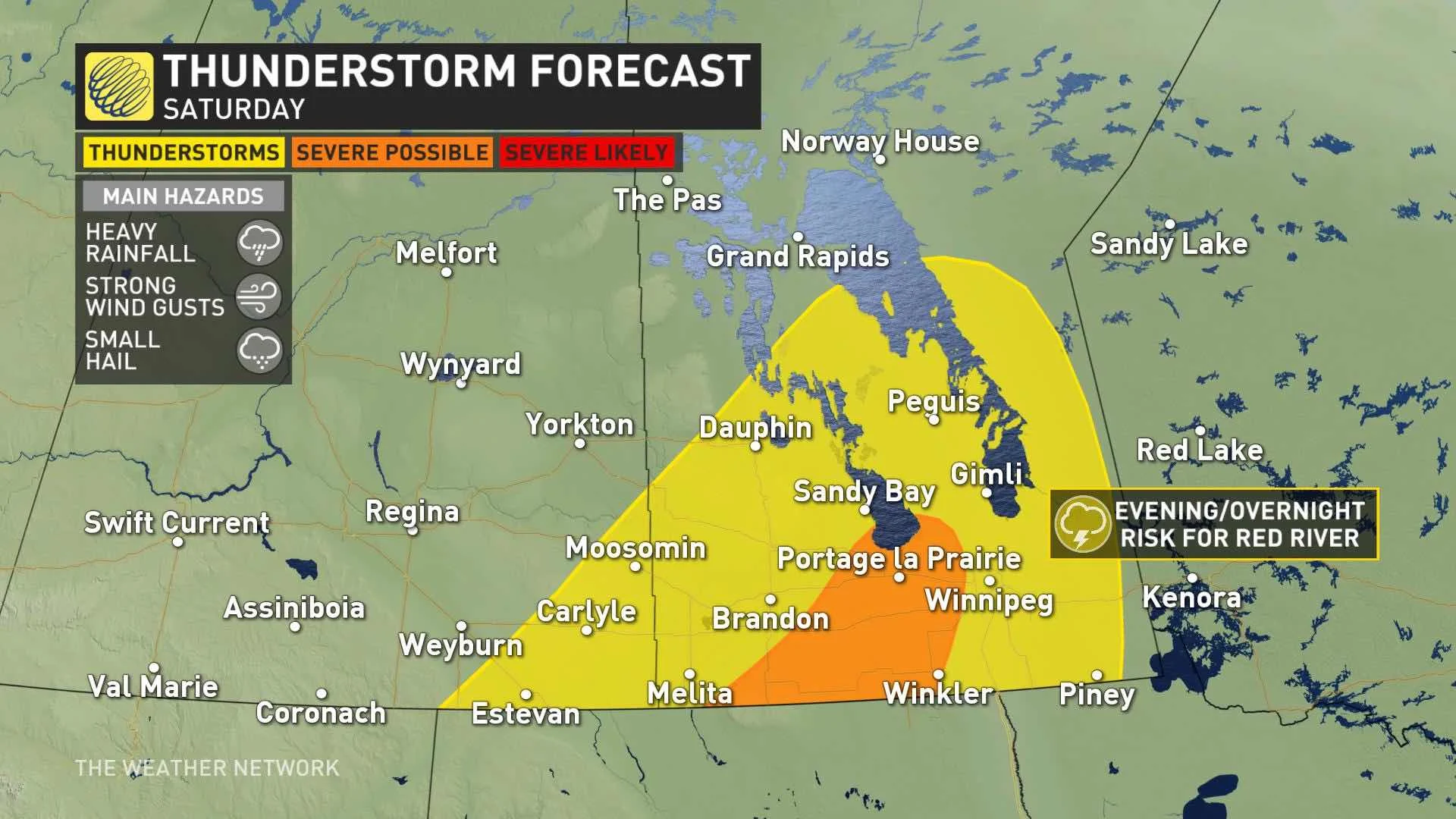
Severe storm risk in Manitoba Saturday afternoon, evening
Temperatures will flip-flop Sunday, with cooling off in Manitoba, recovery in Alberta
Some unsettled weather looms beyond the weekend
Stayed informed of the weather ALERTS in your area
SATURDAY: ONE MORE DAY OF SEVERE STORM POTENTIAL
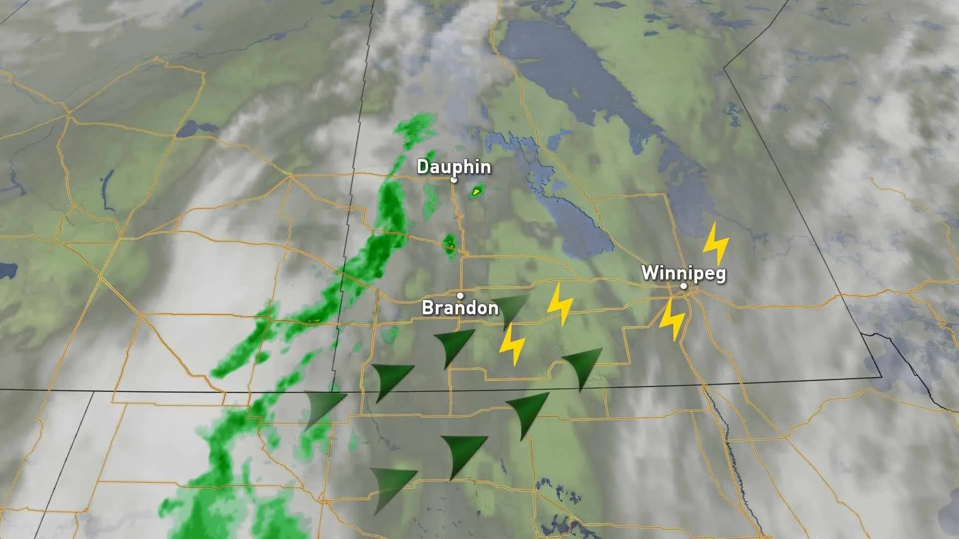
A low across the far northern Prairies, combined with a cold front extending south through Manitoba, as well as instability from the high-plains low stateside, keeps the threat for thunderstorms intact on Saturday. The timing of the risk is through the afternoon and evening in Manitoba, as well as parts of extreme southeastern Saskatchewan.
The areas at greatest severe potential will shift, but will remain outside of Brandon and Winnipeg. The main threats with any storms that develop will be heavy rain, strong winds and small hail.
Alberta finally gets a chance to dry out after a multi-day rain event soaked the province, but temperature-wise it will be cool compared to the eastern Prairies where daytime highs will approach 30°C in Winnipeg.
However, things will flip somewhat Sunday, with Alberta's temperatures recovering, and Manitoba's falling back down to Earth, with the pattern change.
Most of the Prairies will be dry Sunday, but the southeastern Manitoba/Ontario border will see light showers with an isolated thunderstorm risk Sunday and Monday. Any storms that pop up will be non-severe.
LOOK AHEAD: UNSETTLED WEATHER, TEMPERATURE CHANGES
A couple of disorganized systems will track across the region mid-week with showers and thunderstorms, but rainfall totals are not expected to be excessive.
The western Prairies will dry out during the second half of the week, and into the following week as a warmer and drier pattern develops, but a shot of rather chilly weather is expected for the eastern Prairies Thursday/Friday.
Stay tuned to The Weather Network for the latest forecast details.