Prairies: Conditions deteriorate with bursts of snow, warmer air follows

Some lingering late weekend snow will impact parts of the southern Prairies through Monday, ahead of a warming trend that looks to dominate the later parts of the week. More on who stands to see the heaviest accumulating snow and the milder Pacific air that quickly follows, below.
WEATHER HIGHLIGHTS
Snow continues into the morning in southern Alberta, through the day Monday in Saskatchewan
Temperatures gradually warm up after Monday, most of the region above zero by Friday
Keep an eye on weather alerts in your area
MONDAY: SNOW MOVES OUT OF ALBERTA, CONTINUES IN SASKATCHEWAN
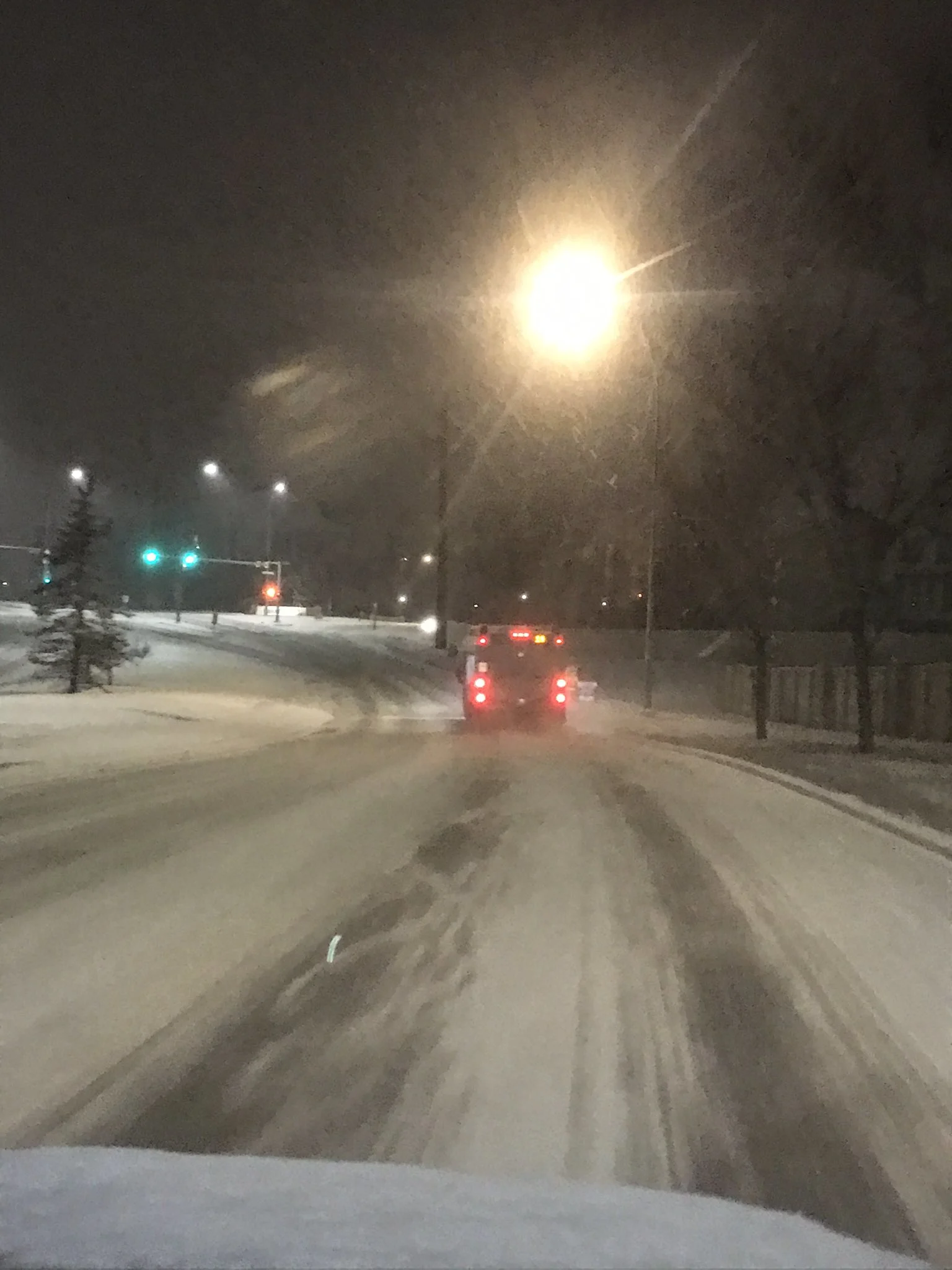
The snow that picked up through Sunday overnight across the western Prairies is courtesy of a low-pressure system meandering just south of the international border, bringing a dash of snow to southern parts of Alberta and Saskatchewan.
The snow began Sunday evening in the foothills, gradually spreading southward through the night and making for some treacherous conditions in southern Alberta as roads quickly became slick and snow covered early Monday.
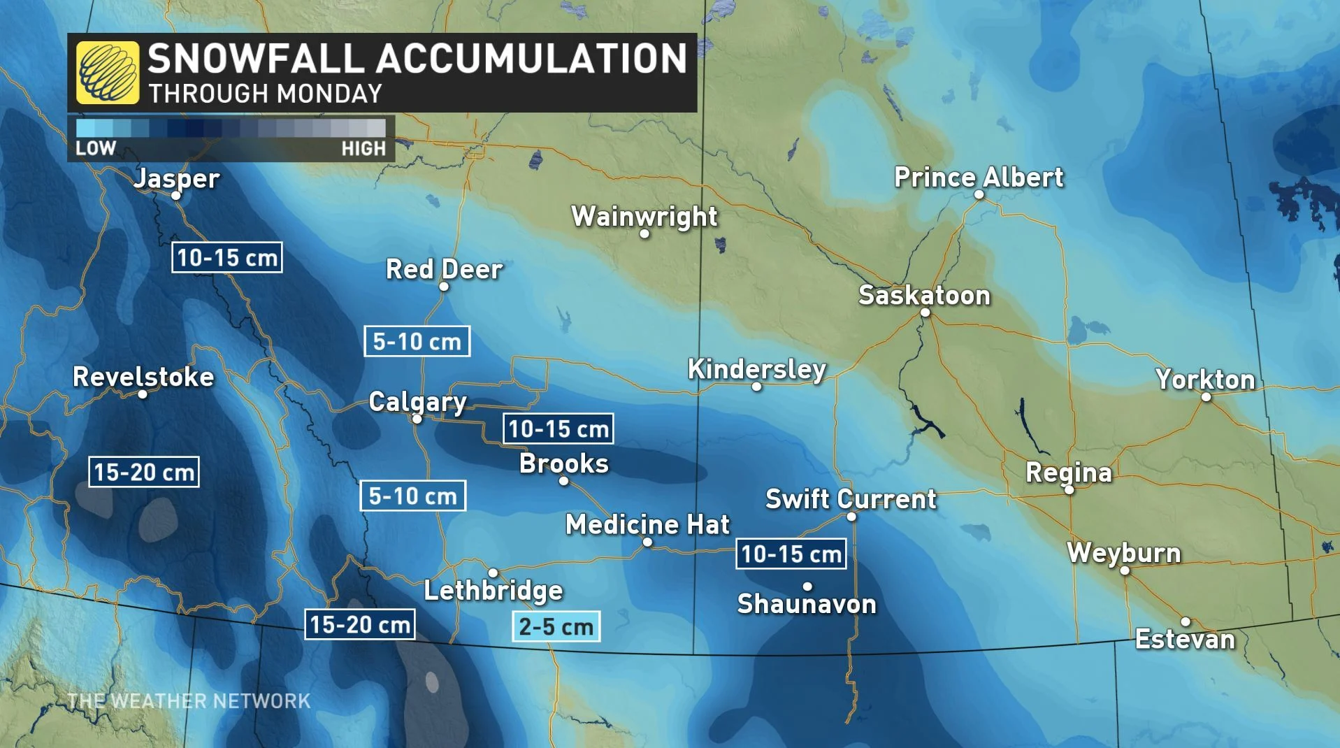
As it winds down in Alberta through the late morning hours, the snow will last a little while longer in southern Saskatchewan, while southern Manitoba looks to largely escape it.
The heaviest-hit areas could see 10-15 cm by Monday's end, with the city of Calgary sitting in the 5-10 cm range.
TUESDAY AND BEYOND: A GRADUAL WARMUP
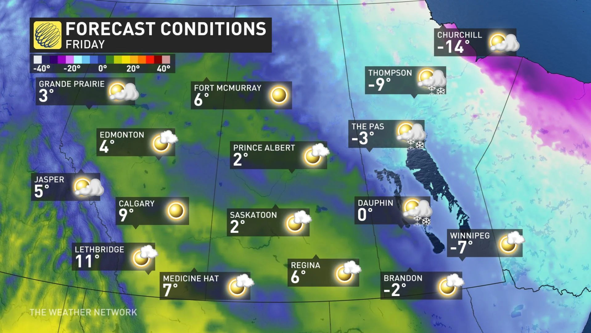
The brief cooldown that has accompanied the early week snow will prove short-lived. In fact, temperatures will gradually begin their recovery as early as Tuesday.
"Milder Pacific air spreads across the region mid to late week and continues through the weekend," says Weather Network meteorologist Dr. Doug Gillham.
It'll take a bit of time to get there, but by week's end, almost all of the Prairies will be looking at daytime highs above zero, and certainly above seasonal, with the exception of southern Manitoba.
The mild air sticks around into the weekend, but the first week of March looks to bring a colder pattern back.
Check back for updates as we continue to monitor the forecast.


