Prairies: Temperatures will be among lowest on Earth with intense deep freeze

Extreme cold warnings are in effect as bitter cold worsens in the Prairies
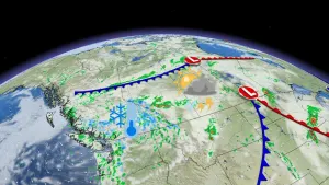
While the Prairies are currently experiencing a deep freeze, temperatures are about to get much colder as Arctic air will remain situated across the region through next week. The deep freeze is courtesy of a cross-polar flow pulling in some of the chilliest air in the Northern Hemisphere into the region. There will be light snow throughout the weekend, but accumulations will be limited. Details and timing, below.
Visit our Complete Guide to Winter 2019/2020 for an in-depth look at the Winter Forecast, tips to plan for it and a sneak peek at the spring season next year
WEATHER HIGHLIGHTS
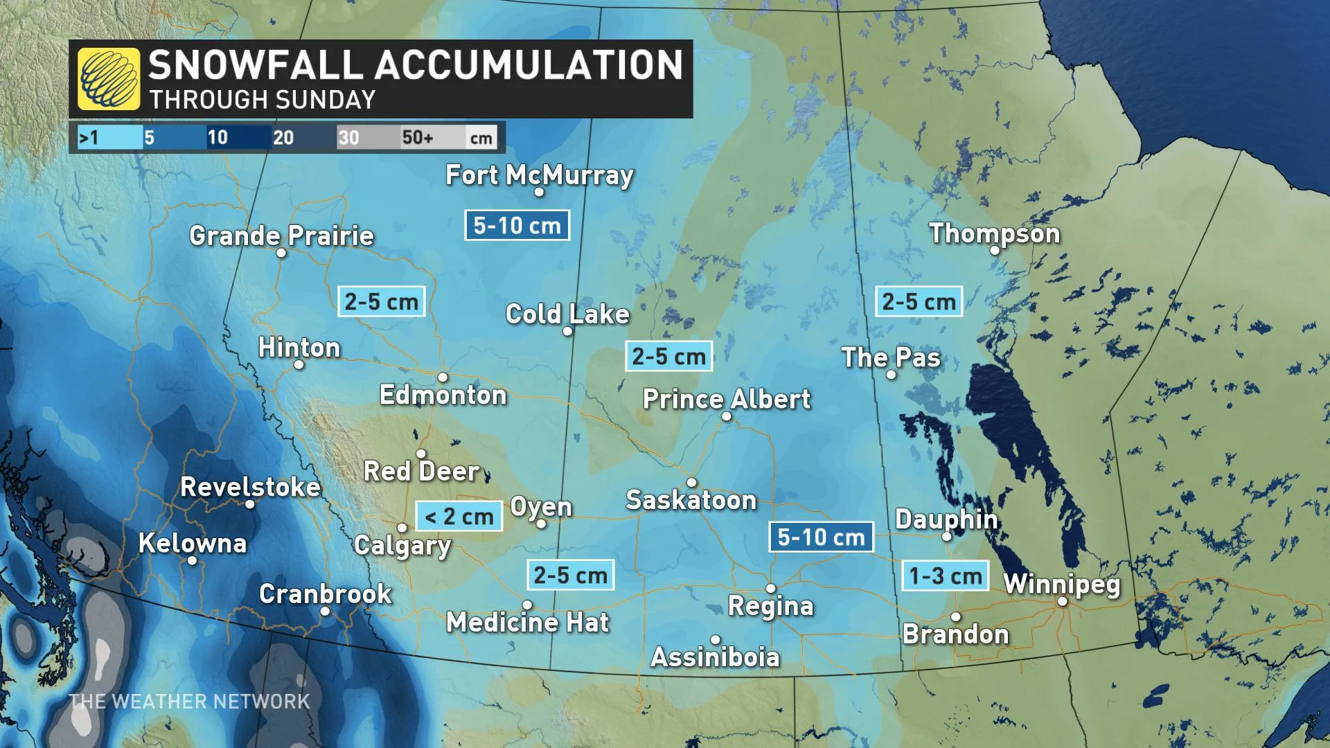
Quick shots of snow over the weekend, highest amounts in northwestern and southeastern Alberta, central Saskatchewan
Dangerously cold air grips the Prairies through next week
Stay up-to-date on the ALERTS in your area
SPORADIC SNOW BURSTS THROUGH WEEKEND, BITING COLD WORSENS
In addition to the extremely bitter air in place, there will be sporadic bursts of snow across the Prairies on Sunday as a pair of systems pass through. Amounts will be on the relatively low end and the highest accumulations will be in parts of northwestern and southeastern Alberta and central Saskatchewan, where 5-10 cm could fall through Sunday.
Frigid and dangerous temperatures will persist through the weekend and next week as the Arctic air tightens its grip on the Prairies. By Sunday, most of the southern Prairies will be firmly stuck in the cold air, with daytime highs ranging from the mid-minus teens to the mid-minus 20s while northern areas could see temperatures approaching -30°C.
The worst of the cold weather is still come, as temperatures plunge even more next week, particularly in Alberta, and will be quite dangerous. Daytime highs will approach or exceed -30°C for parts of the region, with wind chills making them feel like the -30s and even into the -40s for some.
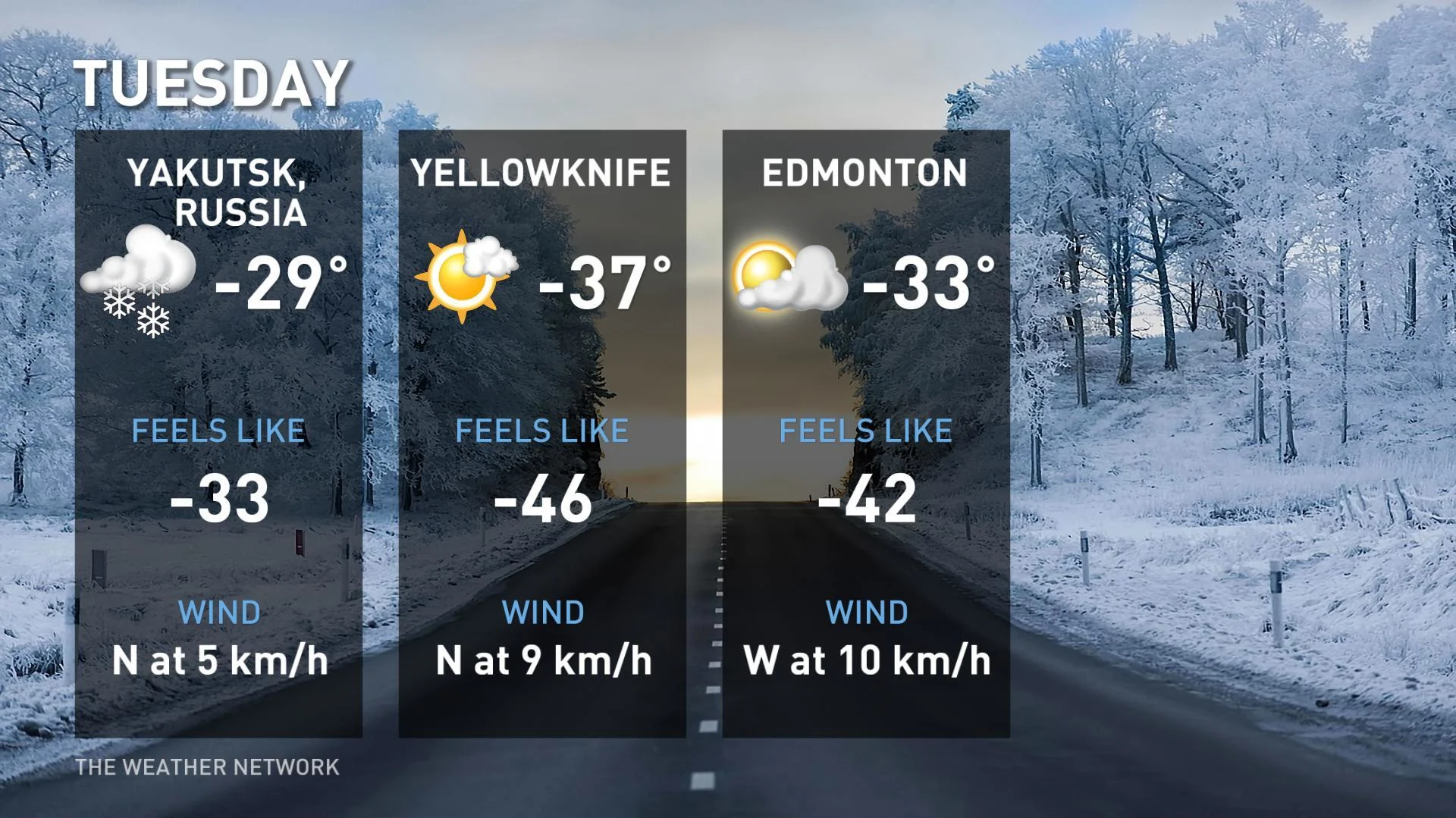
The City of Edmonton could potentially set a new record low next week, as temperatures are forecasted to hit -33°C Tuesday (wind chill making it feel like -42°C), which would break the old record of -28.3°C from 2005.
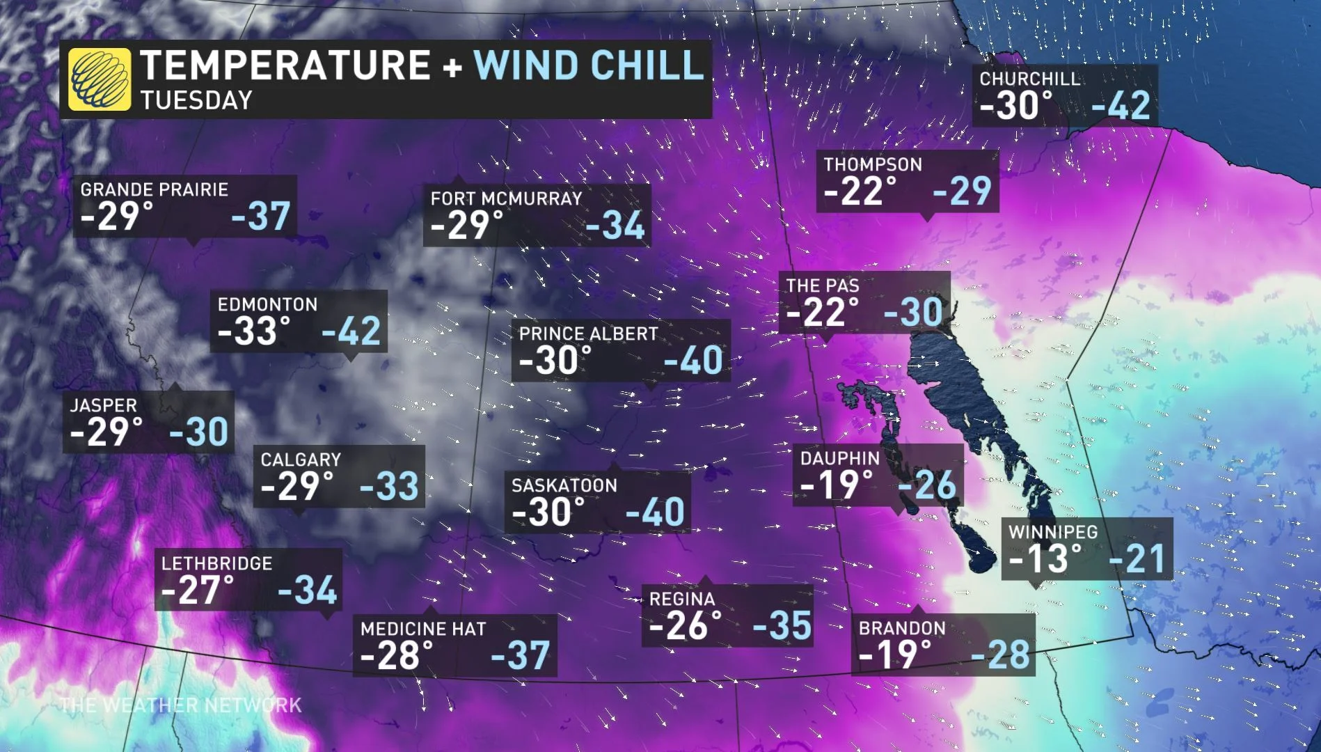
To put it into perspective, Edmonton could be among the coldest places on Earth Tuesday, comparable to two other regions known for their extremely frigid air -- Yellowknife, N.W.T. and Yakutsk, Russia.
A couple of systems next week are expected to bring periods of mostly light snow, but strong winds at times will produce extensive blowing snow and dangerous wind chills.
Stay tuned to The Weather Network for the latest forecast updates.