October snow slows early Thanksgiving travel in Atlantic Canada

Falling temperatures and wet snow are putting a more wintry feel on the start of the Thanksgiving long weekend in parts of Atlantic Canada. Some of the first flakes of the season were reported for the Friday morning commute, with more significant snow totals already closing a few schools in Labrador. More on the timing and impact heading into your long weekend, below.
WEATHER HIGHLIGHTS:
Gusty northwest winds gradually ease through Friday in the Maritimes as the low pulls up towards Labrador
Special weather statements, snowfall warnings in place for the west coast of Newfoundland and Labrador, heavy snow persists into Friday evening
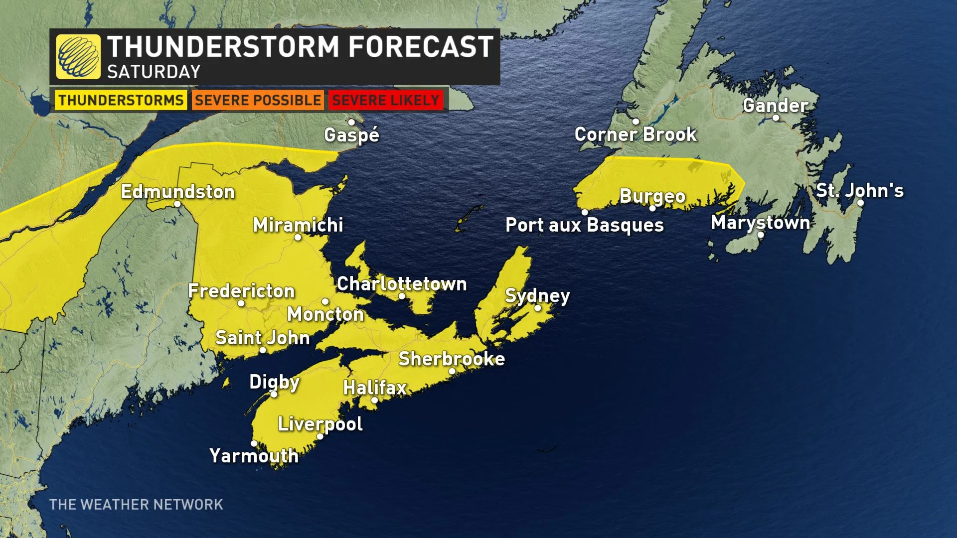
Second round of unsettled weather pushes in region-wide on Saturday, isolated severe thunderstorm risk for Nova Scotia and New Brunswick
FRIDAY: WINDS GRADUALLY EASE IN THE MARITIMES, FIRST FLAKES ACCOMPANY LONG WEEKEND CHILL
Power has been restored for most customers in the Maritimes after howling winds swept through the region on Thursday, impacting all three provinces with scattered outages throughout the day.
Strong gusts between 60-80+ km/h were reported at times, with conditions expected to remain breezy as the low pressure system departs Friday. Special weather statements were issued for the northern half of Cape Breton Island however, with the potential for northwesterly gusts up to 90 km/h.
"Be prepared to adjust your driving with changing road conditions due to high winds," Environment Canada warns in the statement.
It's not just the winds that may impact your commute. Autumnal, cooler weather has also funneled in behind this system, making for a chilly start to the long weekend across much of the Maritimes. Single digit daily high temperatures are forecast, and even the potential for some wet snow through the Cape Breton Highlands.
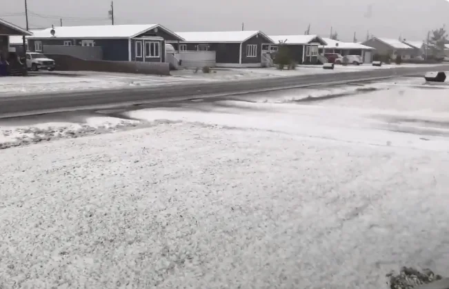
The first flakes of the season were reported in downtown Antigonish, Nova Scotia early Friday, with slick conditions slowing the morning drive there.
SNOW, SLIPPERY CONDITIONS FORCE SCHOOL CLOSURES IN LABRADOR
Winds will remain strong across Newfoundland as well on Friday, pulling cold air down from northern Quebec and resulting in snow potential for western parts of the island.
Special weather statements remain in place, warning of 5-15 cm over the highest terrain by Saturday and the potential for a light dusting at lower elevations, which could still impact driving in some locations. The snow isn't expected to stick around for long however, as a second low-pressure system brings rain back to the region by Saturday night.
Snowfall warnings are in effect for Churchill Falls, Churchill Valley and Labrador City, where up to 15 cm of snow is possible through Friday night, with locally higher amounts over higher elevations. The deteriorating and slippery conditions forced schools to delay openings in parts of Labrador City early Friday.
Visibility may be suddenly reduced at times in heavy snow as gusty winds persist.
SATURDAY: THUNDERSTORM THREAT CREEPS INTO THE MARITIMES, NEXT SNOW DOSE IN LABRADOR
Another round of unsettled weather will make its way into the Maritimes on Saturday, but this time with more of a summer-like threat.
"As the cold front crosses through the region, there's the chance for some isolated thunderstorms in parts of Nova Scotia and New Brunswick on Saturday afternoon and evening," says Weather Network meteorologist Nadine Hinds-Powell.
Parts of Labrador can also expect another dose of snow through Sunday with this next system, along with more powerful winds.
Be sure to check back for updates as conditions change in your area.


