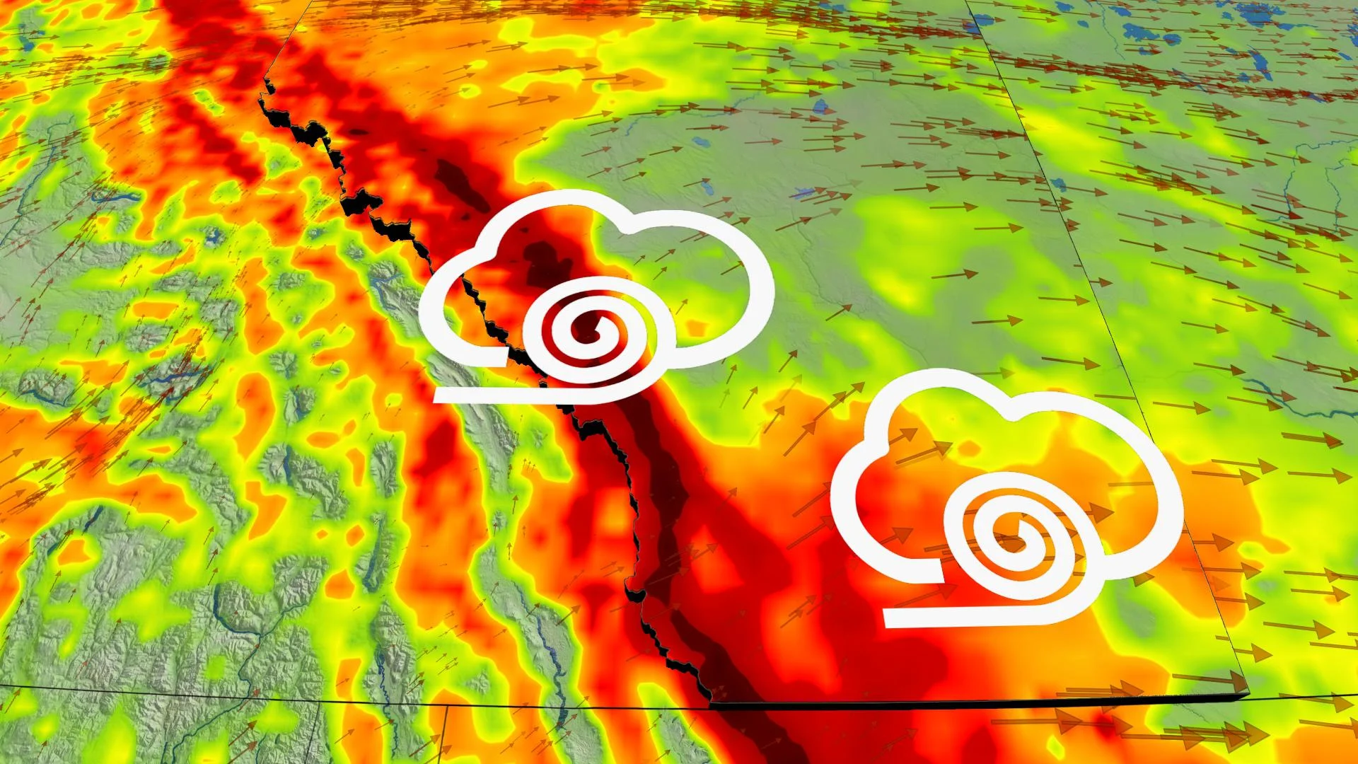
Powerful winds in Alberta and Saskatchewan, over 100 km/h for some

A strong Pacific jet that has taken shape over Western Canada will bring milder air to this region and powerful winds across parts of Alberta.
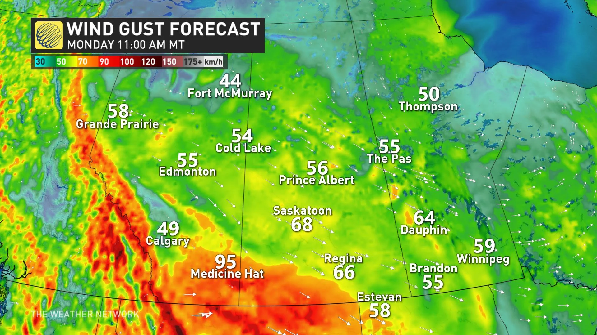
On Sunday, wind gusts reached 104 km/h in Lethbridge, 124 km/h in Pincher Creek, 113 km/h in Waterton Park Gate, and 63 km/h in Calgary. Parts of the Rockies and the southern foothills will see intense downsloping winds between 60-100 km/h throughout Monday, but some southwestern regions could exceed 100 km/h.
“High winds may cause downed trees or toss loose objects. Be prepared to adjust your driving with changing road conditions due to high winds. Drivers may lose control of their vehicles; tall vehicles are at risk of being overturned,” Environment Canada warns.
The winds and mild air flowing in could possibly drive temperatures up well above seasonal across Alberta and Saskatchewan. The Weather Network meteorologist Jessie Uppal says there are some areas that could see temperatures in the double digits this week, which is far from the bone-chilling temperatures this region experienced due to the polar vortex in mid-February.
This type of warmup happens when Chinook winds move into the foothills of Alberta—winds come down the east side of the Rocky Mountains and they accelerate and warm as they do. A brief taste of spring for Alberta and Saskatchewan will likely be welcomed by many.
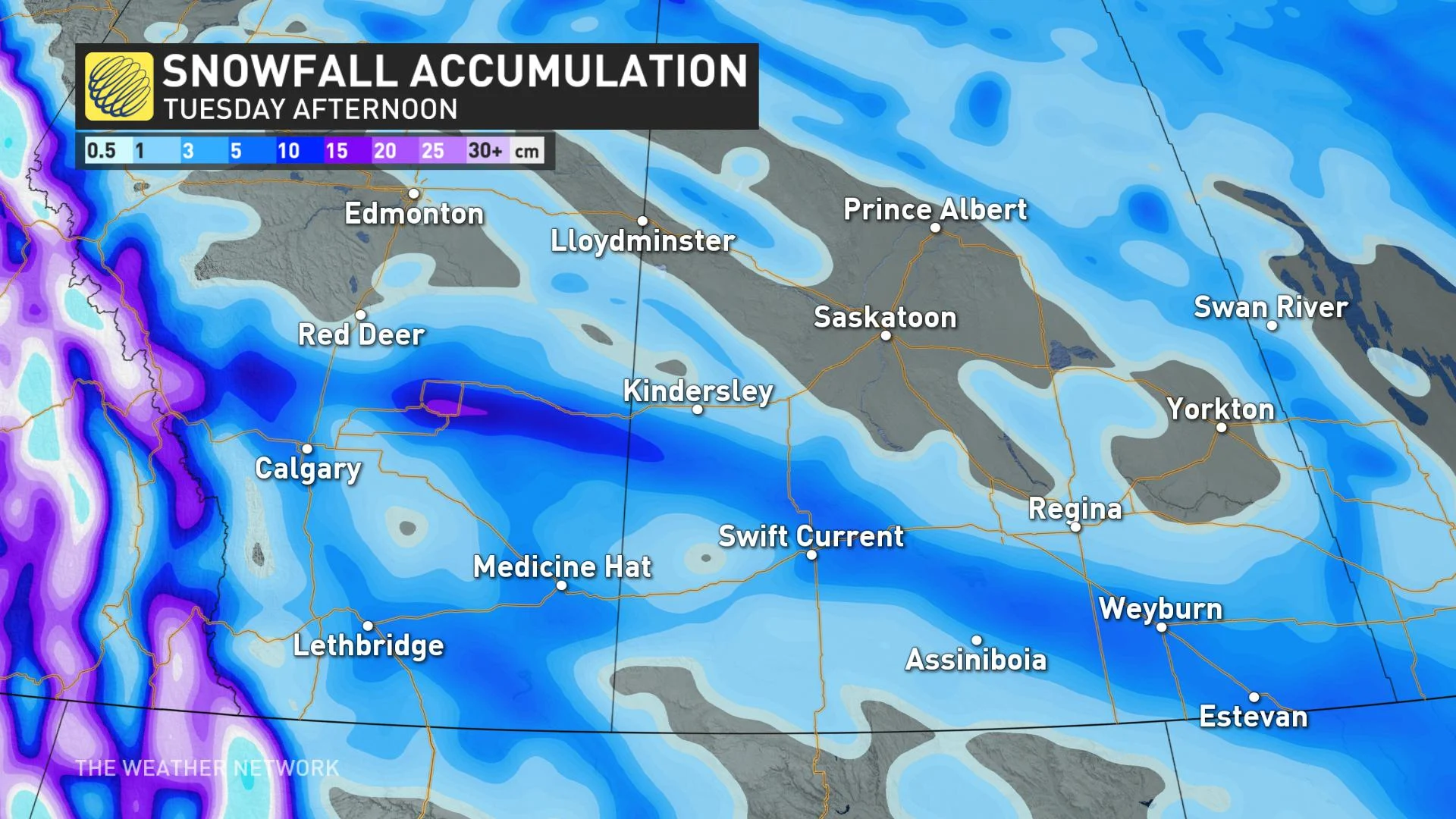
A cold front will track through the eastern Prairies on Monday night, which will create the conditions for a swath of snow stretching through Alberta and Saskatchewan on Tuesday. Areas around Calgary, southeastern Alberta, and southern parts of Saskatchewan could see roughly 5 cm of snow.


