Pair of clipper systems target the Prairies ahead of temperature plunge

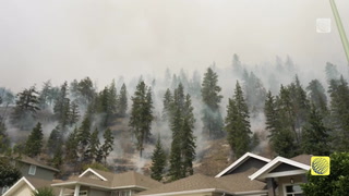
The unsettled weather will continue across the Prairie provinces this week, though no where near the record-setting winds and dangerous blizzard conditions that walloped the region last week. A couple of clipper systems, with strong wind gusts in the 70-80 km/h range are expected through Wednesday, which may create some tricky travel and the threat for whiteout conditions. More details on the snow timing and the cooler conditions that follow, below.
WEATHER HIGHLIGHTS:
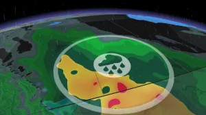
Clippers to bring swath of snow to the Prairies on Monday, 5-10 cm of snow for some
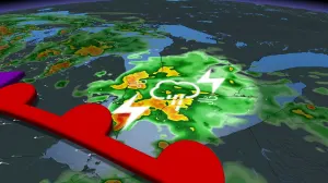
Mid-week trough to deliver more snow, 70-80 km/h wind gusts, whiteout conditions possible
Arctic air finally returns to western Prairies late next week
MONDAY-WEDNESDAY: CLIPPERS TO BRING MULTIPLE SHOTS OF SNOW, BLUSTERY WINDS
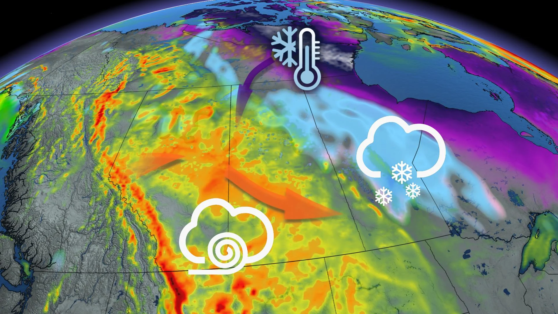
A clipper will ride the boundary extending from northern Alberta to North Dakota on Monday, bringing some spotty snowfall accumulation across Saskatchewan. Pacific warmth will continue to flow over the Rockies into Alberta, while a strengthening pool of Arctic air over Hudson Bay will try to push west from Manitoba.
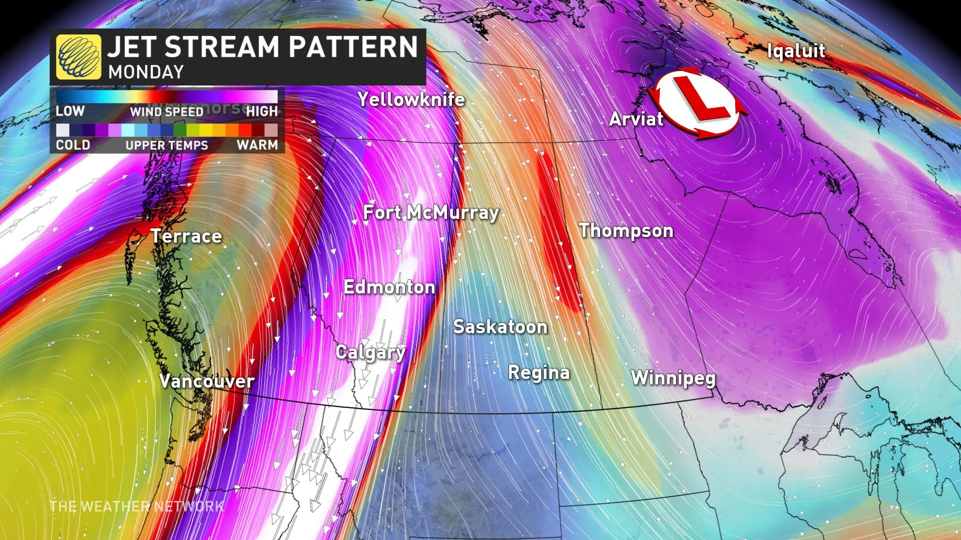
A second clipper that will track in on Wednesday and will be more impactful than the first, especially with the winds.
This system is expected to bring 5-10 cm of snow and powerful wind gusts, which will develop on the backside of the system into Wednesday.
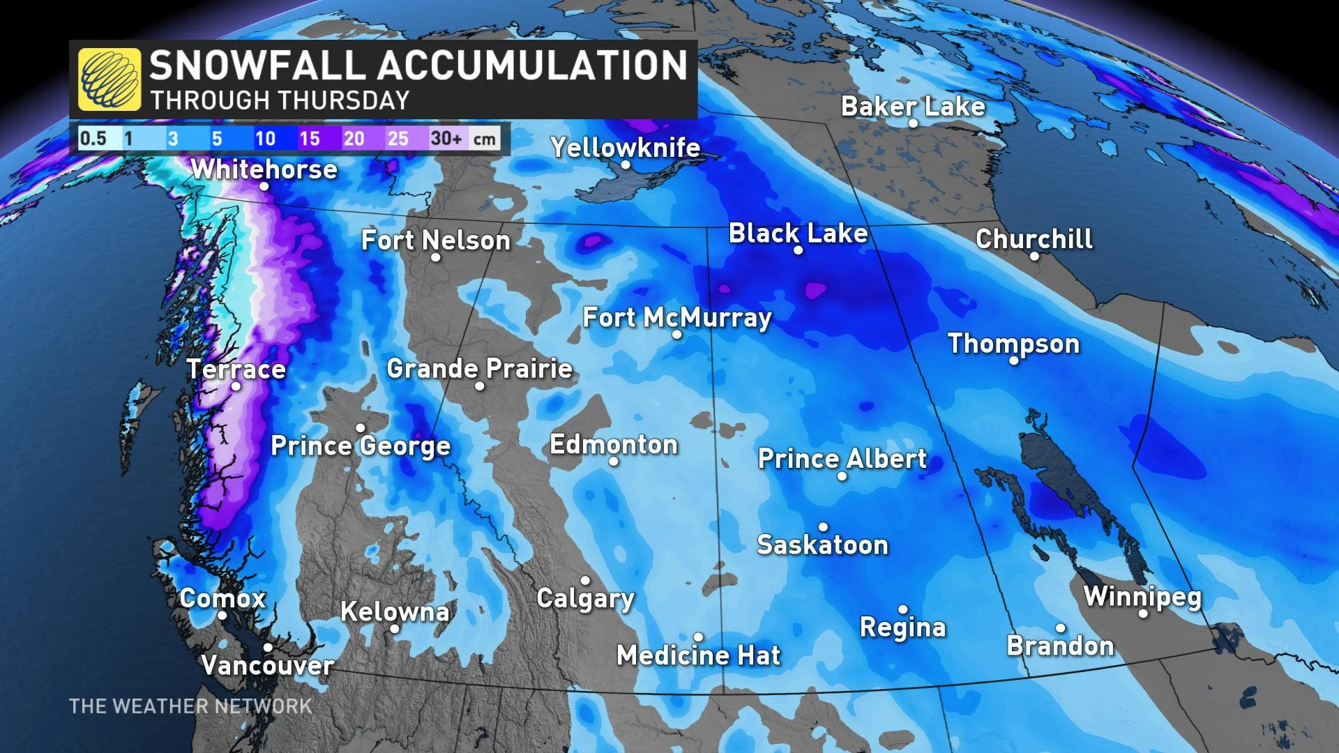
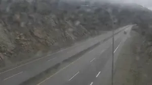
By Wednesday afternoon, wind gusts will intensify and may hit the 70-80 km/h range. These winds will likely create blowing and drifting snow, which could possibly impact travel across the region.
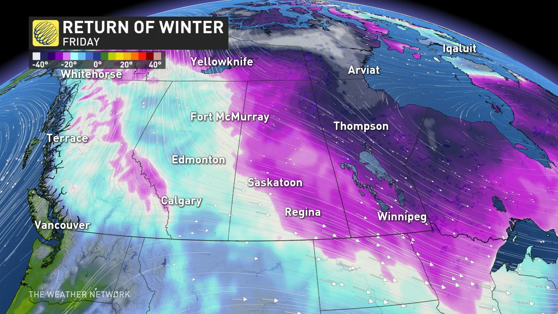
ARCTIC AIR BEGINS TO SINK SOUTH
Temperatures will trend closer to seasonal across southern Manitoba this week, but very mild weather will continue to dominate for western parts of the region to start.
For those in the Winnipeg area, Wednesday will be the one day in a sea of frigid daytime highs, where you'll want to get out and enjoy some milder conditions.
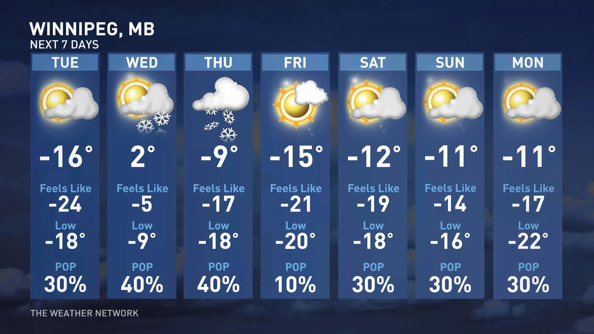
Arctic air will finally return to the western Prairies by the week's end, as the chilly air persists across Manitoba into the weekend.
"The city of Edmonton, Alberta for example, will start the week 10°C above seasonal, and finish it 10°C below," says Weather Network meteorologist Kevin MacKay.
Temperatures will remain frigid for the final week of January, especially for Alberta.
Stay tuned to The Weather Network for the latest forecast updates.