Powerful and dynamic storm puts millions under warnings in B.C.

Batten down the hatches, B.C. Tuesday is going to be quite a blustery, potentially impactful day with a potent Pacific low pushing through the province. Numerous weather warnings (wind, snowfall, winter storm) are all in effect as the system will bring far-reaching impacts. Winds could hit upwards of 110 km/h in parts of the province, forcing several ferry sailing cancellations early Tuesday, and with a heightened risk for power outages throughout the day. The strongest wind gusts will occur in the afternoon. More on the timing and potentially challenging impacts, below.
WEATHER HIGHLIGHTS:
Strong system tracks in with widespread wind impacts through Tuesday, power outages possible with strong wind gusts
Heavy bands of rainfall for coastal sections of B.C. also continue Tuesday
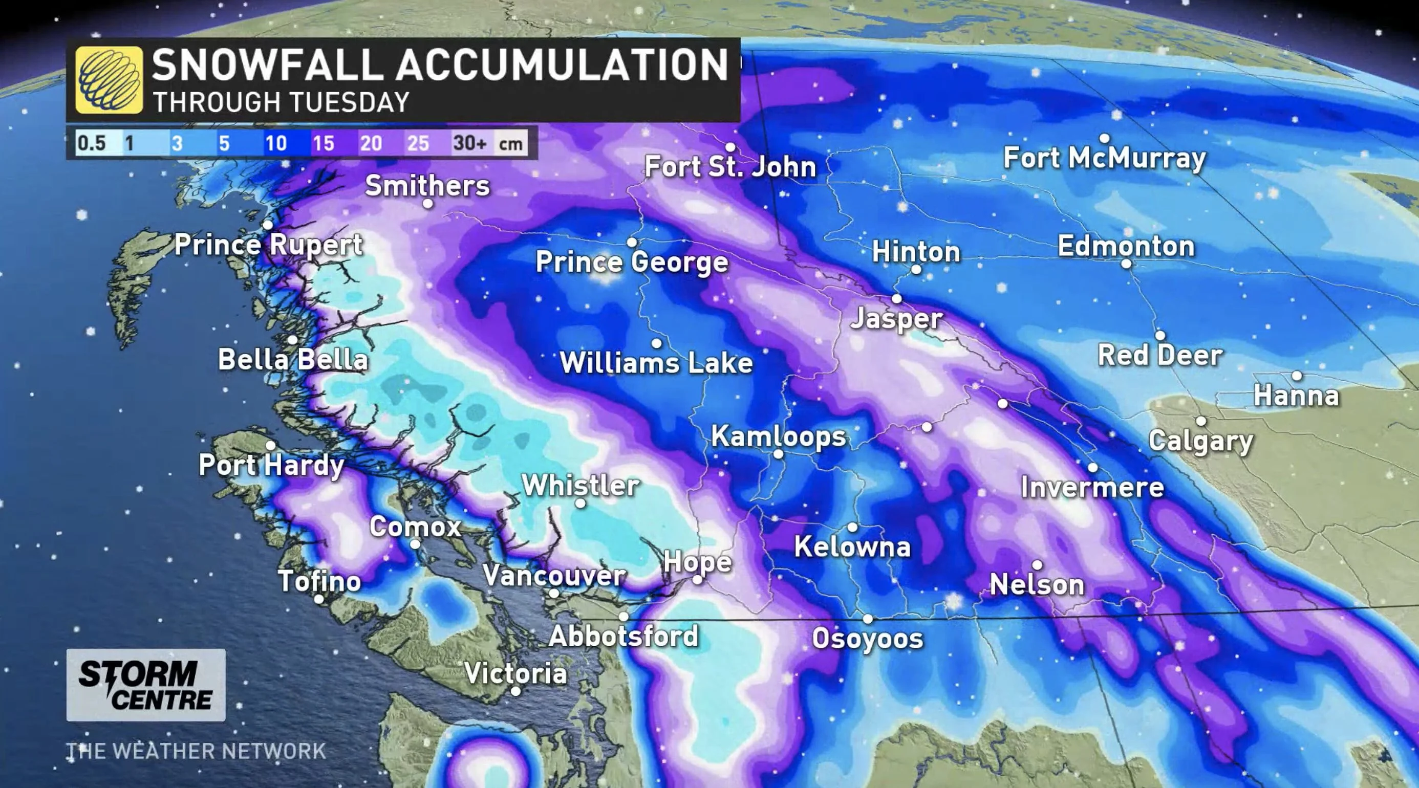
Rounds of snow expected for the southern Interior this week, heaviest for northern sections
THROUGH TUESDAY: DAMAGING WIND GUSTS FOLLOW THUNDERSNOW
The break in the active weather was short-lived as the third moisture-fuelled system in recent days tracked into B.C. Monday night.
"We've already had reports of thundersnow. So where it started to snow late Monday night, there was enough energy in the atmosphere to also create lightning and thunder," says Weather Network meteorologist Jaclyn Whittal. "It's a very powerful and very dynamic low."
The Pacific low will bring similar effects as the previous two systems that have rolled through the region recently, but will likely have a more widespread, potentially damaging impact, especially with the powerful winds expected.
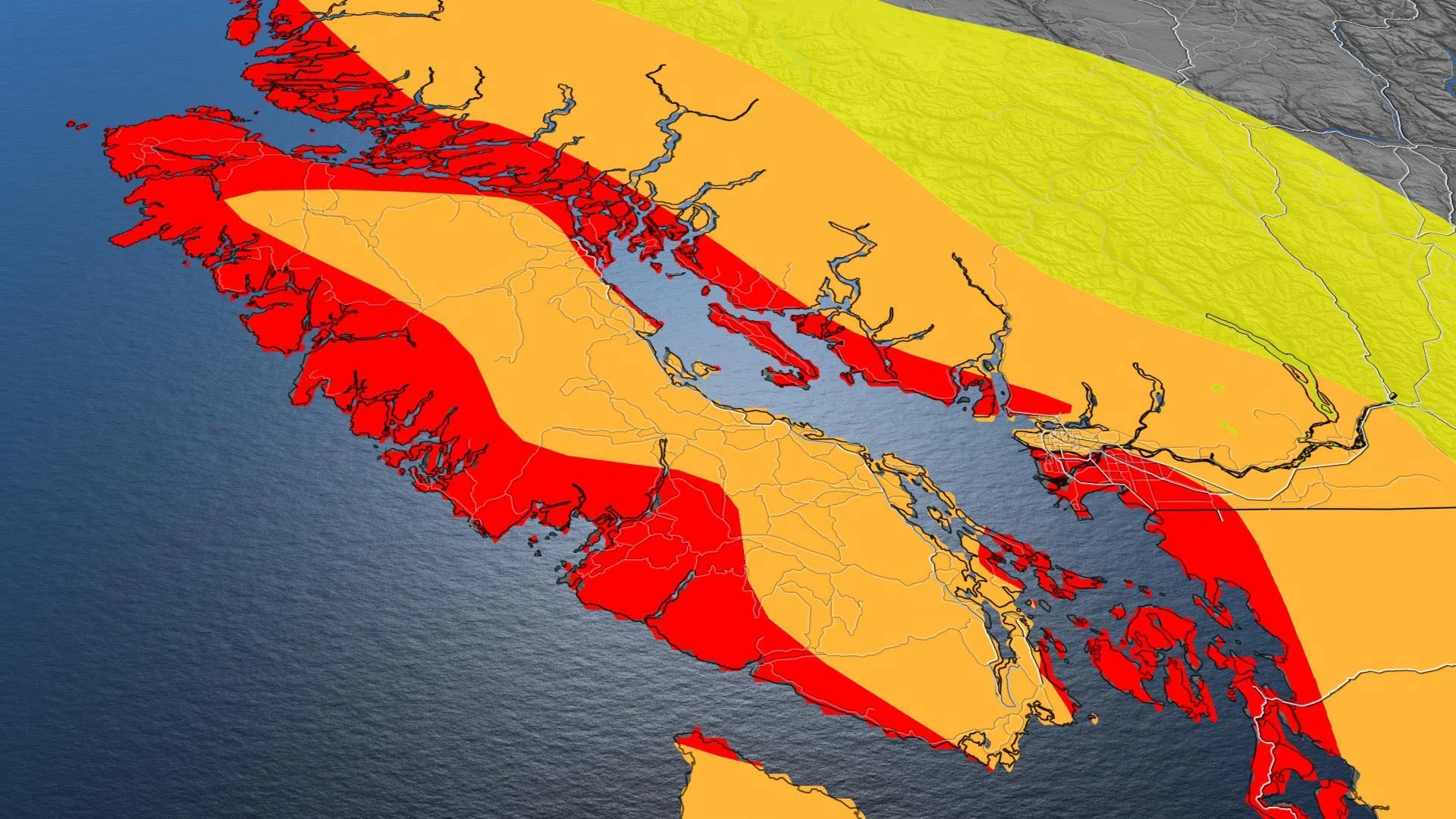
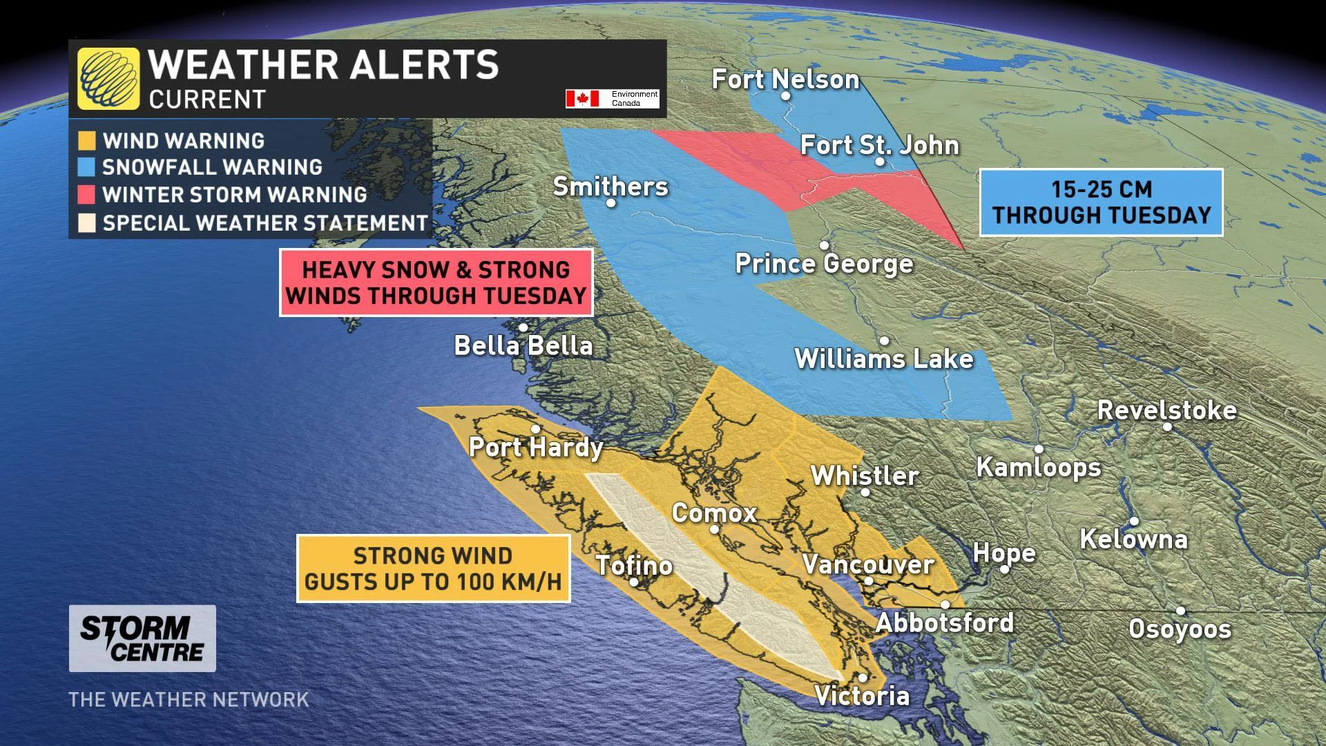
More than three million residents in B.C. are currently under wind warnings and those warnings prompted BC Ferries to cancel several Tuesday morning sailings.
“The safety of our passengers and crew is of primary importance to us. We don’t take the decision to cancel sailings lightly, as we know customers rely on us to get to their destinations. We will resume service as soon as it is safe to do so,” said an advisory from BC Ferries.
WATCH: TIMING THE STRONGEST WINDS
The winds will ramp up Tuesday morning, but the strongest gusts will occur in the afternoon for western Vancouver Island, then intensifying through the Straits and reaching the Lower Mainland by Tuesday evening.
Gusts along coastal areas of western Vancouver Island will hit 80-110 km/h, with 70-90 km/h gusts along southern portions and the Straits, and up to 90 km/h across the Lower Mainland at times.
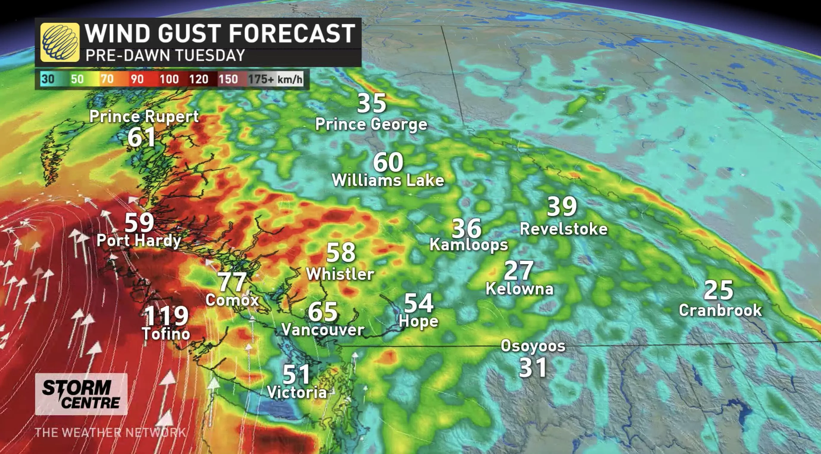
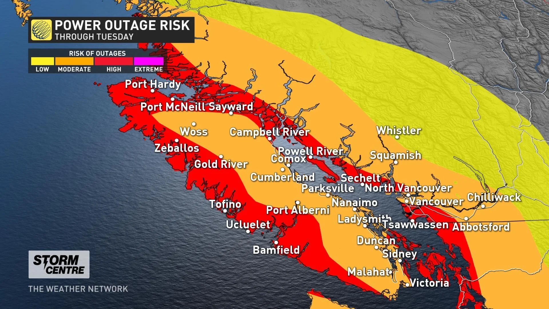
As the winds begin to ease and shift to a southwesterly direction in the evening, and depending on how far south the low sinks, there could be significant impacts to travel and electricity, with the potential for downed trees and power lines.
The risk for power outages will be particularly high along the South Coast including the Sunshine Coast and the Lower Mainland, as well as western Vancouver Island.
HEAVY RAIN AND SNOW ACCOMPANY PACIFIC LOW
In addition to the potentially damaging winds, more heavy rain and alpine snow is expected with the Pacific low Tuesday, with the heaviest snow totals forecast for the Rockies and Kootenay Mountains.
"Prepare for quickly changing and deteriorating travel conditions. Surfaces such as highways, roads, walkways and parking lots may become difficult to navigate due to accumulating snow," Environment Canada says in a snowfall warning for the regions.
LOOK AHEAD: COOL, UNSETTLED PATTERN CONTINUES
In addition to the wet weather, frigid temperatures will linger in southern B.C. for the next several days. A few systems will track across the region with rain for coastal areas and an abundance of high-elevation snow for the ski areas, including the North Shore and southern Rockies.
There will be mix precipitation and snow at times for the southern interior valleys. Significant snow is possible for the Interior with another system moving in Friday.
Stay tuned to the Weather Network for the latest forecast updates.


