PHOTOS: Travel chaos amid first big snow of the year in southern Ontario

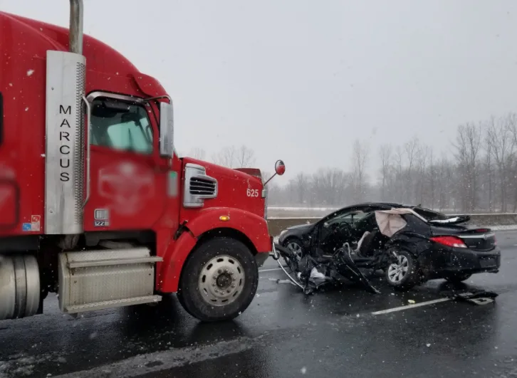
Heavy snowfall brought dangerous whiteout conditions to the GTA and other areas in southern Ontario Tuesday, leading to numerous collisions.
Parts of southern Ontario were on the receiving end of a decent wintry blast Tuesday, courtesy of the northern edge of a Texas low that pushed snow into the region.
The snowfall lead to whiteout conditions and treacherous travel throughout the GTA and surrounding areas, causing several accidents and bringing traffic to a standstill on many roadways.
Snowfall accumulations were projected to be near 10 cm across most of the GTA. Locally higher amounts were possible with lake enhancement between Hamilton, Milton and Toronto due to the east wind off Lake Ontario. Elsewhere across the Golden Horseshoe, including the Niagara region, a widespread 5-10 cm fell.
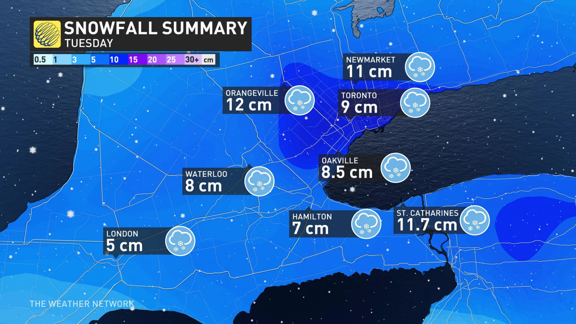
Confirmed snowfall totals from Tuesday's storm include 12 cm in Orangeville, 11 cm in Caledon, 9 cm in Newmarket, 8 cm in Waterloo, 8.5 cm at The Weather Network in Oakville, 9 cm at Toronto Pearson Airport, and 7 cm in Brampton and Guelph.
In addition to the confirmed accumulations, there were unofficial reports of 10 cm in Milton and 9 cm on the escarpment in Grimsby.
MULTIPLE COLLISIONS REPORTED AS ROAD CONDITIONS QUICKLY DETERIORATED
There were reports of multiple crashes on Highway 401 through Milton and Puslinch ahead of the lunch hour, with a jackknifed tractor trailer on Highway 6 southbound, blocking two left lanes and backing up traffic there. Several smaller accidents were also reported in and around the city of Toronto throughout the day.
In a video the Ontario Provincial Police (OPP) posted to Twitter Tuesday, Norfolk County Const. Ed Sanchuk urged people to drive according to the road and weather conditions because the roads are slick.
He also urged motorists to have their "entire headlighting system on... so you are seen to other members of the motoring public." As well, Sanchuk urged people to slow down on the slippery roads, avoid tailgating and ensure the gas tank and windshield washer fluid reservoir are full.
"As you can see, the snow is falling, the roads are snow-covered and we're just asking everyone to please reduce their speed. As you can see it's 80 km/h zone here," said Sanchuk. "You do not have to be doing 80 km/h to travel (during) this weather. Slow your vehicle down to get to where you are going safely."
Weather advisories and snowfall warnings were dropped late Tuesday afternoon, with just flurries lingering into the overnight period.
Beyond Wednesday, Arctic air from the Prairies will be moving into the region for the weekend, starting Friday morning, possibly bringing the coldest of the temperatures of the season so far.
Below is a selection of visuals from Tuesday's snowfall that are making the rounds on social media:
Thumbnail image courtesy: OPP West Region.