PHOTOS: Traffic chaos ensues in B.C. following bout of heavy snow

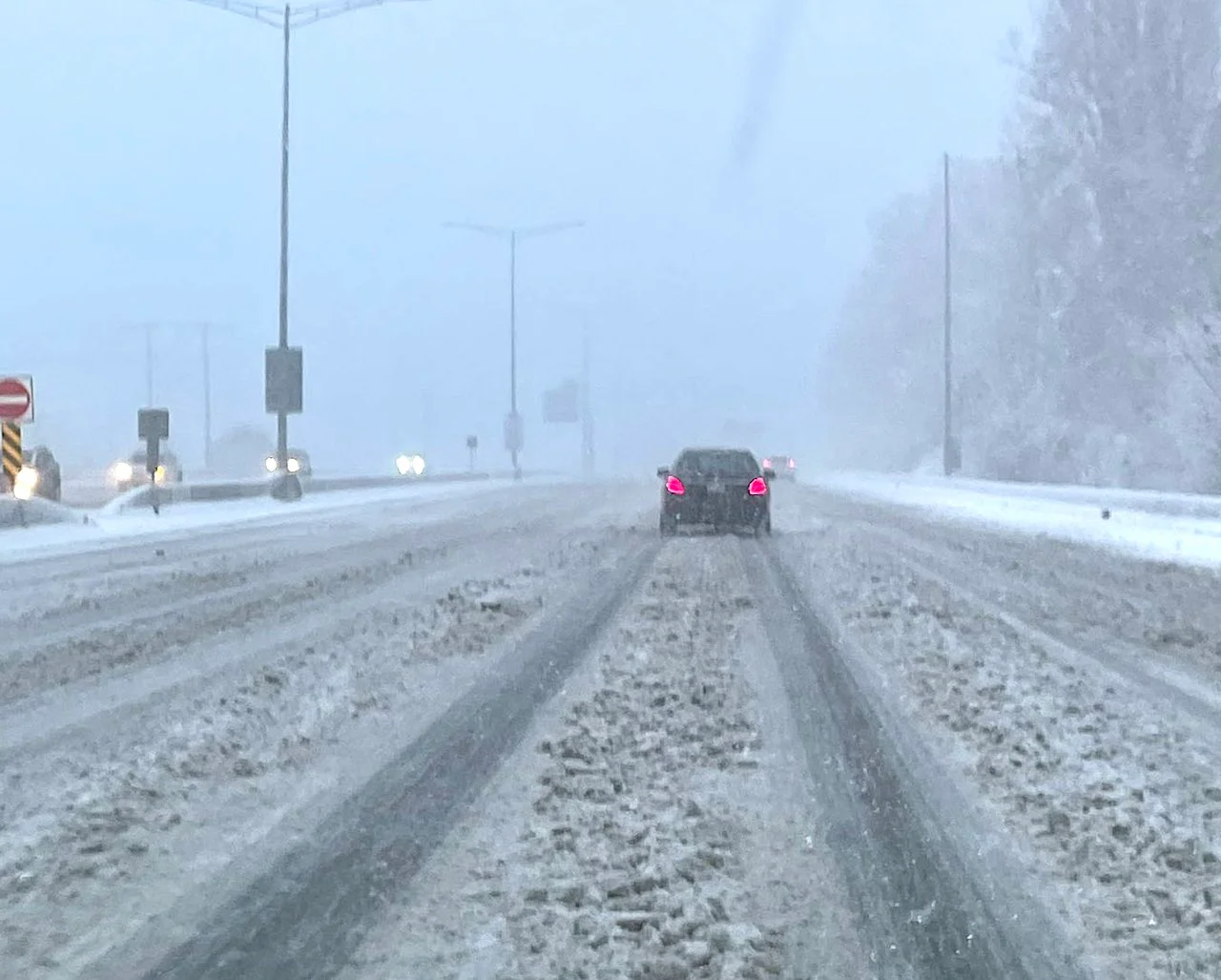
The Sunday morning snowfall along the B.C. South Coast quickly covered roads in many populated centres, causing numerous spinouts and unsafe driving conditions.
B.C. drivers were given another stark reminder that the South Coast is susceptible to heavy snowfall like the rest of the country is.
A powerful Arctic front swept through the Lower Mainland on Sunday, strong enough to produce thundersnow across Metro Vancouver and awakening some residents. Outflow winds roared out of the Howe Sound, meeting with easterly winds blowing across the Lower Mainland, creating significant lift.
RELATED: Arctic blast brings cold air, multiple shots of snow into B.C. coast
The heaviest snowfall rates quickly overwhelmed the roads and bridges across northern and western Vancouver, creating chaos on the roadways. Highway 1 faced a lengthy closure in North Vancouver as the snowfall rapidly deteriorated road conditions -- causing numerous spinouts and making it unsafe to travel.
Metro Vancouver can expect totals of 5-10 cm through the day on Sunday, with totals pushing 10-20 cm for areas east into the Fraser Valley.
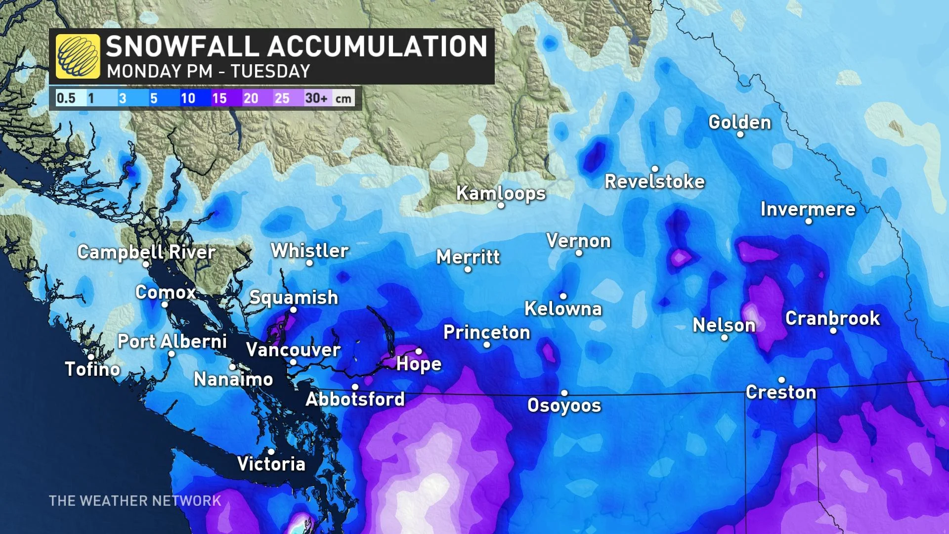
B.C. residents won't get much of a break from the snow as our second round, which looks to be more widespread than Sunday's, arrives Monday overnight with a developing low-pressure system in the Pacific, off the coast of Vancouver Island.
The location of the developing storm will combine with the cold air locked in place to allow widespread snow to spread over southern B.C. through the day on Tuesday, providing a solid opportunity for accumulating snowfall throughout the region.
Once the snow started flying, social media was lit up with compelling videos and photos posted by residents. Below is just a selection of what is currently making the rounds.
Thumbnail courtesy of Johanna Webber/Twitter, taken in Burnaby, B.C.