PHOTOS: St. John's, other N.L. communities buried after winter wallop

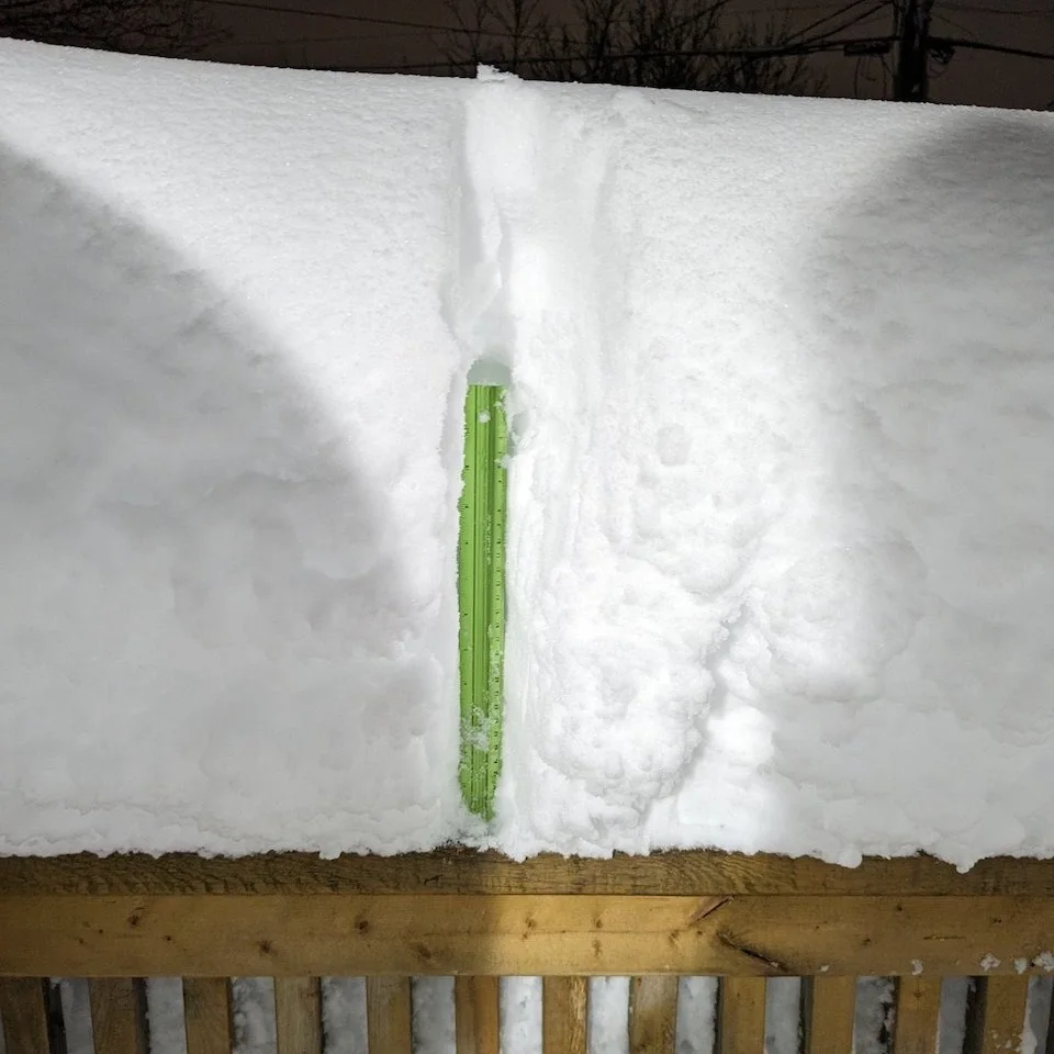
Parts of Newfoundland are beginning to take stock of this weekend's winter storm, with some areas digging out from 40-50+ cm of snowfall.
SEE ALSO: Winter 'vacation' will end soon with return of classic Canadian cold
The Colorado low that ended the snow drought in Halifax, N.S., intensified as it tracked up from the Maritimes, impacting Newfoundland Saturday and into Sunday morning, with heavy snowfall rates across eastern sections of the island and northern areas of the Avalon Peninsula.
Eastern Newfoundland experienced intense winds, in addition to the snow, gusting upwards to 80 km/h throughout Saturday and into Sunday. This led to heavy, blowing snow and whiteout conditions. As a result, there are power outages across the island, with 11,000 customers in the dark at one point during the storm. The number has since gone down.
Blizzard conditions were met in St. John's earlier Saturday. There have also been reports of thundersnow across parts of the Avalon.
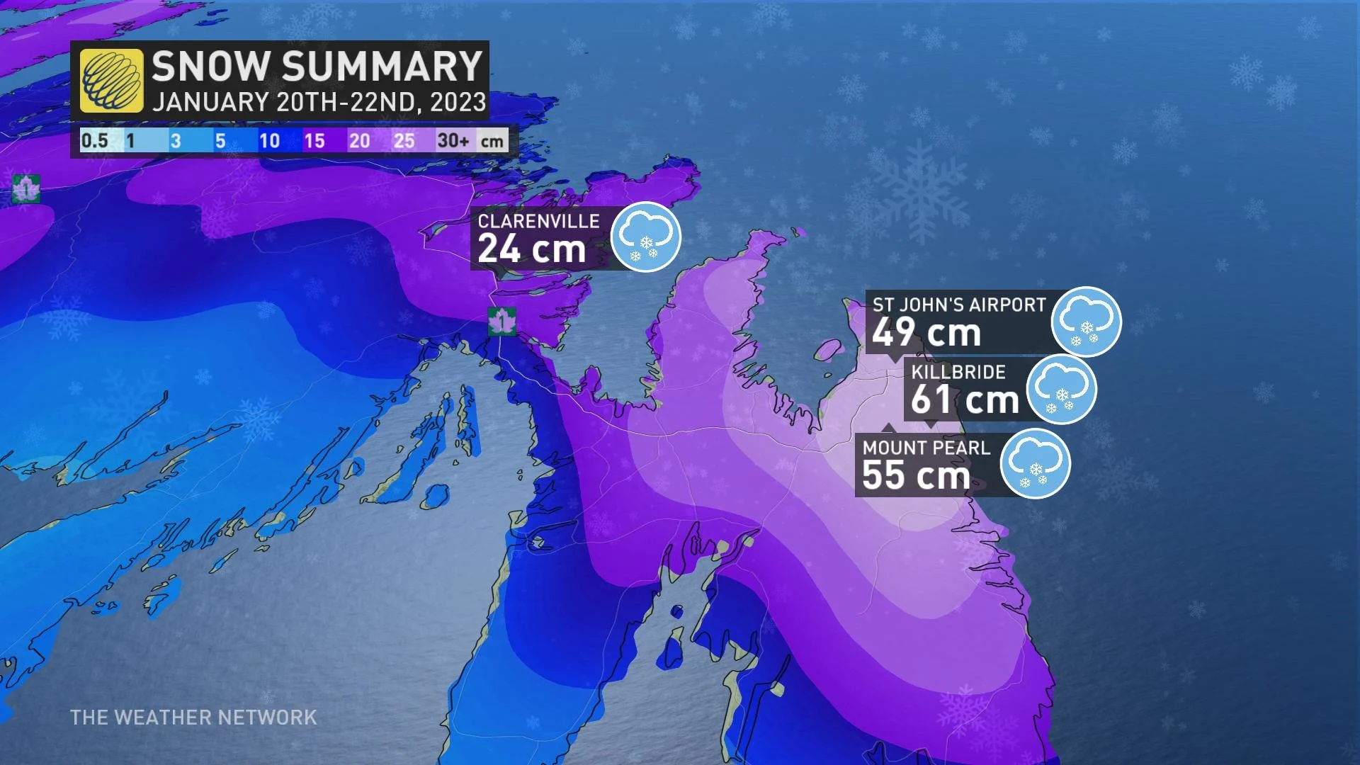
A preliminary summary from Environment and Climate Change Canada (ECCC) says the east end of St. John's recorded 52 cm of snow on the ground so far, with 49 cm documented at the city's international airport so far. This more than doubles St. John's snowfall for the season so far, with 39.2 cm recorded prior to Jan. 20.
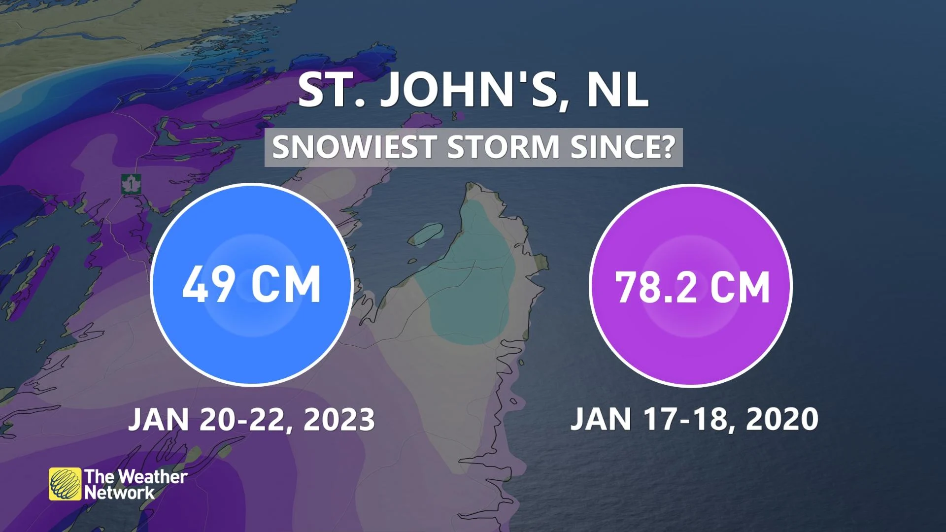
It's the snowiest two-day event since St. John’s historical blizzard three years ago. With a two-day total of 49 cm, Jan. 20 and 21 were the aforementioned city’s snowiest two days since Jan. 17 and 18, 2020.
Other snowfall totals observed include a whopping 61 cm in Kilbride, 55 cm in Mount Pearl and 24 cm in Clarenville.
This system will exit Newfoundland early Sunday morning, but it will not be long before the next one arrives in Atlantic Canada.
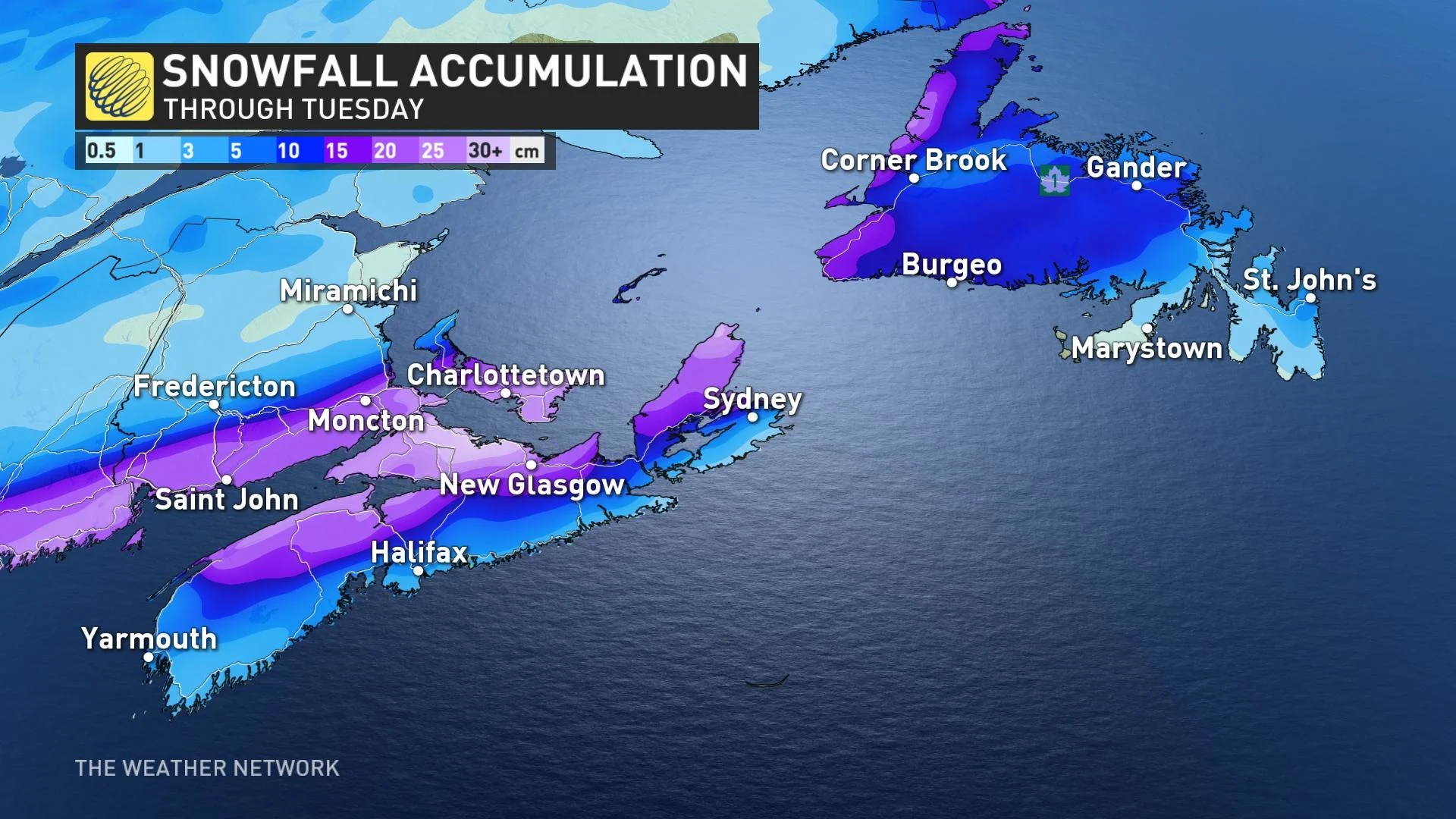
A snow-rain mix will arrive in Newfoundland by late Monday morning, with predominantly rain for the island, with considerable snowfall for the northern and western coastal sections. This could cause localized flooding due to rapid snowmelt from rising temperatures and the rain.
Below is a selection of visuals of the storm currently circulating on social media.
WATCH: S. John's, N.L, sees biggest snowfall since 2020's historical blizzard
Thumbnail courtesy of Sarah Lundrigan/Twitter, taken in St. John's, N.L.


