PHOTOS: Mighty 'weather bomb' knocks out power to thousands in B.C.

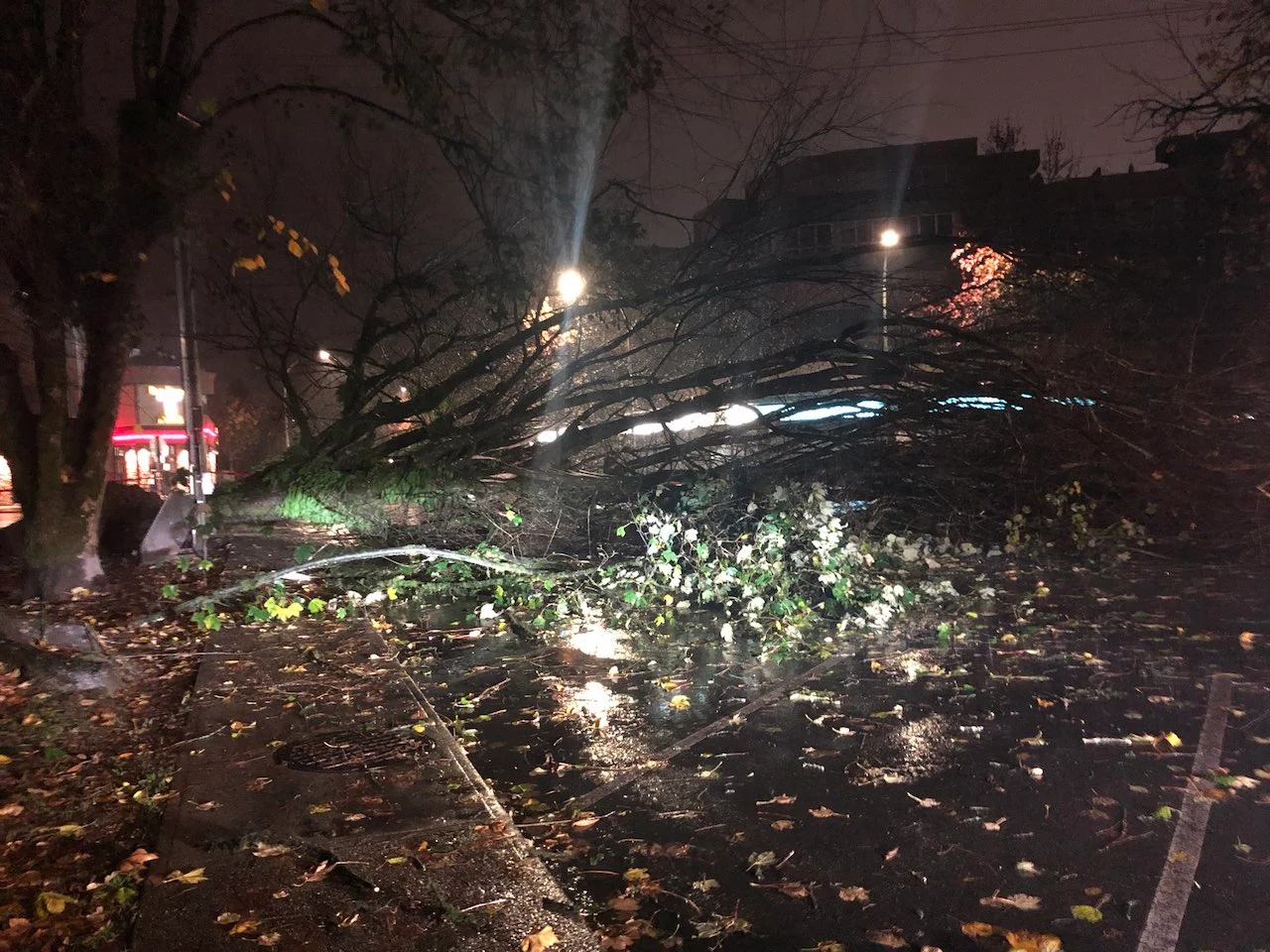
Intense wind gusts brought down trees and knocked out power to thousands of B.C. residents Monday and Tuesday, courtesy of another potent 'weather bomb' that pushed through the province.
B.C. has been hit hard with yet another bomb cyclone, the third such potent low in three weeks, leaving thousands without power Monday night and Tuesday, as the Pacific low brought damaging winds to the coastal sections.
Even before the pre-dawn hours Tuesday, around 30,000 customers were already left in the dark at one point, but most of the power has since been restored. Only a few hundred customers are still without electricity as of Tuesday evening local time, according to BC Hydro.
RELATED: Lower Mainlanders less ready for storm season than others in B.C.
The power outages were caused by falling trees and other debris resulting from the fierce winds. Wind warnings were issued for the North, Central and South coasts, where some areas saw gusts approach or even exceed 100 km/h during the storm's peak.
The system that met "weather bomb" criteria, which has pressure drops of at least 24 millibars in 24 hours, was an intense, but slow-moving Pacific front.

Over the course of two days, it brought heavy rain, powerful wind gusts and copious snowfall for the mountain passes through Tuesday. The latest in a parade of systems is all due to a broad upper trough stationed over the Gulf of Alaska.
In addition to the heavy rain and intense, damaging wind gusts along the coastal sections, the system also brought thunderstorms to parts of the region Tuesday afternoon, with reports of small hail in some locales. Stateside, there were tornado warnings associated with the low in Washington state, but they remained south of the border.
Some of the mountain passes were also impacted, with as much as 20-25 cm of snow forecast to fall by the time the system departed.
While conditions have greatly improved and most of the wind warnings have been dropped, more heavy rain associated with an atmospheric river, along with more mountain snow, is expected with the next system late week.
There will be some brief breaks between storms, but overall, the unsettled pattern will continue for the B.C. coast through most of next week.
Below is a selection of visuals that have been making the rounds on social media so far.
Thumbnail courtesy of @whaler_88/Twitter.