PHOTOS: First big snow of the season overachieves in Atlantic Canada

After being pummeled with howling, hurricane force winds to start the first week of November, the system that quickly followed had a much more wintry feel across parts of Atlantic Canada.
Conditions quickly deteriorated in Nova Scotia on Tuesday, with slick and slushy roads reported in some areas -- including the city of Halifax -- for the afternoon commute home. Between 5-10+ cm of snow piled up before the system made its way into central Newfoundland Tuesday night, catching many off guard as the snow totals well overachieved.
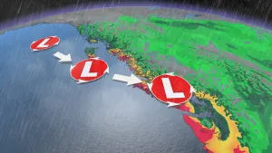
"The higher snowfall totals in Nova Scotia has a lot to do with the exact track of the low pressure system. In this case, the centre of the low was positioned just south enough to bring steady snowfall to the region and remain as snow," says Weather Network meteorologist Jessie Uppal. "Had the positioning of the track shifted a bit further north, we would have seen a lot more rain mixing in."
Up to 20 cm of snow was forecast for the hardest hit areas of Newfoundland, but by 7 a.m. on Wednesday morning, nearly 30 cm had already been reported in the Gander area. The heavy snow coupled with powerful northwest winds made for treacherous travel conditions through the early morning hours.
This first significant blast of snow was also enough to shut several schools, with drivers being urged to avoid any unnecessary travel.
SEE IT: HIT WITH FIRST BIG SNOW OF THE SEASON
WATCH: THICK LAYER OF SNOW COVERS NEWFOUNDLAND
Thumbnail courtesy: Garrett Barry