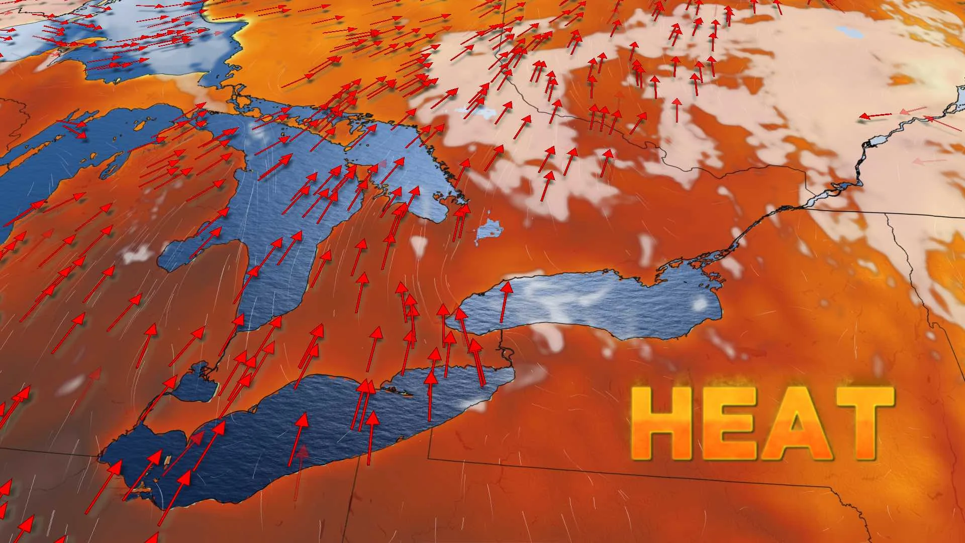
Intense heat, humidity will soon return to Ontario as storm risk continues

Southern Ontario will see another day with temperatures below 30°C and the potential for scattered thunderstorms. While temperatures have recently been relatively close to seasonal, uncomfortably hot conditions will once again return to southern Ontario with many regions soaring above 30°C and humidex values possibly reaching 40 in southwestern regions. Details and timing, below.
Visit our Complete Guide to Summer 2020 for an in-depth look at the Summer Forecast, tips to plan for it and much more
WEATHER HIGHLIGHTS:
Similar temperatures, muggy conditions for most of next week
Intense heat to surge back in late week
Keep an eye on weather ALERTS in your area
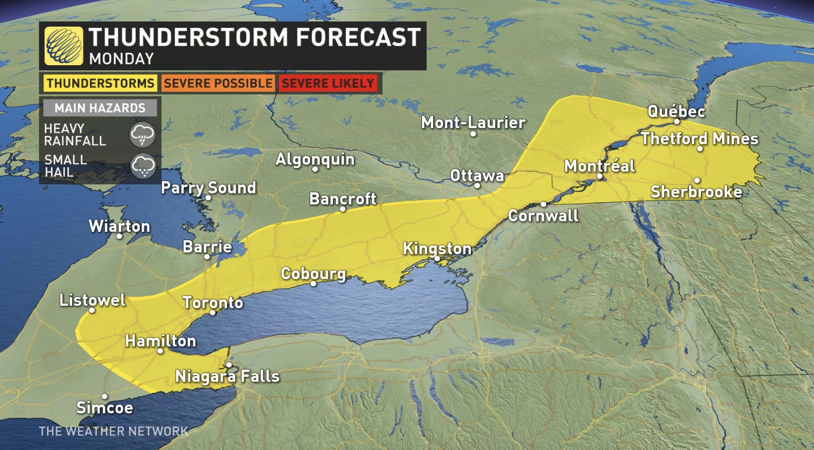
MONDAY: HUMID, CHANCE OF STORMS
Monday will see the threat for scattered, non-severe storms continue across parts of Ontario's southern and eastern regions, thanks to a upper-level trough. The potential for pop-up storms stretches from Niagara all the way into southern Quebec.
Daytime highs won't stray too far from Sunday's, with widespread temperatures hitting the mid to upper-20s again, hovering close to seasonal. However, with the humidity, it will feel well into the 30s.
LOOK AHEAD: WATCHING ANOTHER LATE-WEEK HEAT EVENT
Temperatures will likely remain more or less in the mid-to-high 20 during the rest of the week. It will still be muggy throughout, with the humidex values sitting in the 30s.
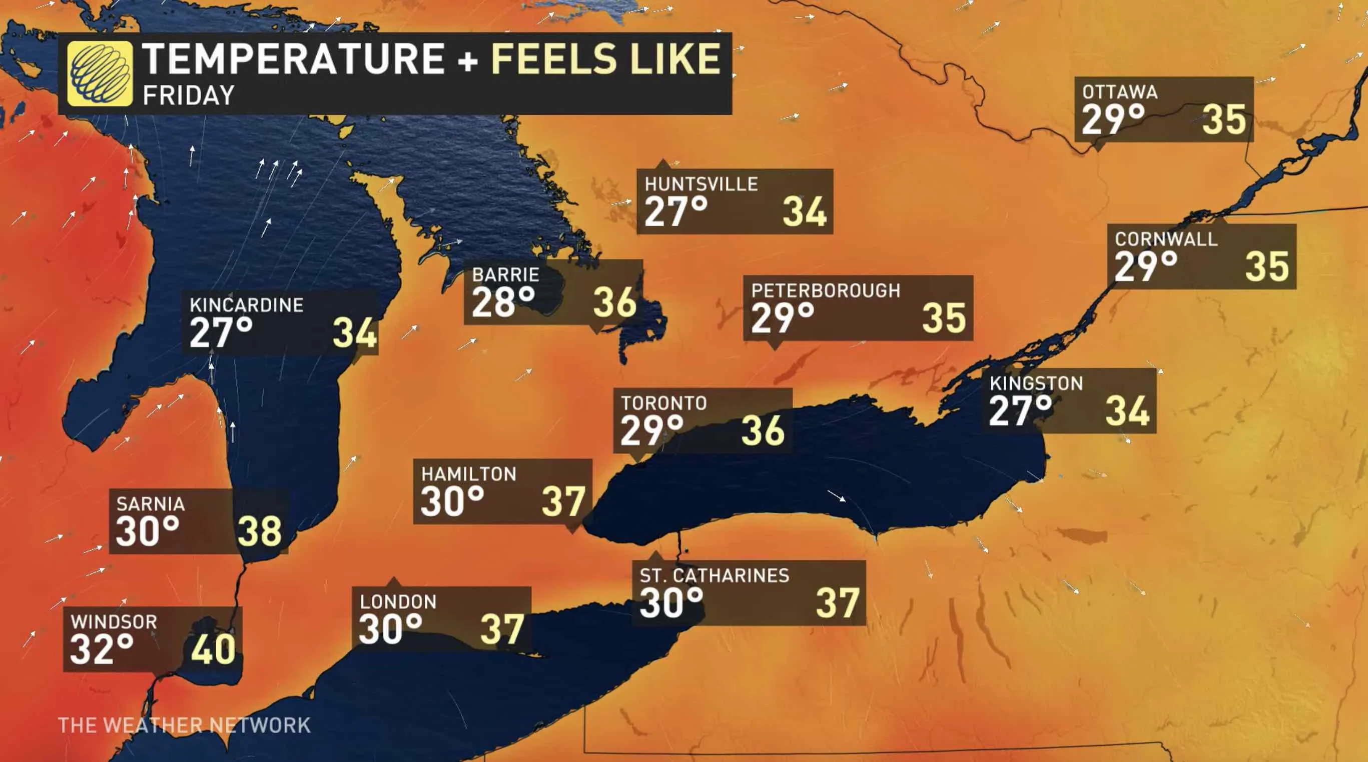
However, a building ridge of high pressure over the Great Lakes will once again bring the return of hotter temperatures late in the week, reaching 30°C by Friday in some locales, with humidex values feeling in the high 30s, possibly reaching 40 in the southwest.
This impending heat wave should be associated with more thunderstorms than what we have seen during the past few weeks, so at this point it doesn’t look like drought will be as big of a concern as it was during the prolonged heat event that marked the early days of July.
The Weather Network meteorologist Tyler Hamilton says that the current drought conditions will be somewhat mitigated over the next 7-10 days due to the upper level pattern in the atmosphere bringing moisture to Ontario.
Stay tuned to The Weather Network as we continue to update the forecast.


