Pattern reversal ahead: Winter slowly returns to Canada

Don't get complacent, we do expect a slow transition to more of a traditional winter pattern during the second half of January.
The first week of January felt more like November across most of Canada. The temperature anomaly map below shows how widespread the above seasonal temperatures have been so far during January, with large parts of central Canada running more than 10 degrees above seasonal.
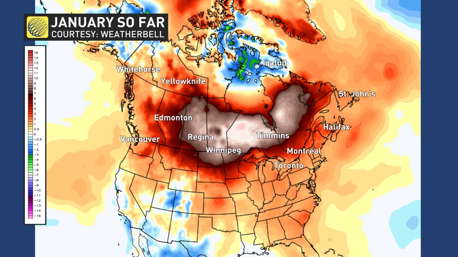
This is very similar to December, which featured well above seasonal temperatures across nearly all of Canada.
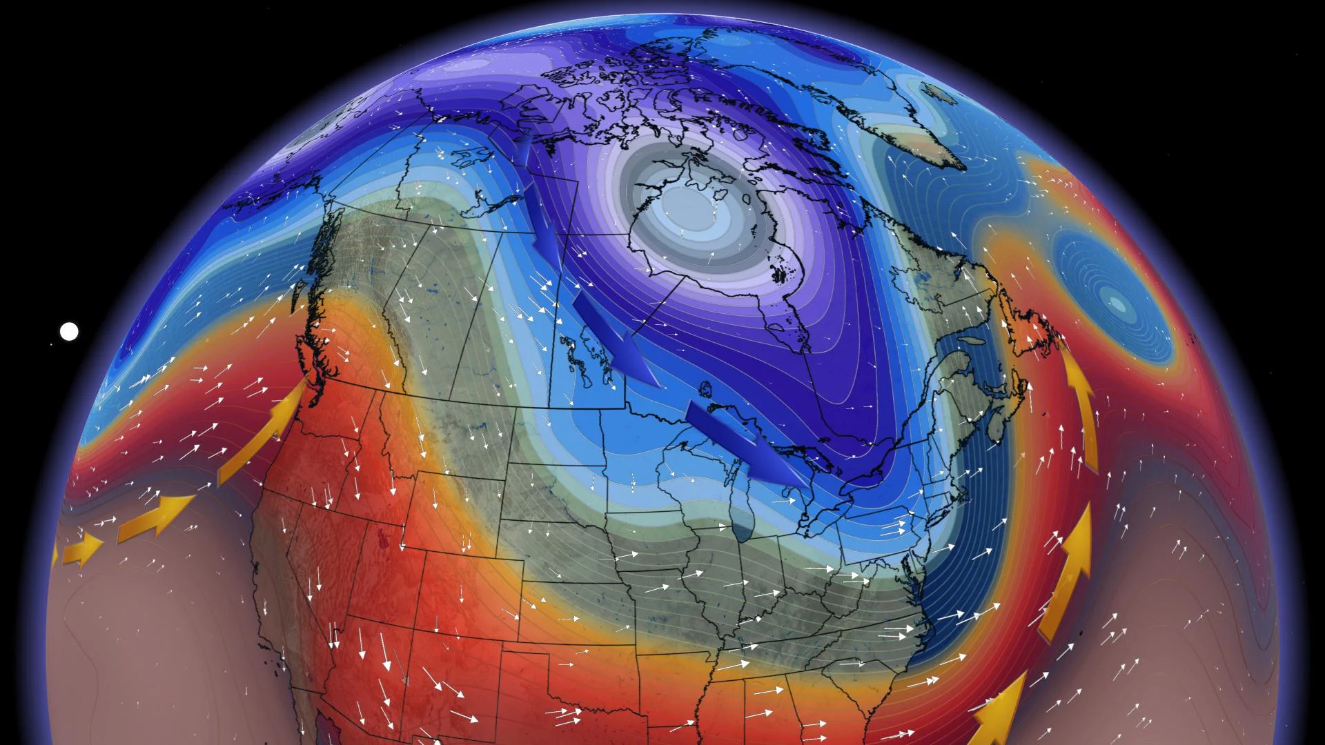
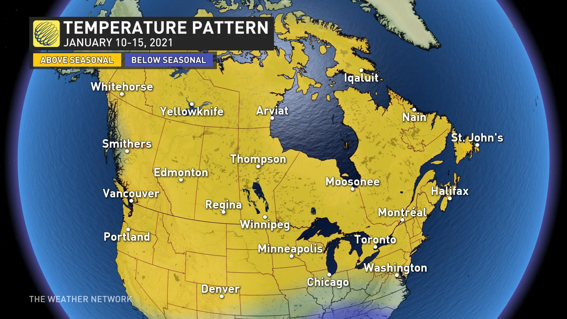
The very mild pattern will continue for another week. A very strong jet stream across the northern Pacific Ocean will continue to flood the country with mild Pacific air and prevent arctic air from plunging south.
However, we do expect a slow transition to more of a traditional winter pattern during the second half of January, especially across western and central Canada.
We will start to see significant changes to the jet stream pattern during the third week of January. Initially, however, this will just bring a couple shots of near seasonal weather to the eastern Prairies and into Ontario since there isn’t any frigid weather lurking just to the north. Therefore, it will take some time for us to fully transition into a more traditional mid-winter pattern.
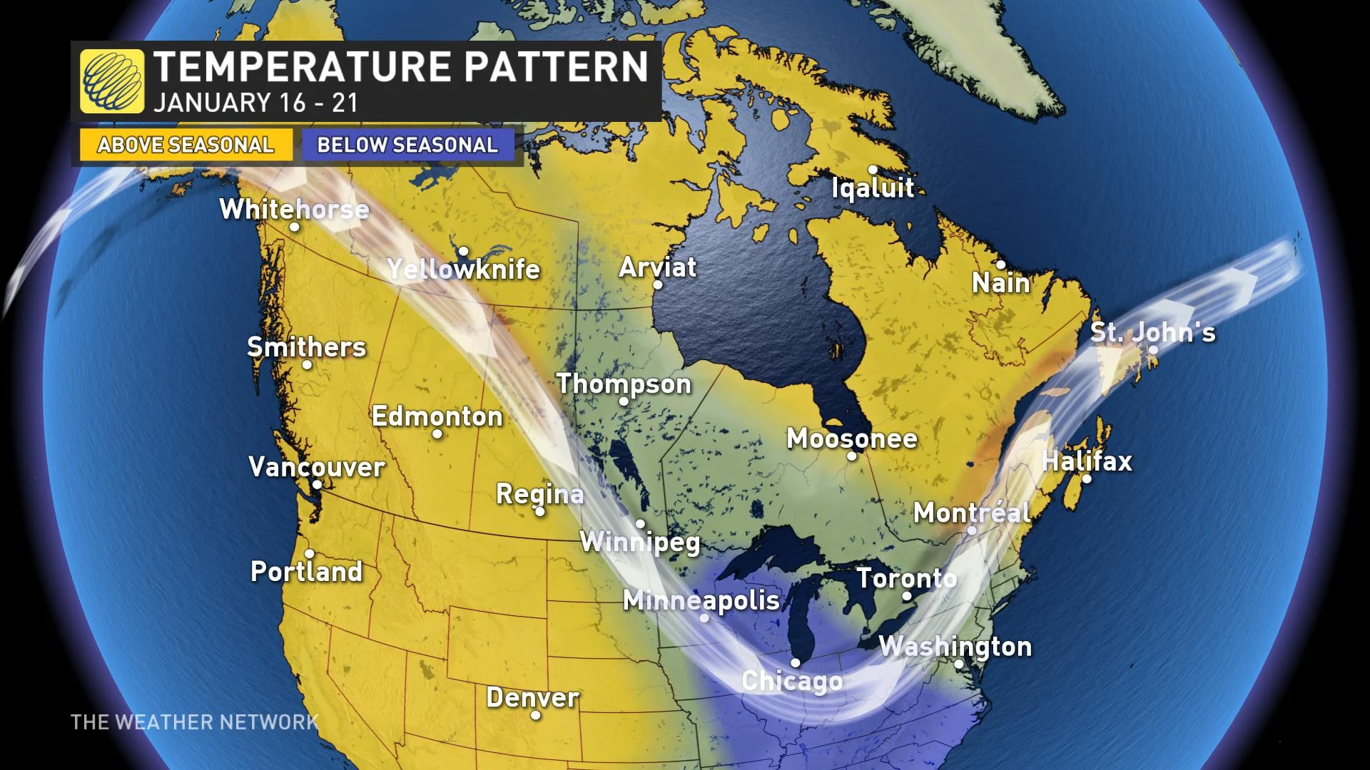
After January 20, more widespread cold weather is expected to arrive, especially across the Prairies. Initially, the coldest weather associated with the polar vortex will remain on the other side of the North Pole (across Asia). However, we are watching the potential for the final week of January to trend well below seasonal across Western Canada.
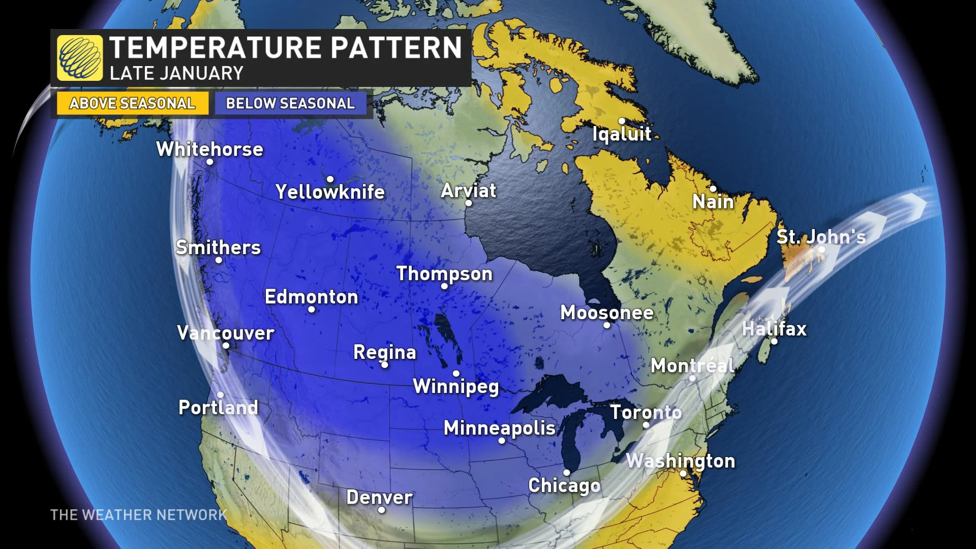
Colder weather will also spread into Ontario and Quebec at times, but we do not expect more than a few days of colder than normal temperatures across southern Ontario and southern Quebec.
As we progress through late January and into February, we expect that the focus of the coldest weather will lock in across the western Prairies and even into B.C. at times and this pattern should dominate through much of February.
Meanwhile, a warmer pattern will develop over the southeastern United States and we expect that will expand north towards southern Ontario, southern Quebec and into the Maritimes.
The contrast in temperatures between the colder weather across central Canada and the warmer pattern over the eastern U.S. should lead to a more active pattern from the Great Lakes to Atlantic Canada during late January and into February. However, some of these storms will likely bring rain rather than snow to southern parts of the region as a mild pattern attempts to return from the Great Lakes to Atlantic Canada.
Be sure to check back as we continue to monitor the winter season.


