Ontario: Warmth returns, along with rain and thunderstorm risk

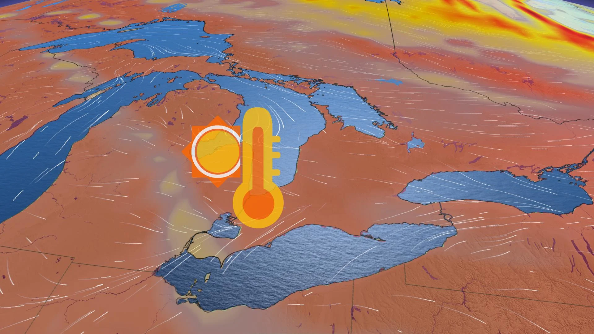
Spring will get off to a booming start in southern Ontario, as Friday will see a wild temperature jump and the risk for early-season thunderstorms
Rapidly rising temperatures usher in the end of the week, reaching the mid-teens by Friday morning, accompanied by a system that will manifest as snow in the north and widespread rain in the south, possibly even featuring a rumble of thunder here and there. But the warmth will be short-lived, as the weekend features yet another drastic cooldown. More, below.
WEATHER HIGHLIGHTS
Colorado low moves in Thursday with snow in the north, rain for the south at night
Chance of non-severe thunderstorms for most of the south Thursday night into Friday
Temperatures jump to the mid- and upper-teens across the south by Friday morning, plunging drastically into Saturday
Keep on top of active weather ALERTS for your area
THURSDAY: WARMTH RETURNS, ACCOMPANIED BY SHOWERS
Wednesday was something of a return to chillier climes, but temperatures will begin their recovery Thursday, though accompanied by a Colorado low system whose effects will differ between northern and southern Ontario.
To the north, the snow will have already begun falling overnight Wednesday, and will last all the way through Thursday into early Friday morning, with 15-30 cm possible over a broad swath northeastward of Lake Superior, though expected amounts rapidly drop off the further south one goes, such that Sudbury may get away with only flurries, if anything.
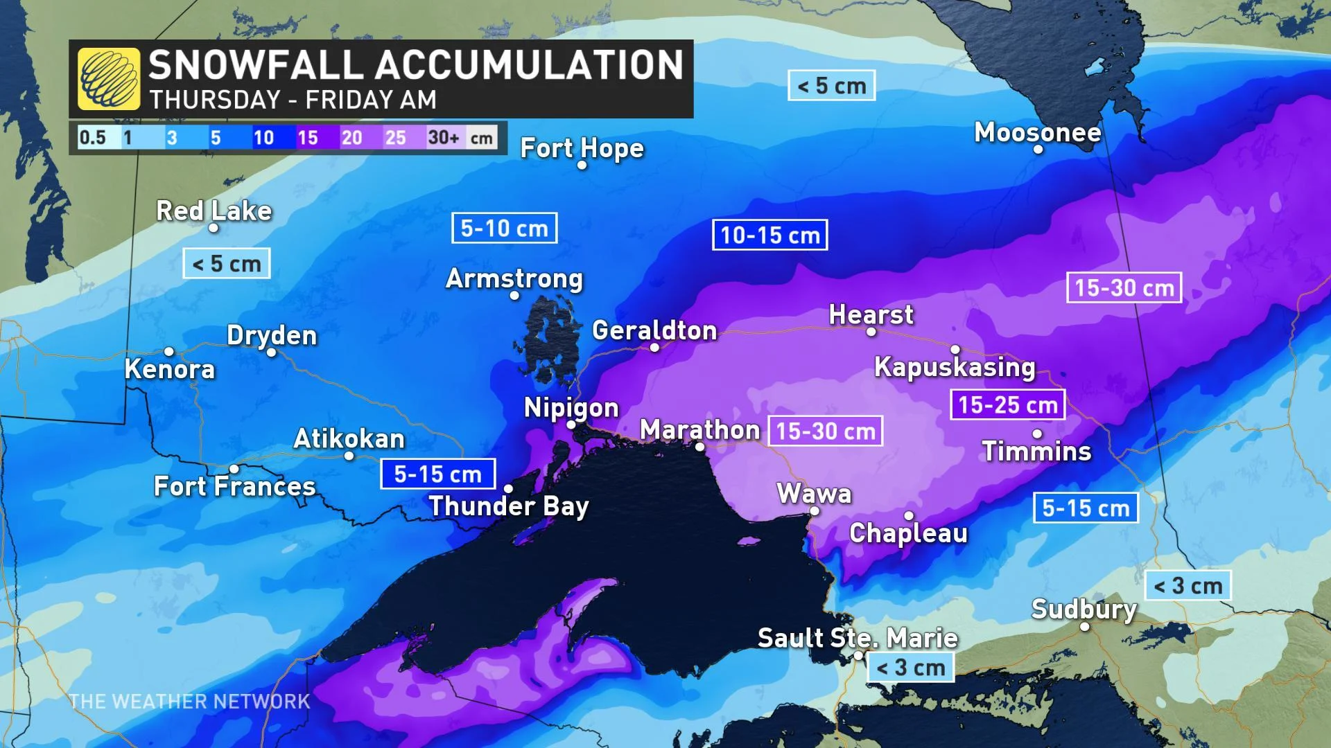
WATCH BELOW: A MORE DETAILED LOOK AT THE EFFECTS ON THE NORTH
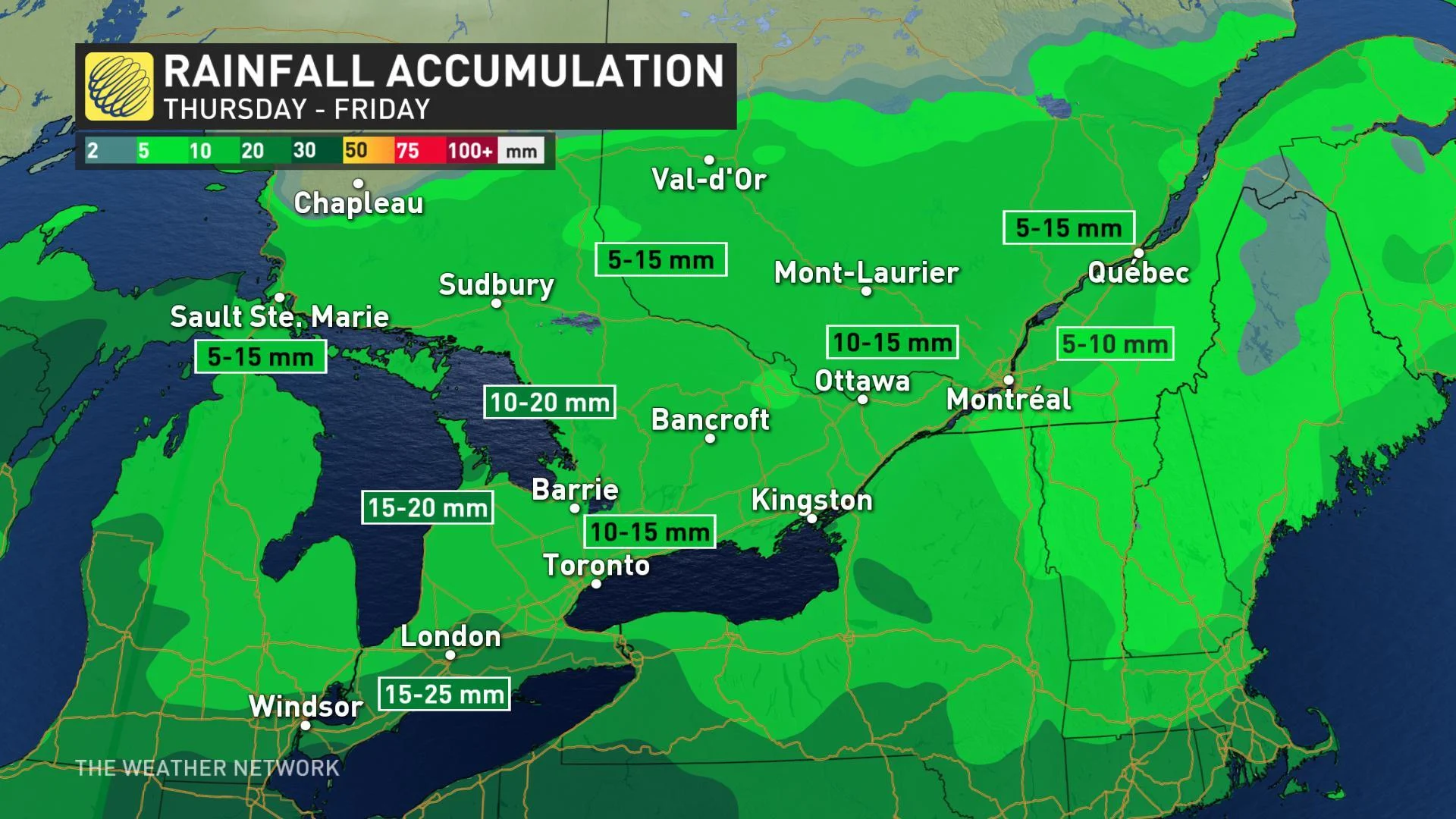
To the south, no chance of snow given the rising temperatures, and the rain begins Thursday night, and in fact the heaviest amounts are likely to fall overnight, along with the first rumbles of thunder.
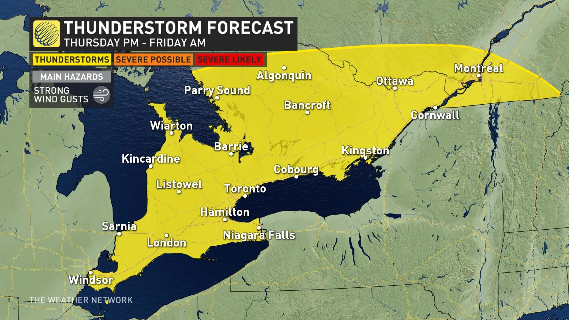
FRIDAY: VERY WARM AIR COULD SPARK MORNING THUNDERSTORMS, POTENTIALLY DAMAGING WINDS
The rain continues Friday morning, with parts of southwestern Ontario in line for 15-25 mm of rain through Friday morning, while central Ontario, the GTA and the rest of the south could get 10-15 mm during the same time period.
Strong winds follow the system as it passes, gusting in the 70-90 km/h range by the afternoon, but more remarkable will be the continuing thunderstorm risk as a cold front passes through Friday morning.
Any storms that do develop will be remarkable not for their severity, which will be minimal, but for their timing, given how uncommon mid-march thunderstorms are in Ontario.
Before the front passes, temperatures will briefly surge into the mid-upper teens, approaching the 20s. Once the front moves through, winds will switch to a northwesterly direction, prompting a significant temperature plunge –– with many areas experiencing a 20-30-degree drop by Saturday morning.
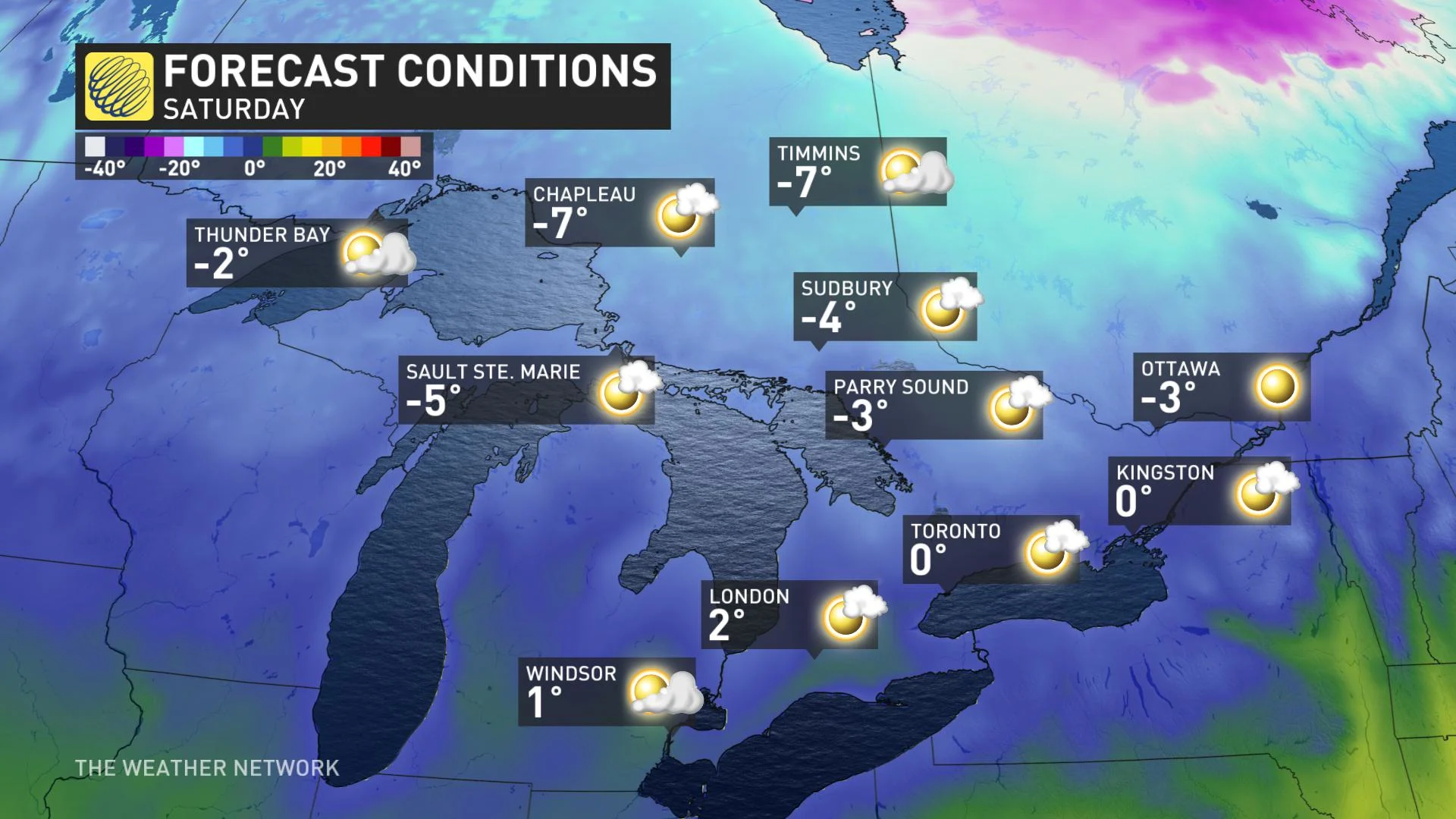
WEEKEND: UP TO 30-DEGREE TEMPERATURE DROP POSSIBLE, WITH LOTS OF SUN
Arctic high pressure will build in for the weekend with abundant sunshine but well below seasonal temperatures. In fact, by Saturday, daytime highs could drop by as much as 30°C in a 24-hour period in some parts of Ontario. Temperatures will be hovering close to the freezing mark for much of the south, while they will dip below in the north.
However, milder weather will returns next week with a warming trend through the middle of the week.
Check back through the week as we continue to monitor the forecast.