
Ontario: Storm threat lingers overnight, temperatures to drop Wednesday

As a cold front treks through Ontario overnight, the threat for thunderstorms will persist in the south and southwest. Some could reach severe limits in the southwest. The main risk with these storms will be heavy rain and strong winds. By Wednesday morning, the storms will have shifted east into Quebec, allowing for sunshine and cooler temperatures to return. More on the lingering storm risk and impact and a look at the cooling temperatures to round out the week, below.
SEE ALSO: Hurricane Dorian grows in size, heads toward Florida after bashing Bahamas
WEATHER HIGHLIGHTS:
Storm risk lingers into overnight hours, will shift out of the province by Wednesday morning
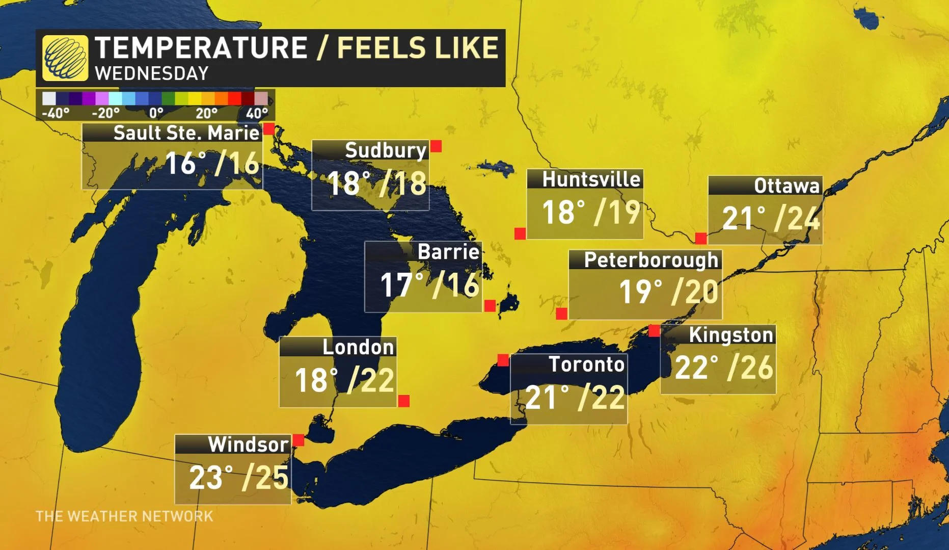
Brisk, cooler conditions return by Wednesday as daytime high temperatures struggle to reach the 20°C mark
Still not the end of summer with temperatures rebounding towards the middle of next week
Stay on top of ALERTS in your area
WATCH BELOW: FUTURE RADAR LOOKING AT OVERNIGHT STORM POTENTIAL
The brief warmup Ontario experienced Tuesday will be gone by Wednesday morning, as cooler air will filter in behind the passage of a cold front. However, there is a lingering risk for thunderstorms overnight, with potential for some to reach severe limits in southwestern portions.
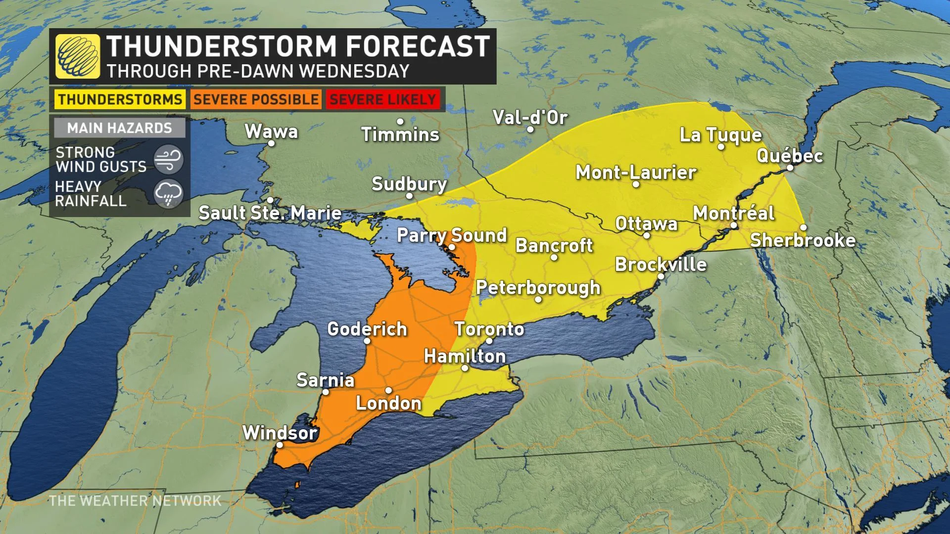
Areas along the Lake Huron shorelines and down through Windsor and Sarnia have the best chance of seeing severe thunderstorms develop, but there is no longer a tornado risk. The main threats with these storms will be heavy rainfall and strong wind gusts.
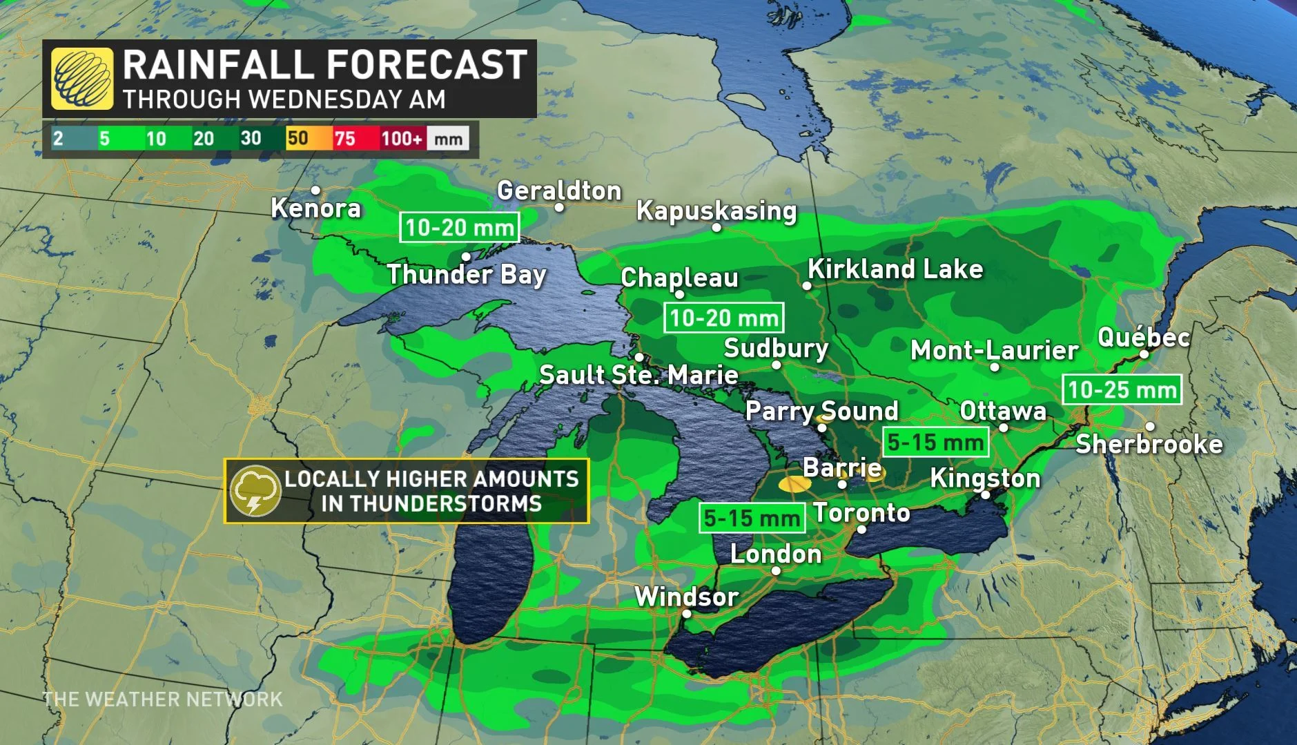
Widespread rainfall amounts of 5 to 15 mm is expected in the south through Wednesday morning, with locally higher amounts in thunderstorms, particularly in storms in cottage country.
As the front slices through, and behind it, winds will be gusty at times and could reach between 40 to 70 km/h through the overnight hours and early Wednesday morning.
TEMPERATURES STRUGGLE TO CRACK 20°C FOR THE REST OF THE WEEK
Early fall-like weather will spread from the Great Lakes to Atlantic Canada for the second half of the week as daytime high temperatures struggle to even reach or top the 20°C mark across the south by Wednesday. For areas north and west of the GTA, daytime highs will remain in the high teens.
Temperatures will remain a few degrees cooler than seasonal despite abundant sunshine through Friday with more fall-like conditions returning for the end of the weekend.
"A cold front will cross our region late Saturday night and at this point it doesn't look like we will see any significant rain with the front, but temperatures will be noticeably cooler on Sunday with temperatures remaining in the upper teens," says Weather Network meteorologist Dr. Doug Gillham.


