Ontario: Blustery, soggy Tuesday set to strip leaves from trees
A mild, rainy start to the week will lead to tumbling temperatures later this week in Ontario.
Tuesday will be soggy for many Ontarians as a major system sweeps through the province. While the heaviest band will push out of southern Ontario by Tuesday evening, that won't be the end of the rain as gusty winds spur showers into Wednesday. And while temperatures won't dip too low, those strong winds may have a lot of trees looking bare by the time we round out the week. We take a look at what you can expect for the days ahead, and when we're watching for a colder pattern to take hold, below.
Visit our Complete Guide to Fall 2019 for an in-depth look at the Fall Forecast, tips to plan for it and a sneak peek at the winter ahead
WEATHER HIGHLIGHTS:
Rainy system moves across province through Tuesday, decent accumulations for some
Strong winds, lake-effect showers likely Tuesday/Wednesday
Potential for late month snow as a colder pattern locks in over the Great Lakes
Stay on top of the ALERTS in your area
Increasing cloud cover across southwestern Ontario kept much of the region from reaching the 20-degree mark on Monday, but we did have a few lucky winners. Parts of the Niagara Peninsula had the best combination to work with -- less cloud cover and gusty southwest winds -- and that was enough to edge temperatures just past the goal line for many.

WIDESPREAD SOAKING RAINS THROUGH TUESDAY
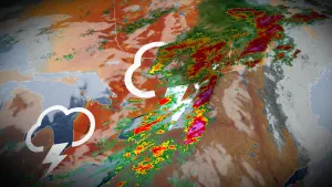
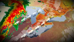
Those 20-degree highs are a thing of the past now, though, as the system that fueled them will bring periods of heavy rain to the province. Soaking rains will spread across southern Ontario through the overnight hours into Tuesday, with a few rumbles of thunder possible through the early morning hours. Further north, the core of the system is expected to linger over the Upper Great Lakes through Thursday.
WATCH BELOW: TRACKING TUESDAY'S RAINY SYSTEM
This rain comes as part of the same system that brought a large tornado and life-threatening conditions to Dallas, Texas Sunday night.
"Severe weather, including tornadoes, is actually quite common for many areas in the southern U.S. for this time of year," says Weather Network meteorologist Jaclyn Whittal. "The jet stream brings in cold air from Canada and it battles against warm air in the Deep South, which can make for a dangerous time of year as the jet stream is very fast, so storms are moving fast as well."

TEMPERATURES TUMBLE BY WEDNESDAY
While temperatures will generally be warm enough across the board to make this a rainy, rather than a snowy, system, strong winds will sweep across the region as the low drifts slowly toward Hudson Bay. The strongest gusts for most are expected on Tuesday.

These winds will likely spur scattered lake-effect showers across southern Ontario into Wednesday, particularly for cottage country and Niagara. The good news is that, while highs aren't likely to reach 20 degrees again for the foreseeable future, we're aren't in for too big a drop. Temperatures will sink back closer to seasonal by week's end -- in the lower double-digits for most of the region.

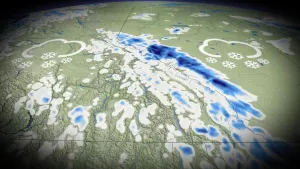
"We have been discussing the transition to a more consistently chilly pattern that would begin during the final week of October and continue well into November. It now appears that the transition to a colder pattern will be delayed until around or just after Halloween," says meteorologist Dr. Doug Gillham. "The initial shots of frigid weather will take aim at the Prairies and so we will just get the leftovers."
Early November, however, looks to bring a more definite colder pattern, and this will likely lead to some significant lake-effect snow in the traditional snowbelt regions.
Be sure to check back as we continue to track this first potential snow event.


