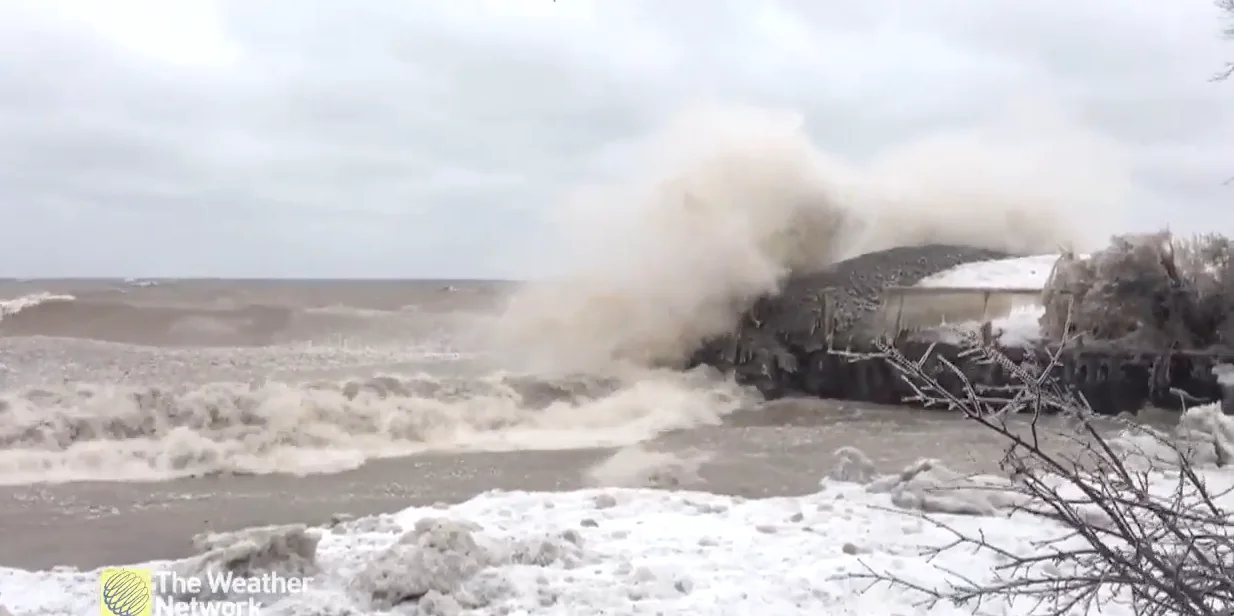
Ontario: Blustery Friday the 13th, with winds gusting 60-80 km/h

Wind gusts could exceed 80 km/h in parts of Ontario
After a rainy start to this Friday the 13th, the departing system has left some very strong winds, likely reaching and possibly exceeding the 70-80 km/h range for areas on or near the shores of Lake Huron, Georgian Bay, and eastern Lake Ontario. For more details on the winds and the calm weekend ahead, as well as what to expect during the March break, read below.
WEATHER HIGHLIGHTS:
Winds gusty across southern Ontario Friday, strongest along lakeshores
Potential for heavy snow in northern Ontario
Fair, cool conditions for the weekend
Mild weather, possible unsettled weather returns during March Break
Keep on top of weather ALERTS in your area
FRIDAY INTO THE WEEKEND: BLUSTERY WINDS TO END THE WEEK
People in the south of the province woke up to rain, though relatively short-lived, ending in the morning for the southwest and Greater Toronto Area and in the afternoon for areas further east.
A bigger story for Ontarians will be the very strong winds generated by the system as it departs. At the moment, it looks like the strongest gusts will be found on and near the shores of Lake Huron and Georgian Bay, where special weather statements are in effect, and along the eastern shores of Lake Ontario, where a wind warning is in effect for Prince Edward County.
Winds along the lakeshores could be in the 60-80 km/h range, locally higher, with Price Edward County possibly topping the 90 km/h mark. Elsewhere, 40-60 km/h gusts will be somewhat widespread.
WINDS WILL BE BLOWING WITH DRIFTING SNOW, WE COULD GET SOME TREE DAMAGE IN NORTHERN ONTARIO:
WEEKEND AND MARCH BREAK: MILD WEATHER RETURNS, BUT SO COULD UNSETTLED WEATHER
Winds will gradually ease off through Friday overnight, paving the way for a fairly calm weekend across the region, as a high pressure system tracks across northern parts of the province.
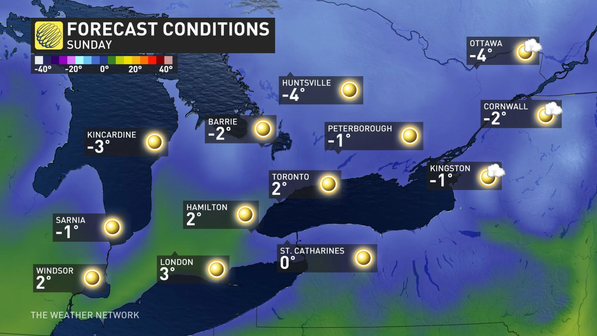
Temperatures will remain in the single digits for much of the south into the weekend, with Sunday actually a few degrees colder than seasonal, despite the abundance of sunshine.
It looks like next week, which is March Break for many, will feature several days of somewhat mild weather, especially during the middle and end of the week. However, the Great Lakes region will become the battleground between very warm weather to the south and Arctic air that will be building to the north. This will set up a more unsettled pattern later in the week.
"Eventually the colder weather developing to our north is expected to win out for a while across southern Ontario, so we expect that the final 10 days of March (and possibly into early April) will bring a cooler pattern to our region," says Weather Network meteorologist Dr. Doug Gillham.
Stay tuned to The Weather Network for the latest forecast updates.