
Ontario: Patience pays off, 'gorgeous' stretch ahead

We're looking at the best long range forecast of the year so far in southern Ontario, but with a thunderstorm threat to come first.
Wednesday's gloomy skies and showers will be the last wet weather Ontario will see all the way through to the weekend, as the province's patience with a cool, soggy spring will shortly be rewarded with rising temperatures and sunny days -- in fact, the longest dry stretch since March! Details, below.
Summer revealed! Visit our Complete Guide to Summer 2019 for an in-depth look at the Summer Forecast, tips to plan for it and much more.
WEATHER HIGHLIGHTS:
Last showers clear out of southern Ontario by Thursday morning
Temperatures finally recover to near-seasonal by Thursday; first dry stretch coming since late March
Latest watches and warnings [HERE]
WATCH BELOW: HIGH PRESSURE CLEARS THE SKIES ABOVE ONTARIO
AFTER GLOOM AND STORMS, GORGEOUS WEATHER TAKES US TO THE WEEKEND
Wednesday's weather was par for the course in what for many has been a disappointing spring: Cloudy, showery, and with a dose of thunderstorms in the southwest.
But by Thursday, it will be a thing of the past, and in fact, Ontario is looking at its most extended period of dry weather since late March -- the last time the province experienced more than three consecutive days without any precipitation interrupting pleasant spring conditions.
"This is the best long range forecast of the year," says Weather Network meteorologist Dr. Doug Gillham, alluding to the gorgeous weekend weather ahead.
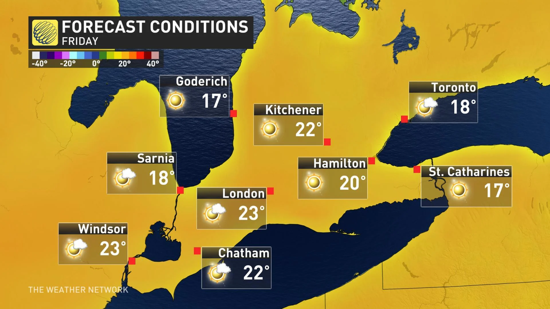
Thursday and Friday will both bring pleasant early June weather to much of southern Ontario as any lingering clouds quickly give way to full sunshine. Temperatures will be seasonal, but still a few degrees cooler right along the Lake Ontario shoreline.
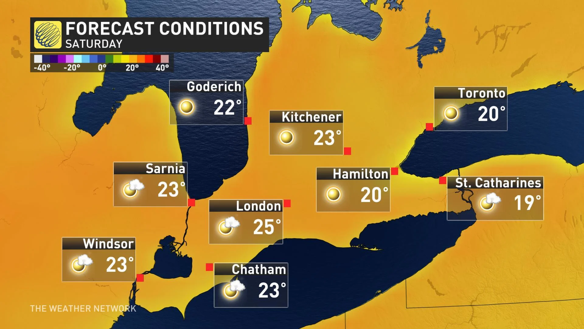
"Saturday will be a gorgeous late spring day across our region with sunshine and near seasonal temperatures," Gillham says, with a little more cloud cover expected by Sunday.
WATCH BELOW: GOLF-LOVERS, THE CANADIAN OPEN BRINGS THE BEST WEATHER IN MONTHS
BUT IT CAN'T LAST FOREVER
While it's looking like we'll at least secure three consecutive dry days, the hitch in this sunny streak comes Monday as the rain and thunderstorm risk returns.
"Showers could linger into Tuesday as well, but the dry weather is expected to return for the middle of next week," Gillham says. "Temperatures, however, are expected to be a few degrees cooler than seasonal for most of next week and next weekend."
And as far as how the rest of the month shapes up, "we do not see any signs of an extended period with warmer than normal temperatures through the middle of the month and that trend could continue into late June," Gillham warns.