Montana low to bring wintry, windy wallop to Ontario, Quebec

A strong stateside low from Montana will sweep across Ontario and Quebec Sunday and Monday, bringing a wide range of impacts -- from heavy snow, freezing rain and rain to howling wind gusts and warmth.
The last lake-effect snow bands will be winding down Sunday morning in Ontario, while a low-pressure system originating from Montana is set to bring rain, snow and strong winds to parts of Ontario and Quebec, as well as some mild temperatures to top it off. This will be a messy system with effects lasting into Monday. For more details, please read on.
Visit our Complete Guide to Winter 2022 for an in-depth look at the Winter Forecast, tips to plan for it, and much more!
SATURDAY OVERNIGHT: SNOW SQUALL WARNINGS IN EFFECT
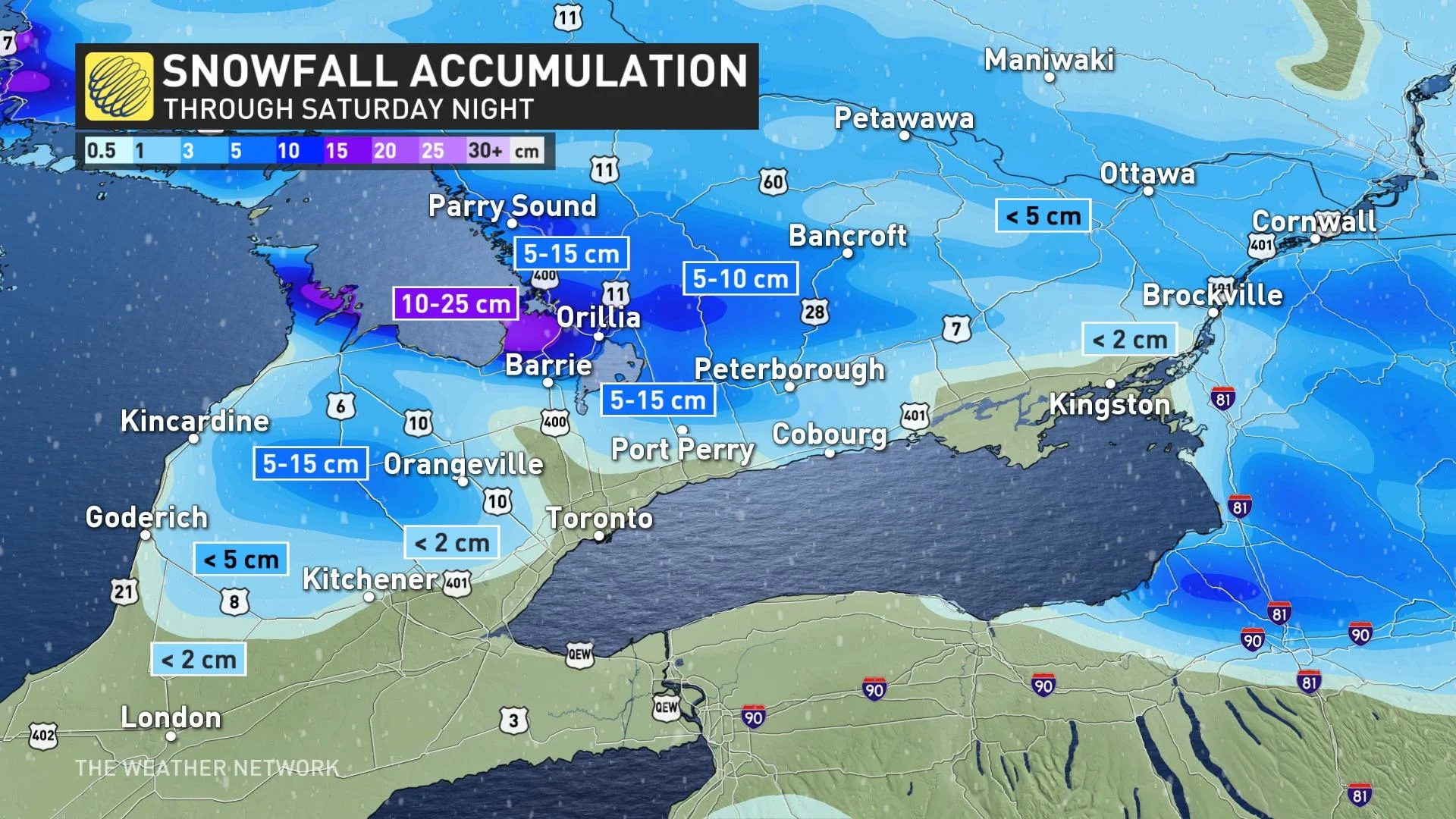
While much of southern Ontario may have seen a few flakes and perhaps even some accumulation, the big show snow-wise will be lake-effect squalls off of Georgian Bay that stretched deep inland as of Saturday night.
Snow squall watches and warnings, were in effect Saturday night, and travel is expected to be the worst along Highway 17 north of Sault Ste. Marie, and highways 11 and 400 in the Barrie-Orillia-Midland triangle through the overnight hours.
The heavy snow, combined with strong northwesterly winds, will result in reduced visibilities. Travel will likely become difficult and motorists are advised to exercise caution.
Hitting the slopes? Be sure to check conditions first with The Weather Network's Ski Report!
The Greater Toronto Area (GTA), meanwhile, will largely stay south of the accumulations, and parts of the southwest will pick up just a dusting -- with less than 2 cm from unorganized bands off of the south end of Lake Huron.
SUNDAY INTO MONDAY: MESSY MIX OF SNOW, RAIN, TEMPORARY WARMTH AND BLUSTERY WINDS
The main event will come Sunday when a Montana low – so named for its origins in that part of the northwestern U.S. – moves into the upper Great Lakes and western Quebec. Heavy snow will extend from northern and central Ontario through western and central Quebec.
The developing low will reach northwestern Ontario Sunday morning. Through the day, snow will spread across northeastern sections and cottage country. The system will make its way into the south during the afternoon, reaching western Quebec in the evening hours.
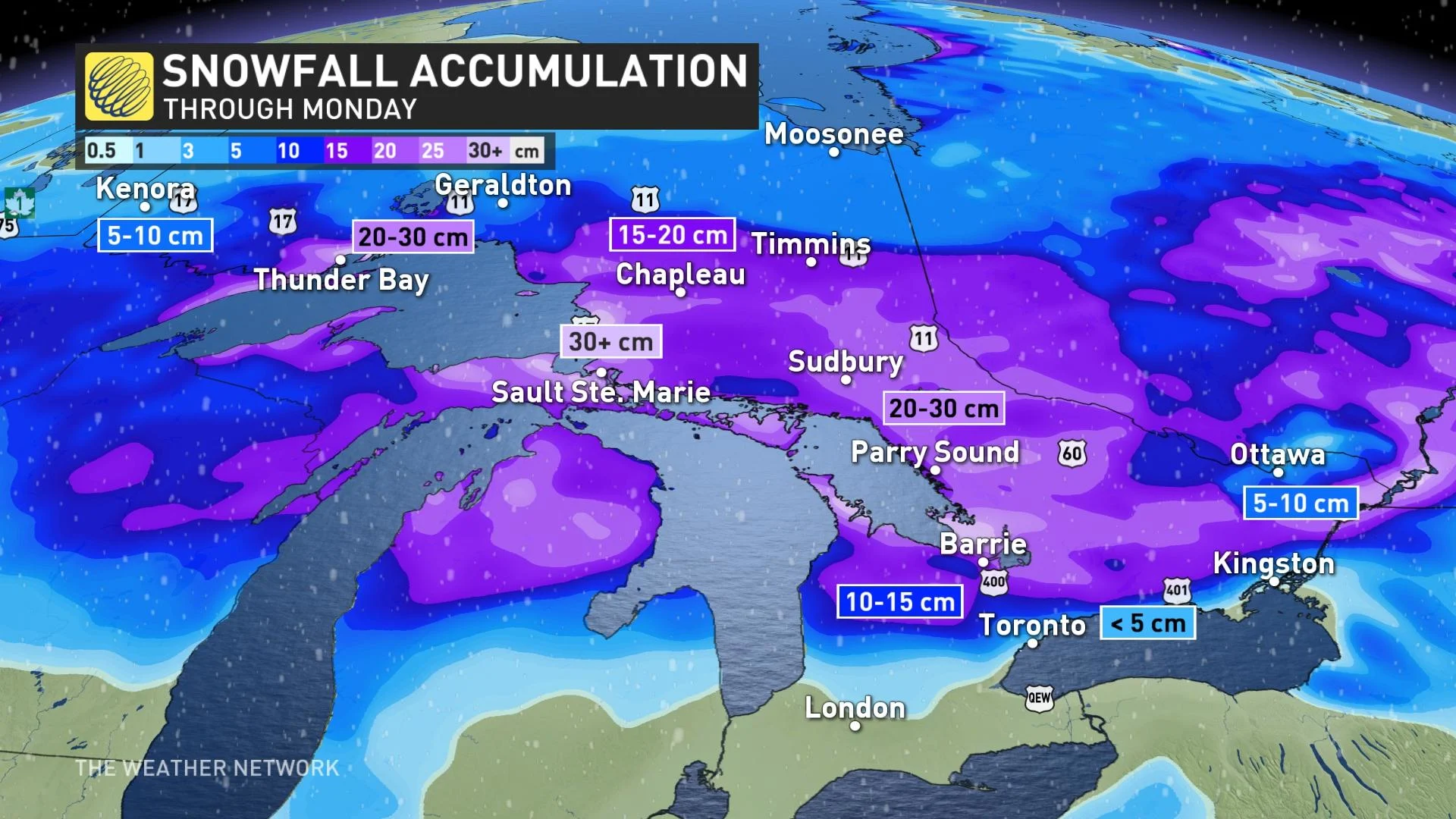
A strong easterly flow will enhance snowfall totals for Thunder Bay, potentially giving the city 20 cm.
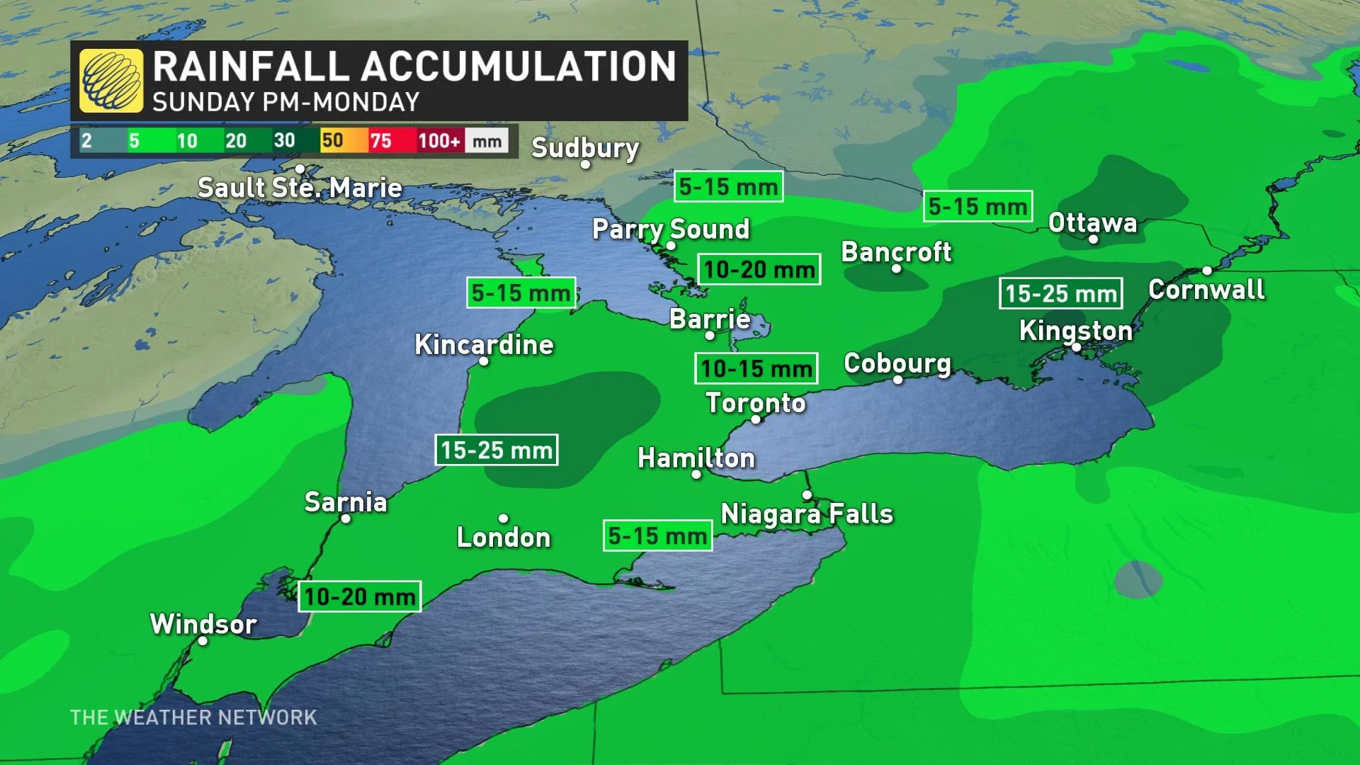
Precipitation to start as snow in eastern Ontario and southern Quebec before transitioning to freezing rain, and eventually rain. In southern Ontario, the event will begin with a burst of snow, then switch to rain.
The GTA will briefly see some flurries in the afternoon before an icy mix moves in for a short time in the evening as the warm front moves through, eventually switching to rain for areas south of the Nickel Belt.
Rainfall amounts won't be excessive, but 10-20 mm for southern and central areas through Monday afternoon will certainly take a chunk out of any reseeding snow.
A DEEPER DIVE INTO THE QUEBEC IMPACT:
Winds will be strong out of the south starting Sunday night and persisting through Monday during the day, further strengthening in the evening as the cold front moves through and the squalls return. Gusts of 60-80 km/h are expected as the cold air sinks south, making for a blustery start to the week.
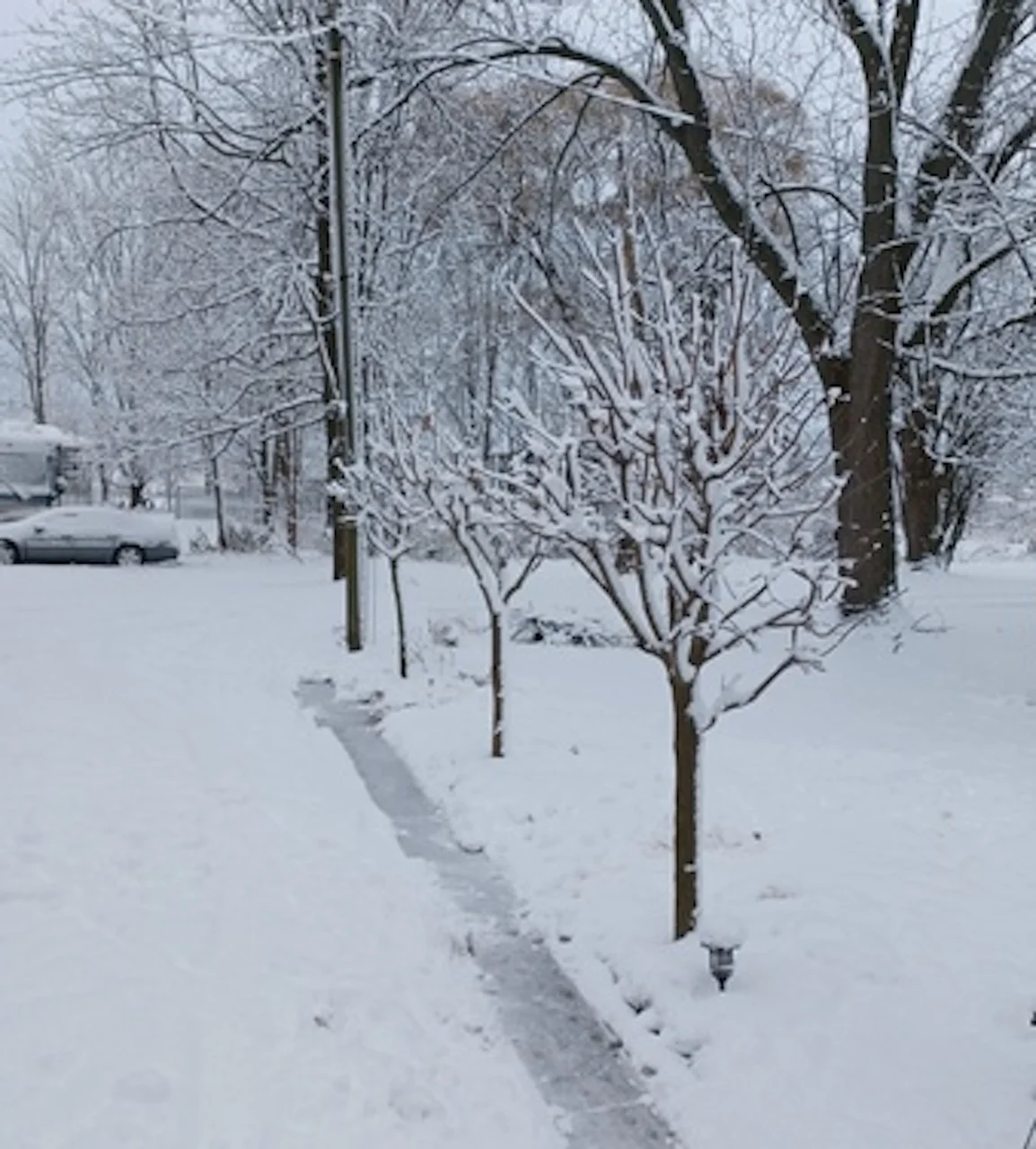
Thumbnail courtesy of Bonnie Parkinson, taken in Devizes, Ont.
Check back through the weekend as we monitor these various systems.


