Ontario: Complicated storm set-up follows this brief deep freeze

The long weekend across southern Ontario will feature some well above seasonal conditions and a messy storm threat for early next week.
There was nothing warm and fuzzy about Friday's wake-up call in southern Ontario as Valentine's Day morning featured the coldest weather of the season so far. While the chill will last into Saturday morning as well, temperatures will recover trendmendously throughout the Family Day long weekend across the region. More on just how warm things get, and the next messy, but extremely complicated system that threatens the start of next week, below.
WEATHER HIGHLIGHTS:
Temperatures recover to well above seasonal values through Sunday, mix of sun and cloud for Family Day Monday
Eyes on messy system for Tuesday, which threatens snow, rain and freezing rain for some
Stay up-to-date on the ALERTS in your area
SATURDAY: BRIEF DEEP FREEZE ENDS, BURST OF SNOW IN THE SOUTH
Friday started with the coldest weather of the season in southern Ontario as temperatures bottomed out near -20°C, feeling closer to the -30s with the wind chill, and daytime highs were definitely frigid. However, that should be the last of the extreme cold for awhile, and Saturday sees the start of a rapid recovery.
MUST SEE: Did you hear it? Frost quakes rumble through southern Ontario
"Temperatures will recover to near seasonal values during Saturday afternoon with a mix of sun and clouds," says Weather Network meteorologist Dr. Doug Gillham.
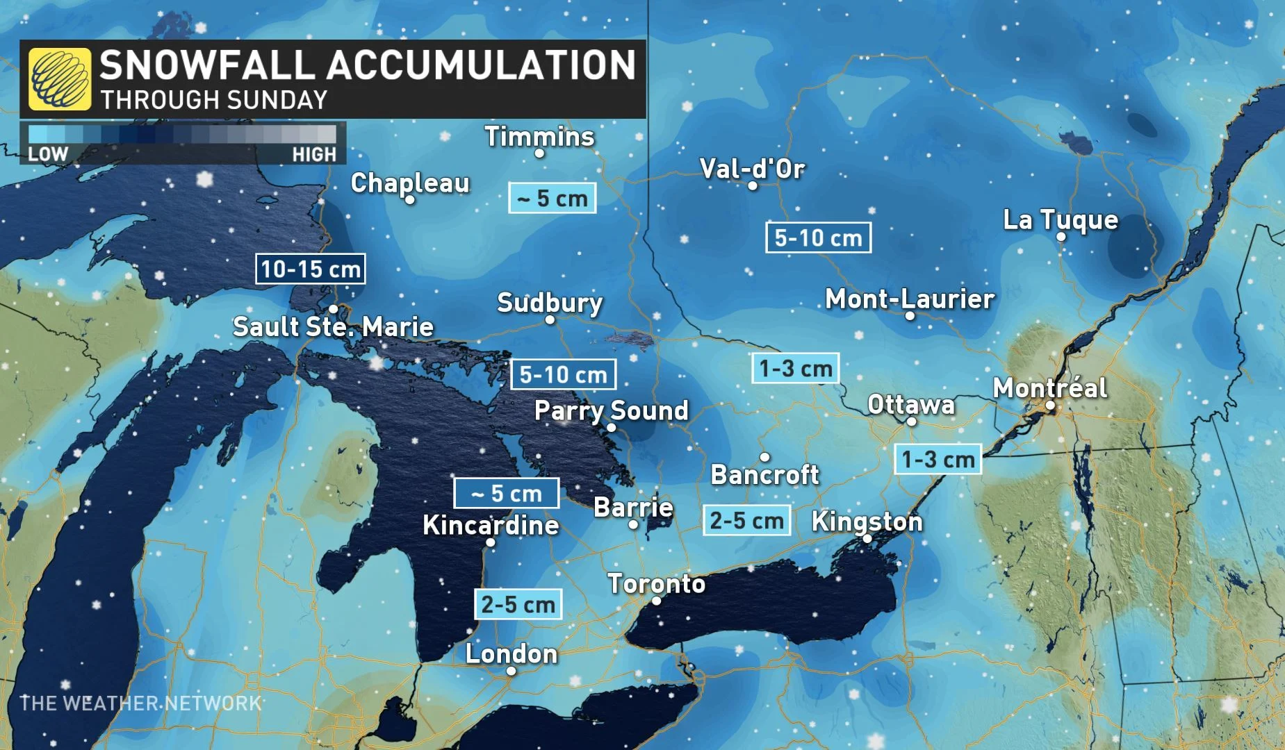
A weak system will track across southern Ontario Saturday night with a dusting of snow possible for the GTA and a few centimetres of accumulation across cottage country.
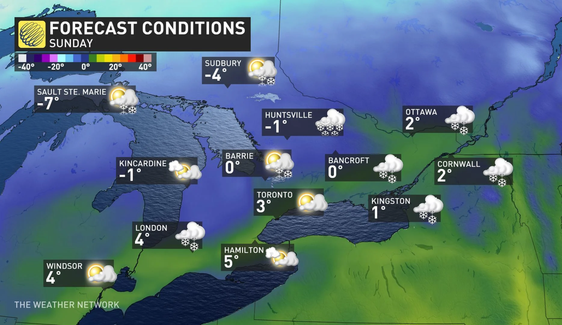
Temperatures will then rise well above seasonal by Sunday, staying clear and calm into Family Day Monday as well.
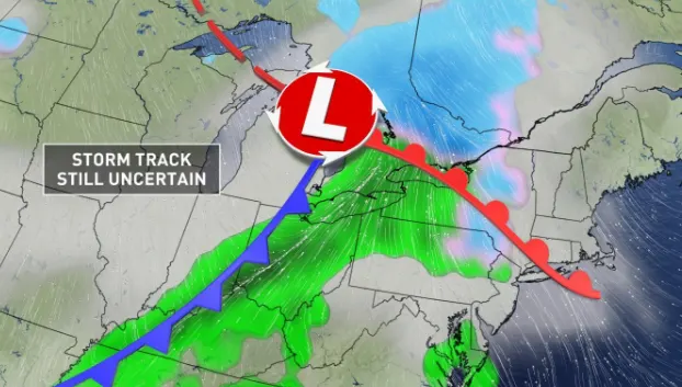
MONITORING COMPLICATED STORM SETUP FOR TUESDAY
Forecasters are closely watching a Colorado low set to track into the Great Lakes region on Monday night, though the exact impact of this system is still uncertain.
"At this point it looks like snow will develop Monday night across most of our region, especially north of Lake Ontario," says Gillham. "During Tuesday morning, the snow will briefly change to freezing rain and then over to rain as very mild air surges into or region."
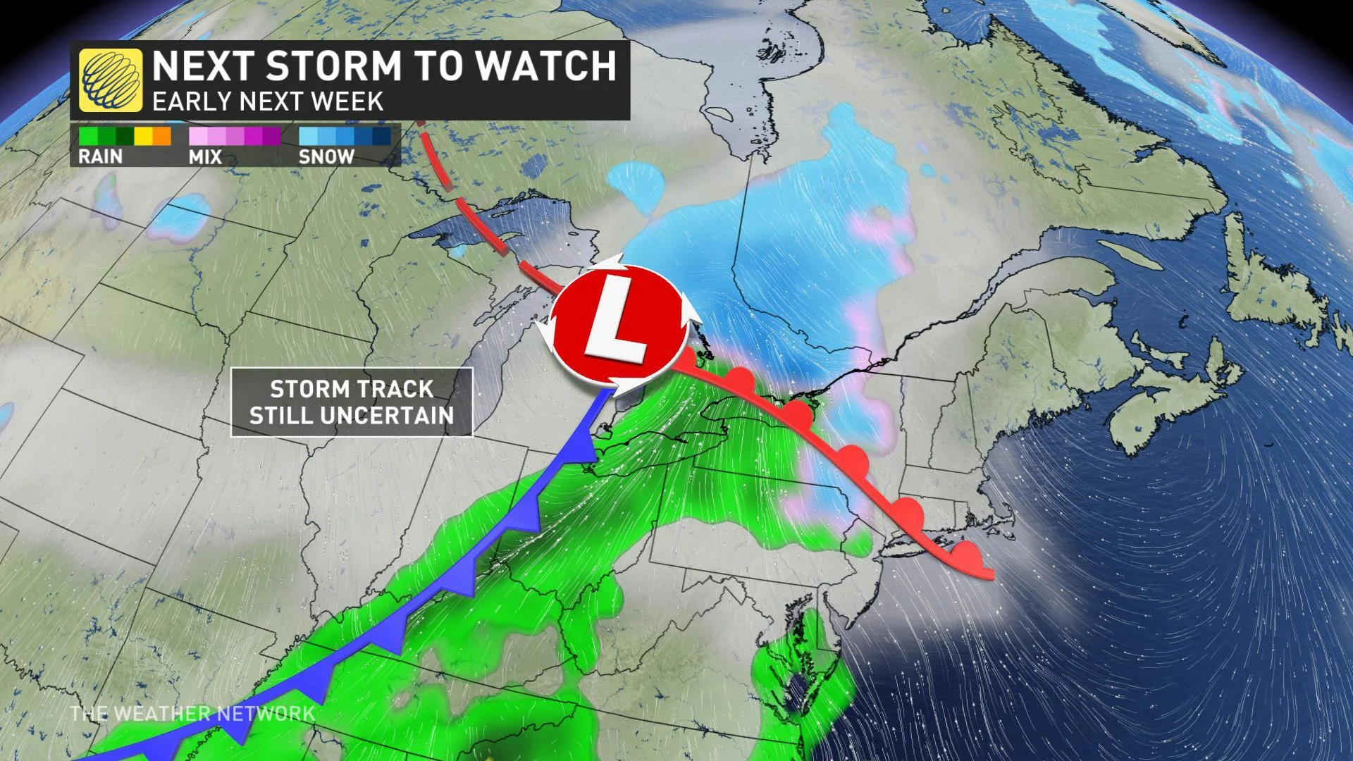
According to Gillham, if the system takes a track further to the south, more snow and ice would spread across the region as opposed to rain.
"However, at this point the warmer scenario looks to be most likely," Gillham adds.
In fact, some parts of southern Ontario could see temperatures near 10°C before they quickly tumble once again with the threat for a potential flash freeze by Wednesday.
MILD WEATHER DOMINATES SECOND HALF OF THE MONTH
Although parts of next week will feature more arctic air, overall there's no consistent cold weather in sight for the rest of February.
"Mild Pacific air is expected to arrive by the end of the week with above seasonal temperatures likely for next weekend," Gillham says, adding that we can still see snow even in a milder pattern, so not to let your guard down completely.
Stay with us here at The Weather Network for all your latest forecast updates.