
Ontario: A snowy start to the week, but there's good news ahead

Southern Ontario residents woke up to another snowy morning on Monday, but there is a pattern change coming this week
Winter isn't quite finished with Ontario, as another round of lake-effect snow overachieved and blanketed surfaces in some areas in the south Monday morning. While it will be coming to an end shortly, cold temperatures will persist into mid-week before a pattern change boosts temperatures up noticeably for the long weekend. Frost advisories are in place for much of the south until then. Details and timing, below.
WEATHER HIGHLIGHTS
Lake-effect, wet snow will diminish late Monday morning
Morning frost likely into the mid-week
Cold pattern eases mid-week, warming up for long weekend
Keep on top of active weather ALERTS in your area.
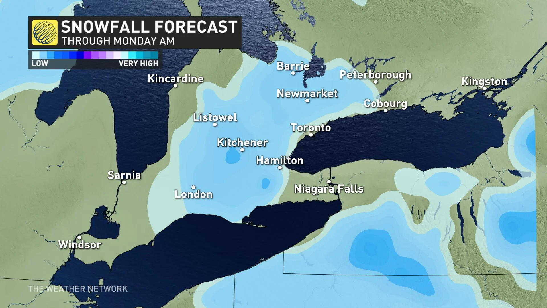
MONDAY: LAKE-EFFECT SNOW WILL EASE OFF
A swath of southern and southwestern Ontario were treated to another dose of wintry weather Monday morning, with some overachieving lake-effect snowfall amounts in some areas. Places such as Guelph and Kitchener saw up to 5 cm fall, but because of the marginal temperatures, accumulations won't stick.
While the snow will diminish by midday, drying out for the afternoon, the below seasonal temperatures will hang on for a few more days. Widespread frost advisories are in place. Daytime highs Monday will remain in the single digits across the south.
SOCIAL MEDIA BLANKETED
As with the case on Saturday, people took to social media to post visuals of Monday morning's snowfall. Here is some of what was captured across the province.
LOOK AHEAD: COLD PATTERN WILL EASE OFF FOR LONG WEEKEND
Another blast of Arctic air has moved into Ontario. With frost advisories in place for the time being, springtime gardeners in the south would be wise to hold off until mid-week, or else cover up anything delicate.
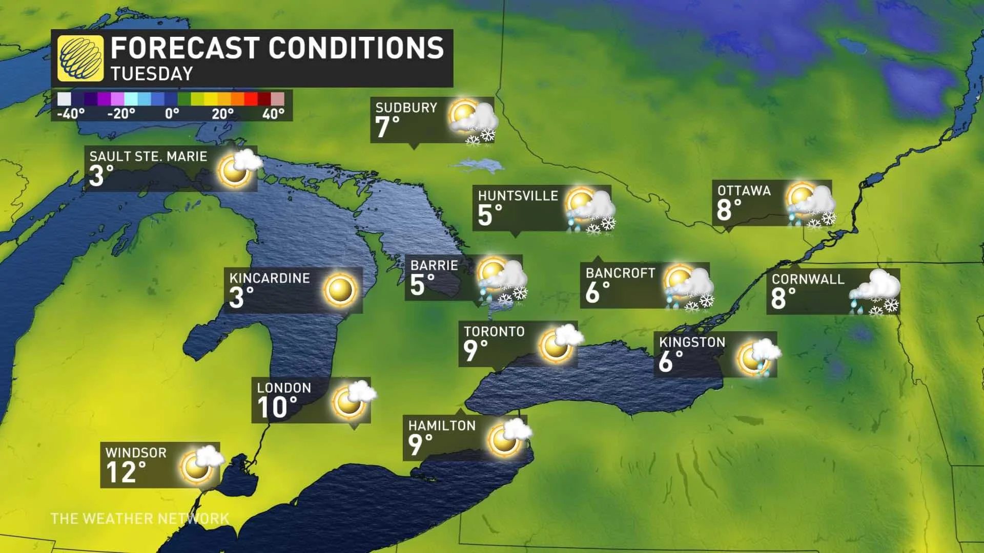
But the cold airmass will relax by mid-week and temperatures will slowly recover Wednesday and Thursday, but remain well below seasonal. By Friday temperatures should be near seasonal, but some rain is also likely Thursday night into Friday.
"As we head into the long weekend, a very warm pattern is expected over the eastern U.S. but we don't think that warmth will quite make it to southern Ontario," says says Weather Network meteorologist Dr. Doug Gillham. "Our temperatures will still be on the cool side of seasonal but they will also be 5 to 10 degrees warmer than what we are seeing this weekend."
Forecasters are cautiously optimistic that there will be a more significant change in the weather pattern near or just after May 20, with temperatures becoming more consistently near seasonal and possibly above seasonal at times during the final week in the month.
Check back for updates as we continue to monitor this system.